How to get to Concierge Md Stat by bus?
Click on the bus route to see step by step directions with maps, line arrival times and updated time schedules.
Bus stops near Concierge Md Stat in Eatontown
Train station near Concierge Md Stat in Eatontown
- Monmouth Park, 52 min walk,VIEW
Bus lines to Concierge Md Stat in Eatontown
What are the closest stations to Concierge Md Stat?
The closest stations to Concierge Md Stat are:
- Wyckoff Rd at South St# is 56 yards away, 2 min walk.
- Eatontown - Rt-35 @ Wyckoff Rd (Northbound) is 432 yards away, 6 min walk.
- Monmouth Park is 4453 yards away, 52 min walk.
Which bus lines stop near Concierge Md Stat?
These bus lines stop near Concierge Md Stat: 831, 832.
What’s the nearest bus station to Concierge Md Stat in Eatontown?
The nearest bus station to Concierge Md Stat in Eatontown is Wyckoff Rd at South St#. It’s a 2 min walk away.
What time is the first train to Concierge Md Stat in Eatontown?
The NJCL is the first train that goes to Concierge Md Stat in Eatontown. It stops nearby at 4:02 AM.
What time is the last train to Concierge Md Stat in Eatontown?
The NJCL is the last train that goes to Concierge Md Stat in Eatontown. It stops nearby at 2:27 AM.
What time is the first bus to Concierge Md Stat in Eatontown?
The 200 is the first bus that goes to Concierge Md Stat in Eatontown. It stops nearby at 5:42 AM.
What time is the last bus to Concierge Md Stat in Eatontown?
The 832 is the last bus that goes to Concierge Md Stat in Eatontown. It stops nearby at 10:33 PM.
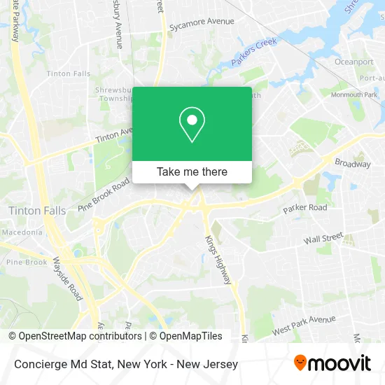
See Concierge Md Stat, Eatontown, on the map
Public Transit to Concierge Md Stat in Eatontown
Wondering how to get to Concierge Md Stat in Eatontown? Moovit helps you find the best way to get to Concierge Md Stat with step-by-step directions from the nearest public transit station.
Moovit provides free maps and live directions to help you navigate through your city. View schedules, routes, timetables, and find out how long does it take to get to Concierge Md Stat in real time.
Looking for the nearest stop or station to Concierge Md Stat? Check out this list of stops closest to your destination: Wyckoff Rd at South St#; Eatontown - Rt-35 @ Wyckoff Rd (Northbound); Monmouth Park.
Bus: 831, 832, 200.Train: NJCL.
Want to see if there’s another route that gets you there at an earlier time? Moovit helps you find alternative routes or times. Get directions from and directions to Concierge Md Stat easily from the Moovit App or Website.
We make riding to Concierge Md Stat easy, which is why over 1.5 million users, including users in Eatontown, trust Moovit as the best app for public transit. You don’t need to download an individual bus app or train app, Moovit is your all-in-one transit app that helps you find the best bus time or train time available.
For information on prices of bus, subway and train, costs and ride fares to Concierge Md Stat, please check the Moovit app.
Use the app to navigate to popular places including to the airport, hospital, stadium, grocery store, mall, coffee shop, school, college, and university.
Concierge Md Stat Address: 145 Wyckoff Rd street in Eatontown
- Tauqeer Qazi, Md, Caqsm,
- Rwjbh Primary Care,
- Rwjbh Medical Group Eatontown Primary Care,
- Michael Jaronczyk Md,
- Rwjbarnabas Health Medical Group,
- Empire Auto Protect,
- Barnabas Health Medical Group,
- Monmouth County Workforce,
- Healing Star Hand & Physical Therapy,
- Monmouth Functional Neurology Center,
- Dr. Jeffrey C. Lederman,
- St Barnabas Healthcare,
- Preferred Home Health Monmouth,
- 409 South St Parking,
- Wrongful Death Lawyer Monmouth County Nj- Hobbie Law,
- United States Postal Service,
- Optum Podiatry - Eatontown,
- United Healthcare Services,
- Crystal Inn,
- Neuropathy Relief Project
Places Near Concierge Md Stat (Eatontown)
- Rockefeller Center, Manhattan,
- Wall Street, Manhattan,
- SoHo, Manhattan,
- Hudson Yards, Manhattan,
- San Gennaro Feast, Manhattan,
- Pier 83, Manhattan,
- Bellevue Hospital, Manhattan,
- Queens Center Mall, Queens,
- 911 Memorial, Manhattan,
- 376 Hudson Street, Manhattan,
- Katz's Deli, Manhattan,
- 3 Stone St, Manhattan,
- 66 John Street, Manhattan,
- Chinatown, Manhattan,
- 1 Police Plaza, Manhattan,
- 111 Centre New York City Supreme Court, Manhattan,
- Times Square, Manhattan,
- qqqq, Manhattan,
- Mountainside Hospital, Glen Ridge,
- 26 Federal Plaza, Manhattan
How to get to popular places in New York - New Jersey with public transit
Get around Eatontown by public transit!
Traveling around Eatontown has never been so easy. See step by step directions as you travel to any attraction, street or major public transit station. View bus and train schedules, arrival times, service alerts and detailed routes on a map, so you know exactly how to get to anywhere in Eatontown.
When traveling to any destination around Eatontown use Moovit's Live Directions with Get Off Notifications to know exactly where and how far to walk, how long to wait for your line, and how many stops are left. Moovit will alert you when it's time to get off — no need to constantly re-check whether yours is the next stop.
Wondering how to use public transit in Eatontown or how to pay for public transit in Eatontown? Moovit public transit app can help you navigate your way with public transit easily, and at minimum cost. It includes public transit fees, ticket prices, and costs. Looking for a map of Eatontown public transit lines? Moovit public transit app shows all public transit maps in Eatontown with all Bus, Train, Subway, Light Rail, Ferry and Cable Car routes and stops on an interactive map.
New York - New Jersey has 6 transit type(s), including: Bus, Train, Subway, Light Rail, Ferry and Cable Car, operated by several transit agencies, including MTA Subway, Metro-North Railroad, LIRR, PATH, MTA New York City Transit - Express routes, MTA Bus, NJ Transit, NYC Ferry, NICE bus, Bee-Line Bus, NJ Transit Rail, Norwalk Transit District, Hartford Line, River Valley Transit and HART