How to get to Concrete Choppers by bus?
Click on the bus route to see step by step directions with maps, line arrival times and updated time schedules.
From Bepxxx, Fort Lauderdale
67 minFrom Tri-Rail-Deerfield Beach Station, Deerfield Beach
84 minFrom Hotel Soap, Fort Lauderdale
84 minFrom Piper High School, Plantation
72 minFrom Tamarac, Coral Springs-Margate
69 minFrom Northeast High School, Fort Lauderdale
79 minFrom Inter Miami CF, Fort Lauderdale
67 minFrom DRV PNK Stadium, Fort Lauderdale
65 minFrom Holy Cross Hospital, Fort Lauderdale
64 minFrom N Federal Hwy, Fort Lauderdale
72 min
Bus stops near Concrete Choppers in Coral Springs-Margate
Bus lines to Concrete Choppers in Coral Springs-Margate
What are the closest stations to Concrete Choppers?
The closest stations to Concrete Choppers are:
- Copans Road/Banks Road is 445 yards away, 6 min walk.
- US 441/Northwest 18th Street is 662 yards away, 8 min walk.
- Northwest 15th Street & US 441 is 779 yards away, 10 min walk.
- Copans Road & US 441 is 822 yards away, 10 min walk.
Which bus lines stop near Concrete Choppers?
These bus lines stop near Concrete Choppers: 19, 83.
What’s the nearest bus station to Concrete Choppers in Coral Springs-Margate?
The nearest bus station to Concrete Choppers in Coral Springs-Margate is Copans Road/Banks Road. It’s a 6 min walk away.
What time is the first bus to Concrete Choppers in Coral Springs-Margate?
The 19 is the first bus that goes to Concrete Choppers in Coral Springs-Margate. It stops nearby at 4:35 AM.
What time is the last bus to Concrete Choppers in Coral Springs-Margate?
The 19 is the last bus that goes to Concrete Choppers in Coral Springs-Margate. It stops nearby at 1:16 AM.
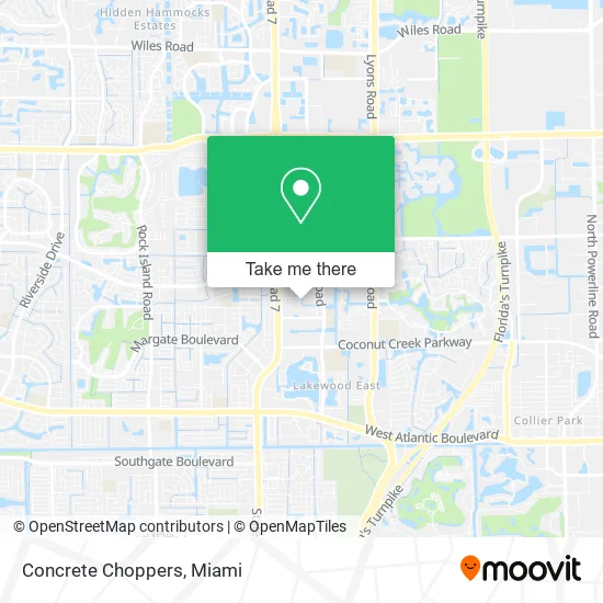
See Concrete Choppers, Coral Springs-Margate, on the map
Public Transit to Concrete Choppers in Coral Springs-Margate
Wondering how to get to Concrete Choppers in Coral Springs-Margate? Moovit helps you find the best way to get to Concrete Choppers with step-by-step directions from the nearest public transit station.
Moovit provides free maps and live directions to help you navigate through your city. View schedules, routes, timetables, and find out how long does it take to get to Concrete Choppers in real time.
Looking for the nearest stop or station to Concrete Choppers? Check out this list of stops closest to your destination: Copans Road/Banks Road; US 441/Northwest 18th Street; Northwest 15th Street & US 441; Copans Road & US 441.
Bus: 19, 83, 60, 441.
Want to see if there’s another route that gets you there at an earlier time? Moovit helps you find alternative routes or times. Get directions from and directions to Concrete Choppers easily from the Moovit App or Website.
We make riding to Concrete Choppers easy, which is why over 1.5 million users, including users in Coral Springs-Margate, trust Moovit as the best app for public transit. You don’t need to download an individual bus app or train app, Moovit is your all-in-one transit app that helps you find the best bus time or train time available.
For information on prices of bus and train, costs and ride fares to Concrete Choppers, please check the Moovit app.
Use the app to navigate to popular places including to the airport, hospital, stadium, grocery store, mall, coffee shop, school, college, and university.
Concrete Choppers Address: 1862 NW 54th Ave Pompano Beach, FL 33063 street in Coral Springs-Margate
- DD World Embroidery,
- Crossfire Magneto,
- LEXUS Doc: LEXUS & TOYOTA Repair Specialist,
- AAC Granite and Marble,
- KG's Auto Repair,
- Kristal Auto Sales,
- Mr Goodmench,
- GGS Auto Repair LLC,
- Expecar Sales,
- Adraski Brian,
- MSD Bakery,
- Express Car Time,
- Tamarac Farmers Market Plantation,
- Genet Property Group,
- Noyamovers,
- RRK Properties,
- Genesis Perfume,
- Horizon Arts,
- Playboy Jewelry,
- Surgical Grade Stainless Steel 925 Sterling Silver Solid 14k Gold and Solid Titanium
Places Near Concrete Choppers (Coral Springs-Margate)
- Port of Miami Cruise Terminal, Miami,
- Miami Freedom Park, Miami,
- Sawgrass Mall, Miami,
- Aventura Mall, Miami,
- Miami VA Hospital, Miami,
- Miami Design District, Miami,
- Zoo Miami, Miami,
- Keiser University Flagship Campus, West Palm Beach,
- Marlins Park, Miami,
- Bayside Marketplace, Miami,
- Wynwood, Miami,
- Richard E. Gerstein Justice Building, Miami,
- Dolphin Mall, Miami,
- Miami-Dade County Courthouse, Miami,
- Sawgrass mall ( FL ), Miami Beach,
- Hard Rock Stadium, Miami Gardens,
- Dolphin Mall Bus, Miami,
- Aventura Mall, Miami Beach,
- Brickell City Centre, Miami,
- Little Havana, Miami
How to get to popular places in Miami with public transit
Get around Coral Springs-Margate by public transit!
Traveling around Coral Springs-Margate has never been so easy. See step by step directions as you travel to any attraction, street or major public transit station. View bus and train schedules, arrival times, service alerts and detailed routes on a map, so you know exactly how to get to anywhere in Coral Springs-Margate.
When traveling to any destination around Coral Springs-Margate use Moovit's Live Directions with Get Off Notifications to know exactly where and how far to walk, how long to wait for your line, and how many stops are left. Moovit will alert you when it's time to get off — no need to constantly re-check whether yours is the next stop.
Wondering how to use public transit in Coral Springs-Margate or how to pay for public transit in Coral Springs-Margate? Moovit public transit app can help you navigate your way with public transit easily, and at minimum cost. It includes public transit fees, ticket prices, and costs. Looking for a map of Coral Springs-Margate public transit lines? Moovit public transit app shows all public transit maps in Coral Springs-Margate with all Bus, Train, Light Rail and Ferry routes and stops on an interactive map.
Miami has 4 transit type(s), including: Bus, Train, Light Rail and Ferry, operated by several transit agencies, including Broward County Transit, Miami-Dade Transit, Metrorail, Palm Tran, Tri-Rail, Brightline, MARTY, City of Homestead Trolley, Key West Transit, Treasure Coast Connector, GoLine IRT, Amtrak, Greyhound-us, FlixBus-us and Aventura Express Shuttle Bus