How to get to Condominio Nonken by bus?
Click on the bus route to see step by step directions with maps, line arrival times and updated time schedules.
From Sucursal Evercrisp, Talcahuano
50 minFrom Av. laguna grande, Concepcion
46 minFrom Villa San Juan, Lomas De San Andres, Talcahuano
38 minFrom Cerro Macera, Talcahuano
59 minFrom Eme Bus, Penco
38 minFrom Capilla Santa Rita De Casia, Concepcion
54 minFrom Edificio Olas, Concepcion
52 minFrom Oficina Corporativa Grupo ARAUCO, Talcahuano
54 minFrom Huertos Familiares de San Pedro, Concepcion
52 minFrom Mall Portal Bío Bío, Concepcion
56 min
Bus stops near Condominio Nonken in Concepcion
Bus lines to Condominio Nonken in Concepcion
- 18PY, 18y - Hualqui,VIEW
- 52AD, 52a - Pta. Leones,VIEW
- 70G, 70g - Km 10,VIEW
- 70I, 70i - Centinela,VIEW
- 72ZK, 72z - Valle Noble,VIEW
- 17OX, 17x - Leonera,VIEW
- 22KD, 22d - Michaihue,VIEW
- 22SN, 22s - Araucana,VIEW
- 23EV, 23v - Michaihue,VIEW
- 23LP, 23l - Nonguen,VIEW
- 40BP, 40b - Nonguen,VIEW
- 71ZI, 71z - 4 Esquinas - Lenga,VIEW
- 70J, 70j - Los Copihues,VIEW
- 70KH, 70k - Los Copihues,VIEW
- 70F, 70f - Nonguén,VIEW
- 24MF, 24m - Los Fresnos,VIEW
- 24TR, 24t - Los Fresnos,VIEW
- 56VO, 56v - T. Collao - Hospital,VIEW
What are the closest stations to Condominio Nonken?
The closest stations to Condominio Nonken are:
- Av Collao Esq P1 Norte is 61 meters away, 2 min walk.
- Cesfam Villa Nonguen Poniente is 72 meters away, 2 min walk.
- Cesafam Villa Nonguen Oriente is 100 meters away, 2 min walk.
- Cno. Nonguen Esq Central Poniente is 650 meters away, 9 min walk.
- Calle Dos Esq Pje Seis is 730 meters away, 10 min walk.
Which bus lines stop near Condominio Nonken?
These bus lines stop near Condominio Nonken: 22KD, 22SN, 23LP, 40BP, 70F.
What’s the nearest bus station to Condominio Nonken in Concepcion?
The nearest bus stations to Condominio Nonken in Concepcion are Av Collao Esq P1 Norte, Cesfam Villa Nonguen Poniente and Cesafam Villa Nonguen Oriente. The closest one is a 2 min walk away.
What time is the first bus to Condominio Nonken in Concepcion?
The 70F is the first bus that goes to Condominio Nonken in Concepcion. It stops nearby at 3:00 AM.
What time is the last bus to Condominio Nonken in Concepcion?
The 70F is the last bus that goes to Condominio Nonken in Concepcion. It stops nearby at 3:31 AM.
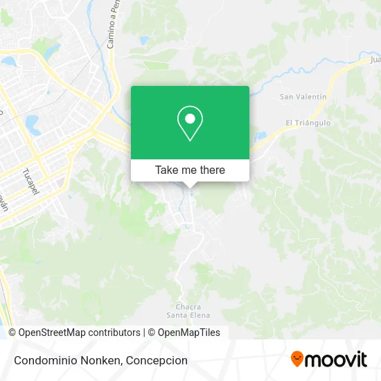
See Condominio Nonken, Concepcion, on the map
Public Transit to Condominio Nonken in Concepcion
Wondering how to get to Condominio Nonken in Concepcion? Moovit helps you find the best way to get to Condominio Nonken with step-by-step directions from the nearest public transit station.
Moovit provides free maps and live directions to help you navigate through your city. View schedules, routes, timetables, and find out how long does it take to get to Condominio Nonken in real time.
Looking for the nearest stop or station to Condominio Nonken? Check out this list of stops closest to your destination: Av Collao Esq P1 Norte; Cesfam Villa Nonguen Poniente; Cesafam Villa Nonguen Oriente; Cno. Nonguen Esq Central Poniente; Calle Dos Esq Pje Seis.
Bus: 22KD, 22SN, 23LP, 40BP, 70F, 18PY, 52AD, 70G, 70I, 72ZK, 17OX, 23EV, 70J, 70KH, 24MF, 24TR, 56VO.
Want to see if there’s another route that gets you there at an earlier time? Moovit helps you find alternative routes or times. Get directions from and directions to Condominio Nonken easily from the Moovit App or Website.
We make riding to Condominio Nonken easy, which is why over 1.5 million users, including users in Concepcion, trust Moovit as the best app for public transit. You don’t need to download an individual bus app or train app, Moovit is your all-in-one transit app that helps you find the best bus time or train time available.
For information on prices of bus, costs and ride fares to Condominio Nonken, please check the Moovit app.
Use the app to navigate to popular places including to the airport, hospital, stadium, grocery store, mall, coffee shop, school, college, and university.
Condominio Nonken Address: Pasaje 7 street in Concepcion
- Camino Nonguén 547,
- Barrio Privado Nonken,
- Valle Nonguén,
- Camino a Nonguén,
- Humedal Pichi Mapu,
- Pro Sushi House,
- donde vitoco,
- Población Puchacay,
- Sala Cuna Y Jardín Infantil Junji Ubb,
- Los Fresnos,
- Cooperativa Puchacay,
- Iglesia: Ministerio Cecarcon,
- Parque Los Fresnos,
- Terrazas De Collao,
- Sede Social Población Ríos de Chile,
- Cno. Nonguén - Central / Poniente,
- Población Ferroviaria,
- Cesfam Nonguén,
- Parque Residencial Los Fresnos,
- Payasita Ale Show
Places Near Condominio Nonken (Concepcion)
- Playa Lenga,
- Penco, Penco,
- En la micro camino a chiguayante, Concepcion,
- Zoológico de Concepción, Concepcion,
- Hualpén, Concepcion,
- Hospital Las Higueras, Talcahuano,
- Caleta Tumbes, Talcahuano,
- Mall Plaza del Trebol, Talcahuano,
- En La Micro Camino A Tome, Concepcion,
- Club Hípico De Concepción, Talcahuano,
- Jumbo - Easy Hualpén, Concepcion,
- Universidad De Concepción, Concepcion,
- San Pedro De La Paz, Concepcion,
- Vega Monumental, Concepcion,
- Lomas San Sebastian, Talcahuano,
- Universidad Del Bío-Bío, Concepcion,
- Mall Plaza Mirador Bío Bío, Concepcion,
- Clinica bio bio, Concepcion,
- Hospital Clínico Del Sur, Concepcion,
- Terminal Aeropuerto Carriel Sur, Talcahuano
How to get to popular places in Concepcion with public transit
Get around Concepcion by public transit!
Traveling around Concepcion has never been so easy. See step by step directions as you travel to any attraction, street or major public transit station. View bus and train schedules, arrival times, service alerts and detailed routes on a map, so you know exactly how to get to anywhere in Concepcion.
When traveling to any destination around Concepcion use Moovit's Live Directions with Get Off Notifications to know exactly where and how far to walk, how long to wait for your line, and how many stops are left. Moovit will alert you when it's time to get off — no need to constantly re-check whether yours is the next stop.
Wondering how to use public transit in Concepcion or how to pay for public transit in Concepcion? Moovit public transit app can help you navigate your way with public transit easily, and at minimum cost. It includes public transit fees, ticket prices, and costs. Looking for a map of Concepcion public transit lines? Moovit public transit app shows all public transit maps in Concepcion with all bus routes and stops on an interactive map.
Concepcion has 1 transit type(s), including: bus, operated by several transit agencies, including División de Transporte Público Regional