How to get to Congregacao Caminho do Ceu by bus?
Click on the bus route to see step by step directions with maps, line arrival times and updated time schedules.
From Estrada do Tingui, Campo Grande
58 minFrom West Shopping, Campo Grande
32 minFrom Praça 1º de Maio, Bangu
38 minFrom Estrada do Campinho, Campo Grande
49 minFrom Hospital da Mulher Mariska Ribeiro, Bangu
34 minFrom Pedra De Guaratiba, Pedra De Guaratiba
56 minFrom Km 32, Nova Iguaçu
56 minFrom Vargem Pequena, Vargem Pequena
90 minFrom Ct Ninho das Garças - Guaratiba, Guaratiba
67 minFrom Estrada da Posse, Campo Grande
35 min
Bus stops near Congregacao Caminho do Ceu in Campo Grande
Train station near Congregacao Caminho do Ceu in Campo Grande
- Campo Grande, 60 min walk,VIEW
Bus lines to Congregacao Caminho do Ceu in Campo Grande
What are the closest stations to Congregacao Caminho do Ceu?
The closest stations to Congregacao Caminho do Ceu are:
- Estrada Da Cachamorra, 2021 is 300 meters away, 4 min walk.
- Estrada Da Cachamorra, 2038 is 304 meters away, 4 min walk.
- Rua Manuel Beckman, 21-27 is 1148 meters away, 15 min walk.
- Campo Grande is 4715 meters away, 60 min walk.
Which bus lines stop near Congregacao Caminho do Ceu?
These bus lines stop near Congregacao Caminho do Ceu: 2804, 835, 854, 857, 883.
What’s the nearest bus station to Congregacao Caminho do Ceu in Campo Grande?
The nearest bus stations to Congregacao Caminho do Ceu in Campo Grande are Estrada Da Cachamorra, 2021 and Estrada Da Cachamorra, 2038. The closest one is a 4 min walk away.
What time is the first train to Congregacao Caminho do Ceu in Campo Grande?
The RAMAL SANTA CRUZ is the first train that goes to Congregacao Caminho do Ceu in Campo Grande. It stops nearby at 4:12 AM.
What time is the last train to Congregacao Caminho do Ceu in Campo Grande?
The RAMAL SANTA CRUZ is the last train that goes to Congregacao Caminho do Ceu in Campo Grande. It stops nearby at 11:41 PM.
What time is the first bus to Congregacao Caminho do Ceu in Campo Grande?
The SN 857 is the first bus that goes to Congregacao Caminho do Ceu in Campo Grande. It stops nearby at 3:13 AM.
What time is the last bus to Congregacao Caminho do Ceu in Campo Grande?
The SN 857 is the last bus that goes to Congregacao Caminho do Ceu in Campo Grande. It stops nearby at 2:45 AM.
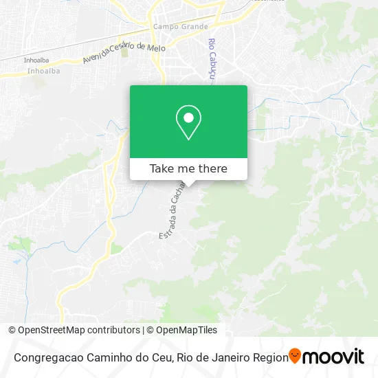
See Congregacao Caminho do Ceu, Campo Grande, on the map
Public Transit to Congregacao Caminho do Ceu in Campo Grande
Wondering how to get to Congregacao Caminho do Ceu in Campo Grande? Moovit helps you find the best way to get to Congregacao Caminho do Ceu with step-by-step directions from the nearest public transit station.
Moovit provides free maps and live directions to help you navigate through your city. View schedules, routes, timetables, and find out how long does it take to get to Congregacao Caminho do Ceu in real time.
Looking for the nearest stop or station to Congregacao Caminho do Ceu? Check out this list of stops closest to your destination: Estrada Da Cachamorra; Estrada Da Cachamorra; Rua Manuel Beckman; Campo Grande.
Bus: 2804, 835, 854, 857, 883, 820, 845, SN 857, 2334, 843.Train: RAMAL SANTA CRUZ.
Want to see if there’s another route that gets you there at an earlier time? Moovit helps you find alternative routes or times. Get directions from and directions to Congregacao Caminho do Ceu easily from the Moovit App or Website.
We make riding to Congregacao Caminho do Ceu easy, which is why over 1.5 million users, including users in Campo Grande, trust Moovit as the best app for public transit. You don’t need to download an individual bus app or train app, Moovit is your all-in-one transit app that helps you find the best bus time or train time available.
For information on prices of bus, costs and ride fares to Congregacao Caminho do Ceu, please check the Moovit app.
Use the app to navigate to popular places including to the airport, hospital, stadium, grocery store, mall, coffee shop, school, college, and university.
Congregacao Caminho do Ceu Address: Rua Lupércio, 318 Campo Grande Rio de Janeiro-RJ 23040-410 street in Campo Grande
- Ministério el Shaddai Internacional,
- Sitio do Angelo,
- R.Lima Eletronicos,
- Igreja Evangélica Ministério El Shaddai Internacional,
- Sítio do Deco,
- Rua Lupércio,
- Sítio do Gilberto,
- Dcgrj,
- Centro Espirita Vinha de Luz,
- Thiago Transporte,
- Pastel Gordinho,
- Lulu e Seus Croches,
- Estrada da Cachamorra,
- Sítio Pedacinho do Céu,
- Renata Cristal,
- Sueli Silva,
- Arena Rio Society,
- Jm Trasportes,
- Fernanda Brandariz,
- Ds Rescue
Places Near Congregacao Caminho do Ceu (Campo Grande)
- Niterói, Niterói,
- Hospital Federal Do Andaraí, Andaraí,
- Rio De Janeiro,
- Shopping Rio Sul, Botafogo,
- Avenida Venezuela 134, Saúde,
- Shopping Nova América, Del Castilho,
- Feirão De Malhas, Duque De Caxias,
- Rua Ulysses Guimarães 16, Cidade Nova,
- Shopping Downtown, Barra Da Tijuca,
- Museu Do Amanhã, Centro,
- Feira Livre da Gloria, Glória,
- Hospital Pedro Ernesto, Vila Isabel,
- Shopping RioSul, Botafogo,
- Avenida Rio Branco, Centro,
- Hospital Municipal Ronaldo Gazolla, Acari,
- Rodoviária Novo Rio (Rodoviária do Rio de Janeiro), Santo Cristo,
- Hospital Federal Cardoso Fontes, Jacarepaguá,
- Norte Shopping, Cachambi,
- Rua Licínio Cardoso, São Francisco Xavier,
- Praia do Arpoador, Ipanema
How to get to popular places in Rio de Janeiro Region with public transit
Get around Campo Grande by public transit!
Traveling around Campo Grande has never been so easy. See step by step directions as you travel to any attraction, street or major public transit station. View bus and train schedules, arrival times, service alerts and detailed routes on a map, so you know exactly how to get to anywhere in Campo Grande.
When traveling to any destination around Campo Grande use Moovit's Live Directions with Get Off Notifications to know exactly where and how far to walk, how long to wait for your line, and how many stops are left. Moovit will alert you when it's time to get off — no need to constantly re-check whether yours is the next stop.
Wondering how to use public transit in Campo Grande or how to pay for public transit in Campo Grande? Moovit public transit app can help you navigate your way with public transit easily, and at minimum cost. It includes public transit fees, ticket prices, and costs. Looking for a map of Campo Grande public transit lines? Moovit public transit app shows all public transit maps in Campo Grande with all Bus, Train, Metro, Light Rail, Ferry, Cable Car, Gondola and Funicular routes and stops on an interactive map.
Rio de Janeiro Region has 8 transit type(s), including: Bus, Train, Metro, Light Rail, Ferry, Cable Car, Gondola and Funicular, operated by several transit agencies, including TrensRJ, Metrô Rio, VLT Carioca, Barcas Rio, BRT MOBI-Rio, Auto Viação Alpha, Auto Viação Tijuca, Gire Transportes, Transurb, Viação Nossa Senhora das Graças, Consórcio INTERSUL, Braso Lisboa (Municipal), Caprichosa Auto Ônibus, Auto Viação Três Amigos and Rodoviária Âncora Matias
Public transit lines with stations closest to Congregacao Caminho do Ceu in Campo Grande
Train lines with stations closest to Congregacao Caminho do Ceu in Campo Grande
Bus lines with stations closest to Congregacao Caminho do Ceu in Campo Grande
Estrada Da Cachamorra, 2021
 820Rio da Prata - Terminal Mato Alto (via Cachamorra)
- 845Cantagalo - Campo Grande (via Cachamorra)
- 857Terminal Campo Grande - Terminal Pingo D'água (Via Cachamorra / Estrada do Catruz)
- SN 857Terminal Campo Grande - BRT Pingo D'água (via Cachamorra / Estrada do Catruz)
- 883Terminal Mato Alto - Terminal Deodoro (via Cachamorra)