Directions to Congregation Tiferes Yisroel (Baltimore) with public transportation
The following transit lines have routes that pass near Congregation Tiferes Yisroel
How to get to Congregation Tiferes Yisroel by bus?
Click on the bus route to see step by step directions with maps, line arrival times and updated time schedules.
How to get to Congregation Tiferes Yisroel by metro?
Click on the metro route to see step by step directions with maps, line arrival times and updated time schedules.
Bus stations near Congregation Tiferes Yisroel in Baltimore
- Park Heights Ave & Pinkney Rd Sb,2 min walk,
- Glen Ave & Park Heights Ave Wb,6 min walk,
Metro stations near Congregation Tiferes Yisroel in Baltimore
- Milford Mill Metro,29 min walk,
Light Rail stations near Congregation Tiferes Yisroel in Baltimore
- Mt. Washington,36 min walk,
Bus lines to Congregation Tiferes Yisroel in Baltimore
- 85,North Ave Lr Station,
- 92,Luckman Park,
- 34,Falls Rd Light Rail,
What are the closest stations to Congregation Tiferes Yisroel?
The closest stations to Congregation Tiferes Yisroel are:
- Park Heights Ave & Pinkney Rd Sb is 109 yards away, 2 min walk.
- Glen Ave & Park Heights Ave Wb is 464 yards away, 6 min walk.
- Milford Mill Metro is 2332 yards away, 29 min walk.
- Mt. Washington is 3079 yards away, 36 min walk.
Which bus line stops near Congregation Tiferes Yisroel?
85
Which metro line stops near Congregation Tiferes Yisroel?
METRO
What’s the nearest metro station to Congregation Tiferes Yisroel in Baltimore?
The nearest metro station to Congregation Tiferes Yisroel in Baltimore is Milford Mill Metro. It’s a 29 min walk away.
What’s the nearest bus stop to Congregation Tiferes Yisroel in Baltimore?
The nearest bus stop to Congregation Tiferes Yisroel in Baltimore is Park Heights Ave & Pinkney Rd Sb. It’s a 2 min walk away.
What time is the first light rail to Congregation Tiferes Yisroel in Baltimore?
The LIGHT RAIL is the first light rail that goes to Congregation Tiferes Yisroel in Baltimore. It stops nearby at 4:32 AM.
What time is the last light rail to Congregation Tiferes Yisroel in Baltimore?
The LIGHT RAIL is the last light rail that goes to Congregation Tiferes Yisroel in Baltimore. It stops nearby at 1:11 AM.
What time is the first metro to Congregation Tiferes Yisroel in Baltimore?
The METRO is the first metro that goes to Congregation Tiferes Yisroel in Baltimore. It stops nearby at 3:45 AM.
What time is the last metro to Congregation Tiferes Yisroel in Baltimore?
The METRO is the last metro that goes to Congregation Tiferes Yisroel in Baltimore. It stops nearby at 12:23 AM.
What time is the first bus to Congregation Tiferes Yisroel in Baltimore?
The 85 is the first bus that goes to Congregation Tiferes Yisroel in Baltimore. It stops nearby at 4:05 AM.
What time is the last bus to Congregation Tiferes Yisroel in Baltimore?
The 85 is the last bus that goes to Congregation Tiferes Yisroel in Baltimore. It stops nearby at 2:14 AM.
How much is the metro fare to Congregation Tiferes Yisroel?
The metro fare to Congregation Tiferes Yisroel costs about $2.00.
See Congregation Tiferes Yisroel, Baltimore, on the map
Public Transit to Congregation Tiferes Yisroel in Baltimore
Wondering how to get to Congregation Tiferes Yisroel in Baltimore, United States? Moovit helps you find the best way to get to Congregation Tiferes Yisroel with step-by-step directions from the nearest public transit station.
Moovit provides free maps and live directions to help you navigate through your city. View schedules, routes, timetables, and find out how long does it take to get to Congregation Tiferes Yisroel in real time.
Looking for the nearest stop or station to Congregation Tiferes Yisroel? Check out this list of stops closest to your destination: Park Heights Ave & Pinkney Rd Sb; Glen Ave & Park Heights Ave Wb; Milford Mill Metro; Mt. Washington.
Bus:859234Metro:METRO
Want to see if there’s another route that gets you there at an earlier time? Moovit helps you find alternative routes or times. Get directions from and directions to Congregation Tiferes Yisroel easily from the Moovit App or Website.
We make riding to Congregation Tiferes Yisroel easy, which is why over 1.5 million users, including users in Baltimore, trust Moovit as the best app for public transit. You don’t need to download an individual bus app or train app, Moovit is your all-in-one transit app that helps you find the best bus time or train time available.
For information on prices of bus and metro, costs and ride fares to Congregation Tiferes Yisroel, please check the Moovit app.
Use the app to navigate to popular places including to the airport, hospital, stadium, grocery store, mall, coffee shop, school, college, and university.
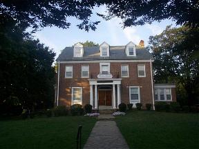
Congregation Tiferes Yisroel Address: 6201 Park Heights Ave Baltimore, MD 21215 street in Baltimore
Attractions near Congregation Tiferes Yisroel
Rufus Ingram Pa,Shul Building,Hertzberg's,Limousine Baltimore,Key Management Co.,Quest Management Group,Steven Simenowitz,Baltimore Club Of Printing,Lady Coach Butterfly,Mesivta Neimus Hatorah,Glen, Maryland,USPS Collection Box - Blue Box,Cecile M Woel Dr,Abilities Occupational Therapy Services,Wrapunzel Baltimore,MD Neuro-Rehab and Wellness Center,Park Heights Avenue & Menlo Drive Southbound,Shooz,Fashion Shop,Park Heights Avenue & Menlo Drive NorthboundHow to get to popular attractions in Baltimore with public transit
Dave & Buster's, Anne Arundel County,Honey Pig Gooldaegee Korean Grill, Fairfax County,The Park at 14th, Washington,Federal Hill, Baltimore,Biergarten Haus, Washington,Marvin, Washington,White Flint Metro Station, Montgomery County,Walmart Supercenter, Anne Arundel County,Local 16, Washington,Nordstrom, Arlington County,Rosa Mexicano, Washington,Hamilton's Bar & Grill, Washington,American Ice Company, Washington,Sticky Rice, Washington,Columbia, MD, Howard County,Centreville, VA, Fairfax County,Matchbox Vintage Pizza Bistro, Washington,Baltimore Farmers' Market & Bazaar, Baltimore,Spider Kelly's, Arlington County,Crystal City Sports Pub, Arlington CountyGet around Baltimore by public transit!
Traveling around Baltimore has never been so easy. See step by step directions as you travel to any attraction, street or major public transit station. View bus and train schedules, arrival times, service alerts and detailed routes on a map, so you know exactly how to get to anywhere in Baltimore.
When traveling to any destination around Baltimore use Moovit's Live Directions with Get Off Notifications to know exactly where and how far to walk, how long to wait for your line, and how many stops are left. Moovit will alert you when it's time to get off — no need to constantly re-check whether yours is the next stop.
Wondering how to use public transit in Baltimore or how to pay for public transit in Baltimore? Moovit public transit app can help you navigate your way with public transit easily, and at minimum cost. It includes public transit fees, ticket prices, and costs. Looking for a map of Baltimore public transit lines? Moovit public transit app shows all public transit maps in Baltimore with all bus or metro routes and stops on an interactive map.
Baltimore has 2 transit type(s), including: bus or metro, operated by several transit agencies, including WMATA, WMATA, Montgomery County Ride On, Fairfax Connector, TheBus, DC Circulator, MDOT MTA, Marc, MDOT MTA, MDOT MTA, Virginia Railway Express (VRE), PRTC, DASH - Alexandria, Arlington Transit (ART) and DC Streetcar