How to get to Conscious Corner by bus?
Click on the bus route to see step by step directions with maps, line arrival times and updated time schedules.
From Elkridge, MD, Howard County
86 minFrom I-95 Exit 33 - Laurel/Burtonsville (Sandy Spring Rd/MD 198), Prince George's County
136 minFrom Lincoln Tech, Howard County
65 minFrom The Mall In Columbia, Howard County
87 minFrom Olney MD USA, Montgomery County
292 minFrom Columbia, MD, Howard County
104 minFrom Howard Community College, Howard County
124 minFrom Laurel, Maryland, Prince George's County
142 minFrom Merriweather Post Pavilion, Howard County
95 min
Bus stop near Conscious Corner in Howard County
- Clarksville Park & Ride, 7 min walk,VIEW
Bus lines to Conscious Corner in Howard County
What are the closest stations to Conscious Corner?
The closest stations to Conscious Corner are:
- Clarksville Park & Ride is 531 yards away, 7 min walk.
Which bus line stops near Conscious Corner?
345 (345/5 Clarksville Park & Ride)
What’s the nearest bus station to Conscious Corner in Howard County?
The nearest bus station to Conscious Corner in Howard County is Clarksville Park & Ride. It’s a 7 min walk away.
What time is the first bus to Conscious Corner in Howard County?
The 335 is the first bus that goes to Conscious Corner in Howard County. It stops nearby at 5:08 AM.
What time is the last bus to Conscious Corner in Howard County?
The 345 is the last bus that goes to Conscious Corner in Howard County. It stops nearby at 7:44 PM.
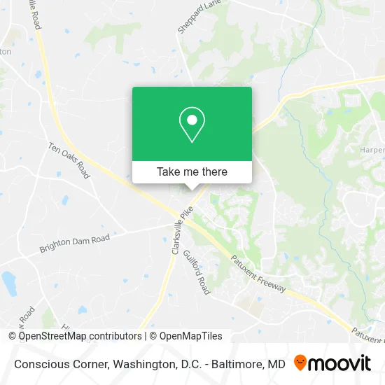
See Conscious Corner, Howard County, on the map
Public Transit to Conscious Corner in Howard County
Wondering how to get to Conscious Corner in Howard County? Moovit helps you find the best way to get to Conscious Corner with step-by-step directions from the nearest public transit station.
Moovit provides free maps and live directions to help you navigate through your city. View schedules, routes, timetables, and find out how long does it take to get to Conscious Corner in real time.
Looking for the nearest stop or station to Conscious Corner? Check out this list of stops closest to your destination: Clarksville Park & Ride.
Bus: 345, 335.
Want to see if there’s another route that gets you there at an earlier time? Moovit helps you find alternative routes or times. Get directions from and directions to Conscious Corner easily from the Moovit App or Website.
We make riding to Conscious Corner easy, which is why over 1.7 million users, including users in Howard County, trust Moovit as the best app for public transit. You don’t need to download an individual bus app or train app, Moovit is your all-in-one transit app that helps you find the best bus time or train time available.
For information on prices of bus, costs and ride fares to Conscious Corner, please check the Moovit app.
Use the app to navigate to popular places including to the airport, hospital, stadium, grocery store, mall, coffee shop, school, college, and university.
Conscious Corner Address: 5805 Clarksville Square Dr street in Howard County
- Ourisman CHRYSLER DODGE Jeep Ram,
- River Hill High School (River Hill Media Center),
- Clarksville, Maryland,
- 5920 Bright Flow Mews,
- 12035 Misty Rise Ct,
- Early Lilacs Shining Ln,
- Indian Summer Dr & Shining Stars Ln,
- Every Sail Path & Great Star Dr,
- 6104 Trackless Sea Ct,
- Clarksville Meadow Way,
- 6590 Barley Corn Row,
- 11820 Clarksville Pike,
- Nodding Night Ct & S Wind Cir,
- Pointers Pilates,
- 6601 Welcome Night Path,
- Great Star Enchanted Key Gate,
- SH- Exit 19,
- Swimmer Row Way,
- 11820 Chapel Bells Way,
- Mary's Land Farm
Places Near Conscious Corner (Howard County)
- Washington DC VA Medical Center, Washington,
- National Theatre, Washington,
- Marriott Marquis Washington, DC, Washington,
- Camden Yards, Baltimore,
- Basilica of the National Shrine, Washington,
- Rock Creek Tennis Center, Washington,
- Amazon Hq2, Arlington County,
- National Zoo, Washington,
- Westfield Montgomery Mall, Montgomery County,
- Sibley Memorial Hospital, Washington,
- Pennsylvania Ave NW (3rd st and pennsylvania), Washington,
- The Anthem, Washington,
- National Museum of African American History and Culture, Washington,
- Warner Theatre, Washington,
- Georgetown, Washington,
- Washington National Cathedral, Washington,
- PG Mall, Prince George's County,
- Capital One Arena, Washington,
- M&T Bank Stadium, Baltimore,
- Museum Of The Bible, Washington
How to get to popular places in Washington, D.C. - Baltimore, MD with public transit
Get around Howard County by public transit!
Traveling around Howard County has never been so easy. See step by step directions as you travel to any attraction, street or major public transit station. View bus and train schedules, arrival times, service alerts and detailed routes on a map, so you know exactly how to get to anywhere in Howard County.
When traveling to any destination around Howard County use Moovit's Live Directions with Get Off Notifications to know exactly where and how far to walk, how long to wait for your line, and how many stops are left. Moovit will alert you when it's time to get off — no need to constantly re-check whether yours is the next stop.
Wondering how to use public transit in Howard County or how to pay for public transit in Howard County? Moovit public transit app can help you navigate your way with public transit easily, and at minimum cost. It includes public transit fees, ticket prices, and costs. Looking for a map of Howard County public transit lines? Moovit public transit app shows all public transit maps in Howard County with all Bus, Train, Metro, Light Rail and Ferry routes and stops on an interactive map.
Washington, D.C. - Baltimore, MD has 5 transit type(s), including: Bus, Train, Metro, Light Rail and Ferry, operated by several transit agencies, including WMATA, Montgomery County Ride On, Fairfax Connector, TheBus, PRTC, DASH - Alexandria, Arlington Transit (ART), RTA of Central Maryland, MDOT MTA, MDOT MTA Light RailLink, MDOT MTA Commuter Bus, MDOT MTA Local Bus, FXBGO!, Virginia Railway Express (VRE) and MARC