Directions to Constance Doherty (Franklin Square) with public transportation
The following transit lines have routes that pass near Constance Doherty
 Bus: N25, N6, N25/58, ELFX.
- Train: HEMPSTEAD BRANCH, WEST HEMPSTEAD BRANCH.
How to get to Constance Doherty by bus?
Click on the bus route to see step by step directions with maps, line arrival times and updated time schedules.
From jetBlue Terminal 5 JFK Int'l Airport NY, Queens
137 minFrom Queens Hospital Center, Queens
73 minFrom JFK Terminal 5/Air Train Station, Queens
140 minFrom North Shore University Hospital, Manhasset
41 minFrom Westbury, NY, Westbury
66 minFrom JFK International Airport Terminal 4, Queens
107 minFrom DMV Jamaica Nys, Queens
66 minFrom Jamaica, Queens
71 minFrom St. John's University, Queens
68 minFrom Jamaica, NY, Queens
70 min
How to get to Constance Doherty by train?
Click on the train route to see step by step directions with maps, line arrival times and updated time schedules.
Bus stops near Constance Doherty in Franklin Square
Train stations near Constance Doherty in Franklin Square
Bus lines to Constance Doherty in Franklin Square
What are the closest stations to Constance Doherty?
The closest stations to Constance Doherty are:
- Franklin Ave + Oaks Dr is 129 yards away, 2 min walk.
- Meacham Ave + Scimitar Ave is 757 yards away, 9 min walk.
- Westwood is 2028 yards away, 24 min walk.
- Stewart Manor is 3730 yards away, 44 min walk.
Which bus lines stop near Constance Doherty?
These bus lines stop near Constance Doherty: N25, N6.
Which train line stops near Constance Doherty?
HEMPSTEAD BRANCH (Hempstead)
What’s the nearest train station to Constance Doherty in Franklin Square?
The nearest train station to Constance Doherty in Franklin Square is Westwood. It’s a 24 min walk away.
What’s the nearest bus station to Constance Doherty in Franklin Square?
The nearest bus station to Constance Doherty in Franklin Square is Franklin Ave + Oaks Dr. It’s a 2 min walk away.
What time is the first train to Constance Doherty in Franklin Square?
The HEMPSTEAD BRANCH is the first train that goes to Constance Doherty in Franklin Square. It stops nearby at 3:16 AM.
What time is the last train to Constance Doherty in Franklin Square?
The HEMPSTEAD BRANCH is the last train that goes to Constance Doherty in Franklin Square. It stops nearby at 3:16 AM.
What time is the first bus to Constance Doherty in Franklin Square?
The ELFX is the first bus that goes to Constance Doherty in Franklin Square. It stops nearby at 4:52 AM.
What time is the last bus to Constance Doherty in Franklin Square?
The N25 is the last bus that goes to Constance Doherty in Franklin Square. It stops nearby at 11:35 PM.
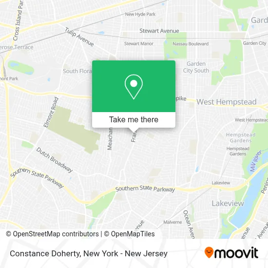
See Constance Doherty, Franklin Square, on the map
Public Transit to Constance Doherty in Franklin Square
Wondering how to get to Constance Doherty in Franklin Square? Moovit helps you find the best way to get to Constance Doherty with step-by-step directions from the nearest public transit station.
Moovit provides free maps and live directions to help you navigate through your city. View schedules, routes, timetables, and find out how long does it take to get to Constance Doherty in real time.
Looking for the nearest stop or station to Constance Doherty? Check out this list of stops closest to your destination: Franklin Ave + Oaks Dr; Meacham Ave + Scimitar Ave; Westwood; Stewart Manor.
Bus: N25, N6, N25/58, ELFX.Train: HEMPSTEAD BRANCH, WEST HEMPSTEAD BRANCH.
Want to see if there’s another route that gets you there at an earlier time? Moovit helps you find alternative routes or times. Get directions from and directions to Constance Doherty easily from the Moovit App or Website.
We make riding to Constance Doherty easy, which is why over 1.5 million users, including users in Franklin Square, trust Moovit as the best app for public transit. You don’t need to download an individual bus app or train app, Moovit is your all-in-one transit app that helps you find the best bus time or train time available.
For information on prices of bus, train and light rail, costs and ride fares to Constance Doherty, please check the Moovit app.
Use the app to navigate to popular places including to the airport, hospital, stadium, grocery store, mall, coffee shop, school, college, and university.
Constance Doherty Address: 390 Franklin Ave street in Franklin Square
- Orlando Frade, Realtor - Douglas Elliman,
- Jennifer 'Berte' Catalano Realtor - Homes Of Love and Dreams,
- Vincent Lupo Realtor,
- Charles Maione,
- Maria Squitieri, Licensed Real Estate Salesperson at Douglas Elliman,
- William Hartmann Realtor at Douglas Elliman In Franklin Square, NY,
- Judith Seide Realtor at Douglas Elliman In Franklin Square, NY,
- Monica Altmann,
- Brian Waite, Licensed Real Estate Salesperson at Douglas Elliman,
- Elisabetta D'Aleo, Realtor at Douglas Elliman Real Estate,
- The Evangelista Team,
- Antoinette Caruso Licensed Associate Broker at Douglas Elliman In Franklin Square, NY,
- Charmaine Davis, Jason Mitchell Group,
- Helena Veloso,
- Raisa Falconi Real Estate Agent at Douglas Elliman,
- Ivy Garito,
- Matt Chiarelli Real Estate,
- Jonathan Dhanraj, Realtor,
- John Vissichelli - Real Estate Professional,
- Linda_Fontana86
Places Near Constance Doherty (Franklin Square)
- 26 Federal Plaza, Manhattan,
- San Gennaro Feast, Manhattan,
- Pier 83, Manhattan,
- Bellevue Hospital, Manhattan,
- Wall Street, Manhattan,
- SoHo, Manhattan,
- Rockefeller Center, Manhattan,
- 911 Memorial, Manhattan,
- Chinatown, Manhattan,
- 66 John Street, Manhattan,
- Mountainside Hospital, Glen Ridge,
- Katz's Deli, Manhattan,
- Queens Center Mall, Queens,
- qqqq, Manhattan,
- 111 Centre New York City Supreme Court, Manhattan,
- Hudson Yards, Manhattan,
- 1 Police Plaza, Manhattan,
- Times Square, Manhattan,
- 376 Hudson Street, Manhattan,
- 3 Stone St, Manhattan
How to get to popular places in New York - New Jersey with public transit
Get around Franklin Square by public transit!
Traveling around Franklin Square has never been so easy. See step by step directions as you travel to any attraction, street or major public transit station. View bus and train schedules, arrival times, service alerts and detailed routes on a map, so you know exactly how to get to anywhere in Franklin Square.
When traveling to any destination around Franklin Square use Moovit's Live Directions with Get Off Notifications to know exactly where and how far to walk, how long to wait for your line, and how many stops are left. Moovit will alert you when it's time to get off — no need to constantly re-check whether yours is the next stop.
Wondering how to use public transit in Franklin Square or how to pay for public transit in Franklin Square? Moovit public transit app can help you navigate your way with public transit easily, and at minimum cost. It includes public transit fees, ticket prices, and costs. Looking for a map of Franklin Square public transit lines? Moovit public transit app shows all public transit maps in Franklin Square with all Bus, Train, Subway, Light Rail, Ferry and Cable Car routes and stops on an interactive map.
New York - New Jersey has 6 transit type(s), including: Bus, Train, Subway, Light Rail, Ferry and Cable Car, operated by several transit agencies, including MTA Subway, Metro-North Railroad, LIRR, PATH, MTA New York City Transit - Express routes, MTA Bus, NJ Transit, NYC Ferry, NICE bus, Bee-Line Bus, NJ Transit Rail, Norwalk Transit District, Hartford Line, River Valley Transit and HART