How to get to Cook Hall & Hyde Insurance by bus?
Click on the bus route to see step by step directions with maps, line arrival times and updated time schedules.
From Holy Name Hospital, Teaneck
43 minFrom Paramus, NJ, Paramus
36 minFrom Westfield Garden State Plaza, Paramus
27 minFrom Hackensack, NJ, Hackensack
50 minFrom BAPS Shri Swaminarayan Mandir, Clifton
60 minFrom Englewood, NJ, Englewood
47 minFrom Teaneck, NJ, Teaneck
48 minFrom Carlstadt, NJ, Carlstadt
58 minFrom Riverside Square Mall, Hackensack
49 minFrom Passaic, NJ, Passaic
63 min
How to get to Cook Hall & Hyde Insurance by train?
Click on the train route to see step by step directions with maps, line arrival times and updated time schedules.
Bus stop near Cook Hall & Hyde Insurance in Fair Lawn
- Fair Lawn Ave at Pollitt Dr, 2 min walk,VIEW
Train station near Cook Hall & Hyde Insurance in Fair Lawn
- Broadway, 10 min walk,VIEW
Bus lines to Cook Hall & Hyde Insurance in Fair Lawn
What are the closest stations to Cook Hall & Hyde Insurance?
The closest stations to Cook Hall & Hyde Insurance are:
- Fair Lawn Ave at Pollitt Dr is 131 yards away, 2 min walk.
- Broadway is 810 yards away, 10 min walk.
Which bus line stops near Cook Hall & Hyde Insurance?
171 (Paterson Garden State Plaza & Ikea)
Which train line stops near Cook Hall & Hyde Insurance?
MCL (Suffern)
What’s the nearest train station to Cook Hall & Hyde Insurance in Fair Lawn?
The nearest train station to Cook Hall & Hyde Insurance in Fair Lawn is Broadway. It’s a 10 min walk away.
What’s the nearest bus station to Cook Hall & Hyde Insurance in Fair Lawn?
The nearest bus station to Cook Hall & Hyde Insurance in Fair Lawn is Fair Lawn Ave at Pollitt Dr. It’s a 2 min walk away.
What time is the first train to Cook Hall & Hyde Insurance in Fair Lawn?
The MCL is the first train that goes to Cook Hall & Hyde Insurance in Fair Lawn. It stops nearby at 5:16 AM.
What time is the last train to Cook Hall & Hyde Insurance in Fair Lawn?
The MCL is the last train that goes to Cook Hall & Hyde Insurance in Fair Lawn. It stops nearby at 2:13 AM.
What time is the first bus to Cook Hall & Hyde Insurance in Fair Lawn?
The 171 is the first bus that goes to Cook Hall & Hyde Insurance in Fair Lawn. It stops nearby at 5:12 AM.
What time is the last bus to Cook Hall & Hyde Insurance in Fair Lawn?
The 171 is the last bus that goes to Cook Hall & Hyde Insurance in Fair Lawn. It stops nearby at 1:47 AM.
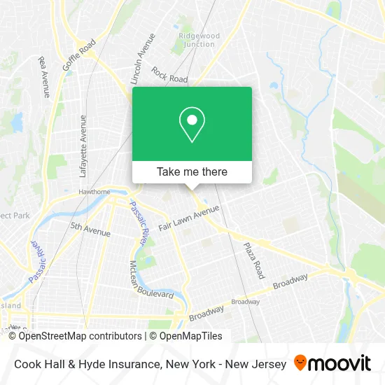
See Cook Hall & Hyde Insurance, Fair Lawn, on the map
Public Transit to Cook Hall & Hyde Insurance in Fair Lawn
Wondering how to get to Cook Hall & Hyde Insurance in Fair Lawn? Moovit helps you find the best way to get to Cook Hall & Hyde Insurance with step-by-step directions from the nearest public transit station.
Moovit provides free maps and live directions to help you navigate through your city. View schedules, routes, timetables, and find out how long does it take to get to Cook Hall & Hyde Insurance in real time.
Looking for the nearest stop or station to Cook Hall & Hyde Insurance? Check out this list of stops closest to your destination: Fair Lawn Ave at Pollitt Dr; Broadway.
Bus: 171, 145.Train: MCL, PJL.
Want to see if there’s another route that gets you there at an earlier time? Moovit helps you find alternative routes or times. Get directions from and directions to Cook Hall & Hyde Insurance easily from the Moovit App or Website.
We make riding to Cook Hall & Hyde Insurance easy, which is why over 1.5 million users, including users in Fair Lawn, trust Moovit as the best app for public transit. You don’t need to download an individual bus app or train app, Moovit is your all-in-one transit app that helps you find the best bus time or train time available.
For information on prices of bus and train, costs and ride fares to Cook Hall & Hyde Insurance, please check the Moovit app.
Use the app to navigate to popular places including to the airport, hospital, stadium, grocery store, mall, coffee shop, school, college, and university.
Cook Hall & Hyde Insurance Address: 17-17 State Rt 208 street in Fair Lawn
- Sethia's Rc Plane Workshop,
- Extra Space Storage,
- Custom Made Kitchens,
- Abandoned Parking Lot,
- Tkl Research,
- Indigokid Montessori School,
- Dr. Yiska Furman,
- All Star Events NJ,
- Garage Door Fair Lawn,
- Total Lab Source - Laboratory Supply,
- Blue Sky Pool Inspections,
- Yamaha Music School Of Fair Lawn and Livingston NJ,
- T.K.L,
- Bushoven Llc,
- Habit Burger & Grill,
- Moxie Salon and Beauty Bar,
- Mira Segal / Dmkpro.Inc,
- Ulma Form Works,
- Craig Mont,
- Jersey Mike's
Places Near Cook Hall & Hyde Insurance (Fair Lawn)
- Katz's Deli, Manhattan,
- 66 John Street, Manhattan,
- Mountainside Hospital, Glen Ridge,
- 1 Police Plaza, Manhattan,
- 3 Stone St, Manhattan,
- 376 Hudson Street, Manhattan,
- Hudson Yards, Manhattan,
- Queens Center Mall, Queens,
- Chinatown, Manhattan,
- Bellevue Hospital, Manhattan,
- Pier 83, Manhattan,
- 111 Centre New York City Supreme Court, Manhattan,
- Wall Street, Manhattan,
- 911 Memorial, Manhattan,
- Rockefeller Center, Manhattan,
- 26 Federal Plaza, Manhattan,
- qqqq, Manhattan,
- Times Square, Manhattan,
- San Gennaro Feast, Manhattan,
- SoHo, Manhattan
How to get to popular places in New York - New Jersey with public transit
Get around Fair Lawn by public transit!
Traveling around Fair Lawn has never been so easy. See step by step directions as you travel to any attraction, street or major public transit station. View bus and train schedules, arrival times, service alerts and detailed routes on a map, so you know exactly how to get to anywhere in Fair Lawn.
When traveling to any destination around Fair Lawn use Moovit's Live Directions with Get Off Notifications to know exactly where and how far to walk, how long to wait for your line, and how many stops are left. Moovit will alert you when it's time to get off — no need to constantly re-check whether yours is the next stop.
Wondering how to use public transit in Fair Lawn or how to pay for public transit in Fair Lawn? Moovit public transit app can help you navigate your way with public transit easily, and at minimum cost. It includes public transit fees, ticket prices, and costs. Looking for a map of Fair Lawn public transit lines? Moovit public transit app shows all public transit maps in Fair Lawn with all Bus, Train, Subway, Light Rail, Ferry and Cable Car routes and stops on an interactive map.
New York - New Jersey has 6 transit type(s), including: Bus, Train, Subway, Light Rail, Ferry and Cable Car, operated by several transit agencies, including MTA Subway, Metro-North Railroad, LIRR, PATH, MTA New York City Transit - Express routes, MTA Bus, NJ Transit, NYC Ferry, NICE bus, Bee-Line Bus, NJ Transit Rail, Norwalk Transit District, Hartford Line, River Valley Transit and HART