How to get to Cook's by bus?
Click on the bus route to see step by step directions with maps, line arrival times and updated time schedules.
From Wanquetin, Saint-Laurent-Blangy
39 minFrom Fraikin Locamion, Tilloy-Lès-Mofflaines
43 minFrom Marais Des Places, Fampoux
72 minFrom Aire de Saint-Laurent-Blangy, Saint-Laurent-Blangy
45 minFrom La Gamme Twenty, Boiry-Sainte-Rictrude
68 minFrom Marais Verlaine, Fampoux
60 minFrom Briand Sylvia, Boiry-Becquerelle
80 minFrom Wailly, Wailly
39 minFrom Régnier Karasinski Fabienne, Boisleux-Au-Mont
68 minFrom Parent Laurent, Feuchy
42 min
Bus stops near Cook's in Arras
Bus lines to Cook's in Arras
What are the closest stations to Cook's?
The closest stations to Cook's are:
- Mandela is 126 meters away, 2 min walk.
- Equipement is 249 meters away, 4 min walk.
- Eglise St Paul is 289 meters away, 4 min walk.
- Arras - Centre Commercial is 778 meters away, 10 min walk.
- Cfa Effeil is 1256 meters away, 16 min walk.
Which bus line stops near Cook's?
L1 (St-Nicolas Cruppes→Arras - Centre Commercial)
What’s the nearest bus station to Cook's in Arras?
The nearest bus station to Cook's in Arras is Mandela. It’s a 2 min walk away.
What time is the first bus to Cook's in Arras?
The L1 is the first bus that goes to Cook's in Arras. It stops nearby at 6:17 AM.
What time is the last bus to Cook's in Arras?
The L1 is the last bus that goes to Cook's in Arras. It stops nearby at 9:20 PM.
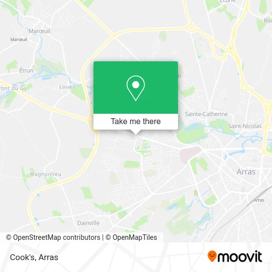
See Cook's, Arras, on the map
Public Transit to Cook's in Arras
Wondering how to get to Cook's in Arras? Moovit helps you find the best way to get to Cook's with step-by-step directions from the nearest public transit station.
Moovit provides free maps and live directions to help you navigate through your city. View schedules, routes, timetables, and find out how long does it take to get to Cook's in real time.
Looking for the nearest stop or station to Cook's? Check out this list of stops closest to your destination: Mandela; Equipement; Eglise St Paul; Arras - Centre Commercial; Cfa Effeil.
Bus: L1, L2, LD1, C6, C8, C24, L6, L18, C1.
Want to see if there’s another route that gets you there at an earlier time? Moovit helps you find alternative routes or times. Get directions from and directions to Cook's easily from the Moovit App or Website.
We make riding to Cook's easy, which is why over 1.5 million users, including users in Arras, trust Moovit as the best app for public transit. You don’t need to download an individual bus app or train app, Moovit is your all-in-one transit app that helps you find the best bus time or train time available.
For information on prices of bus, costs and ride fares to Cook's, please check the Moovit app.
Use the app to navigate to popular places including to the airport, hospital, stadium, grocery store, mall, coffee shop, school, college, and university.
Cook's Address: 225 Avenue Winston Churchill 62000 Arras street in Arras
- Urban Culture,
- Destock Jeans,
- Benoît Stoven Jewelery,
- Aushopping,
- Cleor,
- Armand Thiery,
- Traiteur Auchan Arras,
- Cse Auchan,
- Compagnie du Dragon,
- Easy Cash Arras,
- Easy Cash,
- Centre De Valorisation Des Ressources Humaines D'Arras,
- Memphis,
- Station de recharge pour véhicules électriques,
- Mcdonald's,
- Grand Frais/ Darty/ Besson/ Naturéo/ Saint-Maclou,
- Klo,
- Des Marques,
- Despi le Boucher,
- Lidl
Places Near Cook's (Arras)
- Lycée Général Gambetta Carnot, Arras,
- Centre Commercial Auchan, Arras,
- Marché De Noël, Arras,
- Grand'Place, Arras,
- lycée Baudimont St-Charles, Arras,
- Lycée Polyvalent Guy Mollet, Arras,
- Lycée Professionnel Alain Savary, Arras,
- Lycée Privé Baudimont Saint-Charles, Arras,
- Lfb Group Arras, Bailleul-Sir-Berthoult,
- Auchan Arras, Arras,
- Citadelle D'Arras, Arras,
- Centre Hospitalier D'Arras, Arras,
- Main Square Festival, Arras,
- Artois-Expo, Saint-Laurent-Blangy,
- Caf, Arras,
- Le Set Famous Club Roclincourt, Arras,
- Université D'Artois, Arras,
- Lycée Robespierre, Arras,
- Hôpital Privé Arras Les Bonnettes, Arras,
- Lycée Du Bâtiment Jacques Le Caron, Arras
How to get to popular places in Arras with public transit
Get around Arras by public transit!
Traveling around Arras has never been so easy. See step by step directions as you travel to any attraction, street or major public transit station. View bus and train schedules, arrival times, service alerts and detailed routes on a map, so you know exactly how to get to anywhere in Arras.
When traveling to any destination around Arras use Moovit's Live Directions with Get Off Notifications to know exactly where and how far to walk, how long to wait for your line, and how many stops are left. Moovit will alert you when it's time to get off — no need to constantly re-check whether yours is the next stop.
Wondering how to use public transit in Arras or how to pay for public transit in Arras? Moovit public transit app can help you navigate your way with public transit easily, and at minimum cost. It includes public transit fees, ticket prices, and costs. Looking for a map of Arras public transit lines? Moovit public transit app shows all public transit maps in Arras with all bus routes and stops on an interactive map.
Arras has 1 transit type(s), including: bus, operated by several transit agencies, including Artis