How to get to Cooking For You by bus?
Click on the bus route to see step by step directions with maps, line arrival times and updated time schedules.
From Sorano Thermal Residence, Sorano
195 minFrom Piancastagnaio, Piancastagnaio
136 minFrom San Zeno, Arezzo
167 minFrom Arezzo Equestrian Center, Arezzo
184 minFrom Radicofani, Union of Municipalities of Amiata Val d'Orcia
35 minFrom Abbadia San Salvatore, Union of Municipalities of Amiata Val d'Orcia
86 minFrom Rapolano Terme, Rapolano Terme
189 minFrom Valdichiana Outlet Village, Foiano Della Chiana
151 minFrom Antica Querciolaia Thermal Baths, Rapolano Terme
203 min
Bus stops near Cooking For You in Sarteano
Bus lines to Cooking For You in Sarteano
What are the closest stations to Cooking For You?
The closest stations to Cooking For You are:
- Sarteano-Europa Boulevard Po Street Corner is 202 meters away, 3 min walk.
- Sarteano-Devils Bar is 206 meters away, 3 min walk.
- Sarteano-Bargagli Square is 697 meters away, 10 min walk.
Which bus lines stop near Cooking For You?
These bus lines stop near Cooking For You: FT5, FT9.
What’s the nearest bus station to Cooking For You in Sarteano?
The nearest bus stations to Cooking For You in Sarteano are Sarteano-Europa Boulevard Po Street Corner and Sarteano-Devils Bar. The closest one is a 3 min walk away.
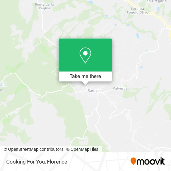
See Cooking For You, Sarteano, on the map
Public Transit to Cooking For You in Sarteano
Wondering how to get to Cooking For You in Sarteano? Moovit helps you find the best way to get to Cooking For You with step-by-step directions from the nearest public transit station.
Moovit provides free maps and live directions to help you navigate through your city. View schedules, routes, timetables, and find out how long does it take to get to Cooking For You in real time.
Looking for the nearest stop or station to Cooking For You? Check out this list of stops closest to your destination: Sarteano-Europa Boulevard Po Street Corner; Sarteano-Devils Bar; Sarteano-Bargagli Square.
Bus: FT5, FT9, T10.
Want to see if there’s another route that gets you there at an earlier time? Moovit helps you find alternative routes or times. Get directions from and directions to Cooking For You easily from the Moovit App or Website.
We make riding to Cooking For You easy, which is why over 1.5 million users, including users in Sarteano, trust Moovit as the best app for public transit. You don’t need to download an individual bus app or train app, Moovit is your all-in-one transit app that helps you find the best bus time or train time available.
For information on prices of bus, costs and ride fares to Cooking For You, please check the Moovit app.
Use the app to navigate to popular places including to the airport, hospital, stadium, grocery store, mall, coffee shop, school, college, and university.
Cooking For You Address: Via Domenico Bandini, 3 53047 Sarteano street in Sarteano
- Calypso Shop,
- Olivia Toelett,
- S. Anna Veterinary Center,
- Fratelli Mancini Printing Shop Sarteano,
- The Maria Mazzone Center For the Arts & Humanities,
- Esso,
- Franco Garosi,
- The Island That Doesn't Exist,
- Paytipper SpA / 8241,
- Scan Service,
- Speech Therapist Tania Rosadini,
- Europe Agency S.a.s. by Marco Bicarini & Co.,
- Neverland,
- Fabiola Clothing,
- Poggiardelli Restaurant,
- La Giara Restaurant Pizzeria,
- Massimiliano Migliore,
- Poggiardelli Village,
- Green Impresa Siena,
- St. Francis Cells
Places Near Cooking For You (Sarteano)
- Nelson Mandela Forum, Florence,
- I Gigli, Campi Bisenzio,
- Santa Maria Nuova Hospital, Florence,
- Mandela Forum (Nelson Mandela Forum), Florence,
- Campi Bisenzio, Campi Bisenzio,
- Michelangelo Square, Florence,
- Piero Palagi Hospital Facility-Florence, Florence,
- Cascine Park, Florence,
- IKEA Florence, Sesto Fiorentino,
- Artemio Franchi Municipal Stadium, Florence,
- Torregalli Hospital Scandicci *, Scandicci,
- Wanny Palace, Florence,
- Verdi Theater, Florence,
- Viola Park, Bagno a Ripoli,
- Tobacco Manufacture, Florence,
- Asmana, Campi Bisenzio,
- Michelangelo Square, Florence,
- Field of Mars, Florence,
- OOO, Florence,
- Santa Maria Novella Station, Florence
How to get to popular places in Florence with public transit
Get around Sarteano by public transit!
Traveling around Sarteano has never been so easy. See step by step directions as you travel to any attraction, street or major public transit station. View bus and train schedules, arrival times, service alerts and detailed routes on a map, so you know exactly how to get to anywhere in Sarteano.
When traveling to any destination around Sarteano use Moovit's Live Directions with Get Off Notifications to know exactly where and how far to walk, how long to wait for your line, and how many stops are left. Moovit will alert you when it's time to get off — no need to constantly re-check whether yours is the next stop.
Wondering how to use public transit in Sarteano or how to pay for public transit in Sarteano? Moovit public transit app can help you navigate your way with public transit easily, and at minimum cost. It includes public transit fees, ticket prices, and costs. Looking for a map of Sarteano public transit lines? Moovit public transit app shows all public transit maps in Sarteano with all Bus, Train, Light Rail, Ferry and Funicular routes and stops on an interactive map.
Florence has 5 transit type(s), including: Bus, Train, Light Rail, Ferry and Funicular, operated by several transit agencies, including Florence Urban - Tuscan Bus Lines, GEST, Livorno and Province - Tuscan Bus Lines, Arezzo, Florence and Provinces - Tuscan Bus Lines, Prato and Province - Tuscan Bus Lines, Lucca and Province - Tuscan Bus Lines, Massa, Carrara and Province - Tuscan Bus Lines, Pisa and Province - Tuscan Bus Lines, Grosseto, Siena and Provinces - Tuscan Bus Lines, Arezzo, Siena and Provinces - Tuscan Bus Lines, Florence and Province - Tuscan Bus Lines, Pistoia and Province - Tuscan Bus Lines, Siena and Province - Tuscan Bus Lines, Arezzo and Province - Tuscan Bus Lines and Trenitalia