Directions to Cooper (Wichita) with public transportation
The following transit lines have routes that pass near Cooper
 Bus: ROUTE22: S BDWY-, ROUTE29: HYDRAUL.
How to get to Cooper by bus?
Click on the bus route to see step by step directions with maps, line arrival times and updated time schedules.
From Clean Harbors Environmental Services, Wichita
53 minFrom Wichita Recover Treatment Center, Wichita
49 minFrom W Kellogg Dr / S Dugan Rd, Wichita
59 minFrom 3301 S Hoover Rd, Wichita
71 minFrom Freedom Preparatory, Wichita
49 minFrom Ict Eye, LLC, Wichita
57 minFrom U-Haul, Wichita
43 minFrom Altitude at Wichita, Wichita
47 minFrom ATHLETA, Wichita
54 minFrom Southern Baptist Convention, Wichita
61 min
Bus stops near Cooper in Wichita
Bus lines to Cooper in Wichita
What are the closest stations to Cooper?
The closest stations to Cooper are:
- Harry And George Wash Blvd Ib is 48 yards away, 1 min walk.
- Lincoln And Chautauqua Ib is 932 yards away, 11 min walk.
Which bus line stops near Cooper?
ROUTE22: S BDWY- (2201ob)
What’s the nearest bus station to Cooper in Wichita?
The nearest bus station to Cooper in Wichita is Harry And George Wash Blvd Ib. It’s a 1 min walk away.
What time is the first bus to Cooper in Wichita?
The ROUTE29: HYDRAUL is the first bus that goes to Cooper in Wichita. It stops nearby at 5:02 AM.
What time is the last bus to Cooper in Wichita?
The ROUTE22: S BDWY- is the last bus that goes to Cooper in Wichita. It stops nearby at 10:13 PM.
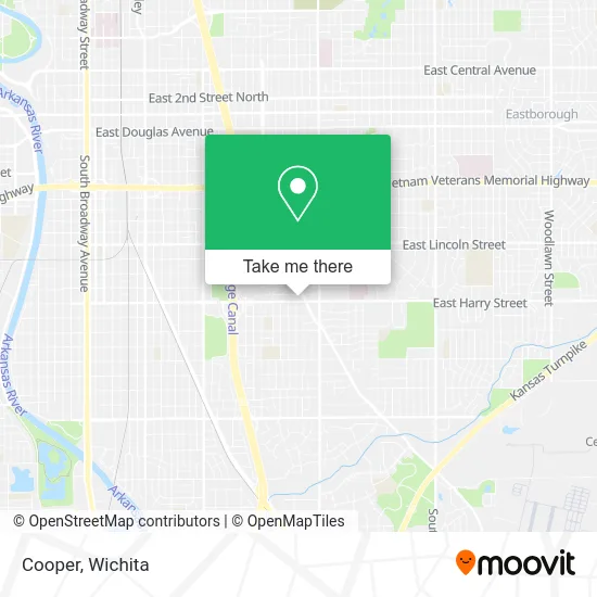
See Cooper, Wichita, on the map
Public Transit to Cooper in Wichita
Wondering how to get to Cooper in Wichita? Moovit helps you find the best way to get to Cooper with step-by-step directions from the nearest public transit station.
Moovit provides free maps and live directions to help you navigate through your city. View schedules, routes, timetables, and find out how long does it take to get to Cooper in real time.
Looking for the nearest stop or station to Cooper? Check out this list of stops closest to your destination: Harry And George Wash Blvd Ib; Lincoln And Chautauqua Ib.
Bus: ROUTE22: S BDWY-, ROUTE29: HYDRAUL.
Want to see if there’s another route that gets you there at an earlier time? Moovit helps you find alternative routes or times. Get directions from and directions to Cooper easily from the Moovit App or Website.
We make riding to Cooper easy, which is why over 1.5 million users, including users in Wichita, trust Moovit as the best app for public transit. You don’t need to download an individual bus app or train app, Moovit is your all-in-one transit app that helps you find the best bus time or train time available.
For information on prices of bus, costs and ride fares to Cooper, please check the Moovit app.
Use the app to navigate to popular places including to the airport, hospital, stadium, grocery store, mall, coffee shop, school, college, and university.
Cooper Address: 2910 E Harry St Wichita, KS 67211 street in Wichita
- ATM,
- S George Washington Dr / E Harry St,
- Rose Garden Massage & Spa,
- Wray Property Management,
- Jackson Hewitt Tax Service,
- New Hope Christian Church,
- D & T Smoke Shop & Liq,
- Level X Beauty Salon,
- Digi Computer & Network,
- D & T Smoke and Liquor,
- CVS/pharmacy,
- Tankhouse Float & Massage,
- Funes Guardado,
- Apollo Fermentations,
- All Saints Knights of Columbus Council,
- NU Image Beauty Salon Wichita,KS,
- Mid Continent Lease Rental & Car Sales,
- Crispy Donuts,
- Clair Dwight St do,
- Winged Electrical Repair
Places Near Cooper (Wichita)
- Sena African Hair Braiding LLC, Wichita,
- Hubb's glory hole, Wichita,
- East 21st Street North and Webb Road, Wichita,
- Spirit Aerosystems,
- 21st & Maize, Wichita,
- Bmer Tech Automotive, Wichita,
- Lopez Services, Wichita,
- Towne East Mall, Wichita,
- McConnell Air Force Base, Mcconnell Afb,
- Spirit Aerosystems Inc, Building 1-198D,
- Wichita Dwight D. Eisenhower National Airport (ICT) (Wichita Eisenhower National Airport), Wichita,
- Paige Place Apartments, Wichita,
- Four Corners Cafe @ Wesley Medical Center, Wichita,
- Spirit AeroSystems, Bldg 2-280J (Section 9),
- Ascencion Via Christi Hospital St Francis, Wichita,
- North High School, Wichita,
- Ratcliff Auto and Truck Repair, Wichita,
- Westside Athletic Field (Friends University Baseball Field), Wichita,
- Afghan Halal Market, Wichita,
- Total Card Solutions, Wichita
How to get to popular places in Wichita with public transit
Get around Wichita by public transit!
Traveling around Wichita has never been so easy. See step by step directions as you travel to any attraction, street or major public transit station. View bus and train schedules, arrival times, service alerts and detailed routes on a map, so you know exactly how to get to anywhere in Wichita.
When traveling to any destination around Wichita use Moovit's Live Directions with Get Off Notifications to know exactly where and how far to walk, how long to wait for your line, and how many stops are left. Moovit will alert you when it's time to get off — no need to constantly re-check whether yours is the next stop.
Wondering how to use public transit in Wichita or how to pay for public transit in Wichita? Moovit public transit app can help you navigate your way with public transit easily, and at minimum cost. It includes public transit fees, ticket prices, and costs. Looking for a map of Wichita public transit lines? Moovit public transit app shows all public transit maps in Wichita with all bus routes and stops on an interactive map.
Wichita has 1 transit type(s), including: bus, operated by several transit agencies, including Wichita Transit, Greyhound-us and FlixBus-us