How to get to Cooperativa by bus?
Click on the bus route to see step by step directions with maps, line arrival times and updated time schedules.
From Residencial Las Plazas, Aguascalientes
61 minFrom Fraccionamiento Villa Montaña Javer, Aguascalientes
62 minFrom Fracc. Colinas del Sol, Aguascalientes
48 minFrom Villa Montaña, Aguascalientes
62 minFrom Torre Plaza, Aguascalientes
26 minFrom Centro de Salud Urbano de Jesús Maria, ags., Aguascalientes
48 minFrom Terminal 50, Aguascalientes
45 minFrom CLINICA NO 9 IMSS, Aguascalientes
44 minFrom Imss Jesus Maria Clinica#6, Aguascalientes
41 minFrom Universidad Autónoma de Aguascalientes Campus Sur, Aguascalientes
43 min
Bus stops near Cooperativa in Aguascalientes
Bus lines to Cooperativa in Aguascalientes
- RUTA 20S, Terminal Oriente - Terminal Oriente (S),VIEW
- RUTA 27, Vicente Guerrero,VIEW
- RUTA 30, Martínez Dóminguez,VIEW
- RUTA 33, Jesús María,VIEW
- RUTA 20N, Terminal Oriente - Terminal Oriente (N),VIEW
- RUTA 09, Cumbres III - Mahatma Gandhi,VIEW
- RUTA 09, Mahatma Gandhi - Los Laureles,VIEW
- RUTA 10, UAA Sur - Paseos de Aguascalientes,VIEW
- RUTA 11, Mahatma Gandhi - Chichimeco,VIEW
- RUTA 12, Vicente Guerrero - Lunaria,VIEW
- RUTA 40, Terminal Oriente - Terminal Oriente (S),VIEW
What are the closest stations to Cooperativa?
The closest stations to Cooperativa are:
- Avenida De La Convención De 1914 Poniente, 1308 is 397 meters away, 5 min walk.
- Avenida De La Convención De 1914 Poniente, 1132 is 427 meters away, 6 min walk.
- Dif Estatal is 494 meters away, 7 min walk.
- Avenida Aguascalientes Poniente, 1680 is 944 meters away, 13 min walk.
Which bus lines stop near Cooperativa?
These bus lines stop near Cooperativa: RUTA 09, RUTA 10, RUTA 23, RUTA 30, RUTA 33.
What’s the nearest bus station to Cooperativa in Aguascalientes?
The nearest bus station to Cooperativa in Aguascalientes is Avenida De La Convención De 1914 Poniente, 1308. It’s a 5 min walk away.
What time is the first bus to Cooperativa in Aguascalientes?
The RUTA 20N is the first bus that goes to Cooperativa in Aguascalientes. It stops nearby at 6:01 AM.
What time is the last bus to Cooperativa in Aguascalientes?
The RUTA 30 is the last bus that goes to Cooperativa in Aguascalientes. It stops nearby at 10:14 PM.
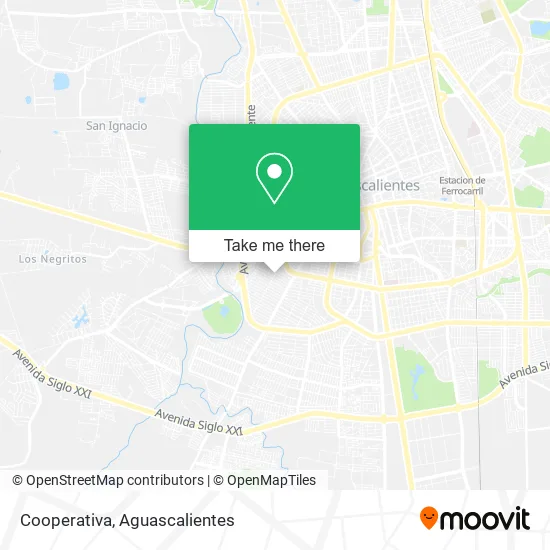
See Cooperativa, Aguascalientes, on the map
Public Transit to Cooperativa in Aguascalientes
Wondering how to get to Cooperativa in Aguascalientes? Moovit helps you find the best way to get to Cooperativa with step-by-step directions from the nearest public transit station.
Moovit provides free maps and live directions to help you navigate through your city. View schedules, routes, timetables, and find out how long does it take to get to Cooperativa in real time.
Looking for the nearest stop or station to Cooperativa? Check out this list of stops closest to your destination: Avenida De La Convención De 1914 Poniente; Avenida De La Convención De 1914 Poniente; Dif Estatal; Avenida Aguascalientes Poniente.
Bus: RUTA 09, RUTA 10, RUTA 23, RUTA 30, RUTA 33, RUTA 20S, RUTA 27, RUTA 20N, RUTA 11, RUTA 12, RUTA 40.
Want to see if there’s another route that gets you there at an earlier time? Moovit helps you find alternative routes or times. Get directions from and directions to Cooperativa easily from the Moovit App or Website.
We make riding to Cooperativa easy, which is why over 1.5 million users, including users in Aguascalientes, trust Moovit as the best app for public transit. You don’t need to download an individual bus app or train app, Moovit is your all-in-one transit app that helps you find the best bus time or train time available.
For information on prices of bus, costs and ride fares to Cooperativa, please check the Moovit app.
Use the app to navigate to popular places including to the airport, hospital, stadium, grocery store, mall, coffee shop, school, college, and university.
Cooperativa Address: Calle España, Fraccionamiento España, 20210 Aguascalientes, Aguascalientes street in Aguascalientes
- Estacionamiento de Pureza,
- Bazar Ropa,
- Salon de Belleza Juanita,
- IEA Participación Social,
- Tridiseño,
- Compton Tienda Ropa para Caballero,
- Primaria Ingeniero Jesús MA Rodríguez,
- Rafaelos Pizza,
- Muñoz Garampiñados y Botanas,
- Yeo Fashion Boutique,
- Sociedad Misionera Internacional de la Iglesia Adventista del Séptimo Día Movimiento de Reforma,
- Club de Nutricion Herbalife,
- Dulceria El Guero,
- Ed Hardy,
- La Esquinita Mix,
- Corpus Terapia Física,
- XIOMARA, S.A. DE C.V.,
- Estetica de Lopez,
- Panadería Mamá Rosy,
- Barber Bros. Peluquería
Places Near Cooperativa (Aguascalientes)
- Isla San Marcos, Aguascalientes,
- Aeropuerto de Aguascalientes S.A. de C.V., Aguascalientes,
- ESPACIOS, Aguascalientes,
- Ciudad industrial, Aguascalientes,
- Agropecuario, Aguascalientes,
- Villas de Nuestra Señora de la Asunción, Aguascalientes,
- Terminal De Combis, Aguascalientes,
- Centro, Aguascalientes,
- clinica 3 uaa, Aguascalientes,
- Imss Clinica 1, Aguascalientes,
- Centro Comercial Altaria, Aguascalientes,
- La Isla San Marcos, Aguascalientes,
- Universidad Autónoma de Aguascalientes, Aguascalientes,
- Hospital Imss No. 3, Aguascalientes,
- Parque Las Tres Centurias, Aguascalientes,
- Villasuncion, Aguascalientes,
- Central De Autobuses, Aguascalientes,
- Blvd. Luis Donaldo Colosio, Aguascalientes,
- Jesús María, Aguascalientes,
- Nuevo Hospital Hidalgo, Aguascalientes
How to get to popular places in Aguascalientes with public transit
Get around Aguascalientes by public transit!
Traveling around Aguascalientes has never been so easy. See step by step directions as you travel to any attraction, street or major public transit station. View bus and train schedules, arrival times, service alerts and detailed routes on a map, so you know exactly how to get to anywhere in Aguascalientes.
When traveling to any destination around Aguascalientes use Moovit's Live Directions with Get Off Notifications to know exactly where and how far to walk, how long to wait for your line, and how many stops are left. Moovit will alert you when it's time to get off — no need to constantly re-check whether yours is the next stop.
Wondering how to use public transit in Aguascalientes or how to pay for public transit in Aguascalientes? Moovit public transit app can help you navigate your way with public transit easily, and at minimum cost. It includes public transit fees, ticket prices, and costs. Looking for a map of Aguascalientes public transit lines? Moovit public transit app shows all public transit maps in Aguascalientes with all bus routes and stops on an interactive map.
Aguascalientes has 1 transit type(s), including: bus, operated by several transit agencies, including Coordinación General de Movilidad