How to get to Copa by bus?
Click on the bus route to see step by step directions with maps, line arrival times and updated time schedules.
From K Star Mall (K Star Mall, Chembur), Chembur
53 minFrom Haji Malang Baba Dargah Sharif, Kandivali East
51 minFrom Godrej One, Ghatkopar East
73 minFrom Ion Digital Zone, Bhandup West
56 minFrom S.M.Shetty College, Bhandup West
46 minFrom Wadala RTO, Sion Koliwada
77 minFrom Bombay Convention & Exhibition Centre Nesco, Goregaon
35 minFrom Marol Naka, Andheri East
29 minFrom R. D. National College, Vandre West
24 minFrom Vikhroli, Vikhroli
58 min
How to get to Copa by train?
Click on the train route to see step by step directions with maps, line arrival times and updated time schedules.
How to get to Copa by metro?
Click on the metro route to see step by step directions with maps, line arrival times and updated time schedules.
Bus stops near Copa in Andheri West
- Juhu Bus Station, 3 min walk,VIEW
Bus lines to Copa in Andheri West
- A-56, Worli Depot - Vesava Yari Road Bus Station,VIEW
- 203, Juhu Beach Bus Station - Dahisar Bridge,VIEW
- A-203, Juhu Beach - Dahisar Bridge,VIEW
- 231, Santacruz Station (W) - Juhu Bus Station,VIEW
- 255LTD, Pratiksha Nagar Depot - JVPD Bus Station,VIEW
- A-256, Malvani Depot (Gaikwad Nagar) - Juhu Bus Station,VIEW
- 339, Majas Depot - Juhu Bus Station,VIEW
- 28, Chhatrapati Shivaji Maharaj Terminus,VIEW
- 627, Mora Village,VIEW
What are the closest stations to Copa?
The closest stations to Copa are:
- Juhu Bus Station is 210 meters away, 3 min walk.
- Vile Parle is 868 meters away, 12 min walk.
- Andheri is 1883 meters away, 24 min walk.
- Andheri (West) is 2320 meters away, 30 min walk.
- DN Nagar is 2523 meters away, 33 min walk.
Which bus lines stop near Copa?
These bus lines stop near Copa: 255LTD, 627, A-256, A-56.
Which train lines stop near Copa?
These train lines stop near Copa: HR, WR.
Which metro line stops near Copa?
LINE 1 (Versova)
What’s the nearest metro station to Copa in Andheri West?
The nearest metro station to Copa in Andheri West is Andheri (West). It’s a 30 min walk away.
What’s the nearest train station to Copa in Andheri West?
The nearest train station to Copa in Andheri West is Vile Parle. It’s a 12 min walk away.
What’s the nearest bus station to Copa in Andheri West?
The nearest bus station to Copa in Andheri West is Juhu Bus Station. It’s a 3 min walk away.
What time is the first metro to Copa in Andheri West?
The LINE 1 is the first metro that goes to Copa in Andheri West. It stops nearby at 5:31 AM.
What time is the last metro to Copa in Andheri West?
The LINE 1 is the last metro that goes to Copa in Andheri West. It stops nearby at 12:11 AM.
What time is the first train to Copa in Andheri West?
The WR is the first train that goes to Copa in Andheri West. It stops nearby at 4:05 AM.
What time is the last train to Copa in Andheri West?
The WR is the last train that goes to Copa in Andheri West. It stops nearby at 1:43 AM.
What time is the first bus to Copa in Andheri West?
The A-56 is the first bus that goes to Copa in Andheri West. It stops nearby at 5:28 AM.
What time is the last bus to Copa in Andheri West?
The 231 is the last bus that goes to Copa in Andheri West. It stops nearby at 1:35 AM.
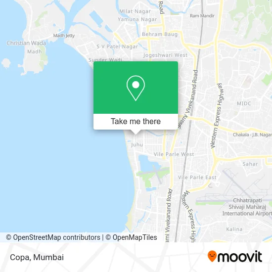
See Copa, Andheri West, on the map
Public Transit to Copa in Andheri West
Wondering how to get to Copa in Andheri West? Moovit helps you find the best way to get to Copa with step-by-step directions from the nearest public transit station.
Moovit provides free maps and live directions to help you navigate through your city. View schedules, routes, timetables, and find out how long does it take to get to Copa in real time.
Looking for the nearest stop or station to Copa? Check out this list of stops closest to your destination: Juhu Bus Station; Vile Parle; Andheri; Andheri (West); DN Nagar.
Bus: 255LTD, 627, A-256, A-56, 203, A-203, 231, 28.Train: HR, WR, BR, WR-AC, WR-AC, CGDR, WR-AC, WR-AC, WR-AC, WR-AC.Metro: LINE 1, LINE 2A.
Want to see if there’s another route that gets you there at an earlier time? Moovit helps you find alternative routes or times. Get directions from and directions to Copa easily from the Moovit App or Website.
We make riding to Copa easy, which is why over 1.5 million users, including users in Andheri West, trust Moovit as the best app for public transit. You don’t need to download an individual bus app or train app, Moovit is your all-in-one transit app that helps you find the best bus time or train time available.
For information on prices of bus, metro and train, costs and ride fares to Copa, please check the Moovit app.
Use the app to navigate to popular places including to the airport, hospital, stadium, grocery store, mall, coffee shop, school, college, and university.
Location: Andheri West, Mumbai
- Lotus Eye Hospital, Juhu,
- Archana Kutir Gate 1,
- Nandlal Jalan Municipal Dispensary,
- Juhu Consumers Stores,
- Re Rushabh Enterprises,
- LOTUS College of Optometry,
- Lotus Eye Hospital,
- Sweet Home,
- Vailankanni Pan Beedi Shop,
- Amartower,
- BMC Free Dispensary,
- Monsieur Bespoke Tailoring,
- Healing Journey,
- Lifestyle Fitness & Dance Studio,
- Joya Fashion & Lifestyle Exhibition,
- Patanjali Arogya Kendra,
- DTDC,
- Om Jewels,
- Hot Chips,
- Natural Ice Cream
Places Near Copa (Andheri West)
- Bombay Exhibition Center, Goregaon,
- Oberoi Mall, Dindoshi,
- Hinduja Hospital, Mahim,
- Govardhan Ecovillage, Palghar (St),
- Ikea, Worli,
- Malabar Hill, Malabar Hill,
- INFINITI Mall (Infinity Mall, andheri), Versova,
- Gateway Of India,
- Dome @ Nsci - Svp Stadium Mumbai, Worli,
- Mumbai University, Kalina,
- Oberoi Sky City, Borivali East,
- J. J. Hospital, Byculla,
- Juhu Beach,
- Rani Baug, Byculla,
- TCS Olympus, Thane,
- NESCO, Goregaon,
- R CITY MALL, Ghatkopar East,
- Inorbit Mall, Malad West,
- Bhaucha Dhakka,
- Worli Sea Face
How to get to popular places in Mumbai with public transit
Get around Andheri West by public transit!
Traveling around Andheri West has never been so easy. See step by step directions as you travel to any attraction, street or major public transit station. View bus and train schedules, arrival times, service alerts and detailed routes on a map, so you know exactly how to get to anywhere in Andheri West.
When traveling to any destination around Andheri West use Moovit's Live Directions with Get Off Notifications to know exactly where and how far to walk, how long to wait for your line, and how many stops are left. Moovit will alert you when it's time to get off — no need to constantly re-check whether yours is the next stop.
Wondering how to use public transit in Andheri West or how to pay for public transit in Andheri West? Moovit public transit app can help you navigate your way with public transit easily, and at minimum cost. It includes public transit fees, ticket prices, and costs. Looking for a map of Andheri West public transit lines? Moovit public transit app shows all public transit maps in Andheri West with all Bus, Train, Metro and Ferry routes and stops on an interactive map.
Mumbai has 4 transit type(s), including: Bus, Train, Metro and Ferry, operated by several transit agencies, including MMMOCL (Maha Mumbai Metro Operation Corporation Ltd.), NMM CIDCO (Navi Mumbai Metro Maha Metro), Reliance Mumbai Metro, MMRCL (Mumbai Metro Rail Corporation Ltd), BEST (Brihanmumbai Electricity Supply & Transport), BEST AC Services, A.C.Trains (Air-Conditioning Trains), W.R. (Western Railways), C.R. (Central Railways), C.R.MEMU (Central Railways Shuttle MEMU Trains), H.R. (Harbour Railways), T.R.(Trans Harbour Railways), U.R.(Uran-Ulwe Railways), I.R.(Indian Railways) and TMT (Thane Municipal Transport)