Directions to Copa Airlines (Boston) with public transportation
The following transit lines have routes that pass near Copa Airlines
 Bus: 104, 450, BB, MANSFIELD TO LOGAN AIRPORT, SL3.
- Train: NEWBURYPORT/ROCKPORT.
- Subway: BLUE LINE.
- Ferry: HINGHAM/HULL FERRY, QUINCY FERRY, WINTHROP FERRY, WINTHROP/QUINCY FERRY.
How to get to Copa Airlines by bus?
Click on the bus route to see step by step directions with maps, line arrival times and updated time schedules.
From Target, Everett
47 minFrom GE Aviation, Lynn
45 minFrom Apple Cinemas, Cambridge
102 minFrom Walmart, Lynn
60 minFrom Spaulding Hospital, Cambridge
73 minFrom The Fairmont Copley Plaza Hotel, Boston
32 minFrom Massachusetts, Boston
78 minFrom Harvard Square T Station - Red Line, Cambridge
62 minFrom Hilton Boston Back Bay, Boston
36 minFrom Jamaica Plain, Boston
70 min
How to get to Copa Airlines by train?
Click on the train route to see step by step directions with maps, line arrival times and updated time schedules.
How to get to Copa Airlines by subway?
Click on the subway route to see step by step directions with maps, line arrival times and updated time schedules.
From Jamaica Plain, Boston
43 minFrom The Fairmont Copley Plaza Hotel, Boston
26 minFrom Harvard Square T Station - Red Line, Cambridge
36 minFrom Target, Everett
45 minFrom Apple Cinemas, Cambridge
56 minFrom Hilton Boston Back Bay, Boston
36 minFrom Massachusetts, Boston
73 minFrom Spaulding Hospital, Cambridge
55 min
Bus stops near Copa Airlines in Boston
Subway station near Copa Airlines in Boston
- Wood Island, 12 min walk,VIEW
Ferry stations near Copa Airlines in Boston
Bus lines to Copa Airlines in Boston
- MANSFIELD TO LOGAN AIRPORT, Terminal E - Arrivals,VIEW
- 11, Terminal E - Arrivals - Terminal E - Arrivals,VIEW
- 33, Conrac Rental Car Center, Drop Off - Conrac Rental Car Center, Pick Up,VIEW
- 55, Conrac Rental Car Center, Drop Off - Conrac Rental Car Center, Pick Up,VIEW
- 66, Water Transportation Dock - Water Transportation Dock,VIEW
- 88, Economy Parking - Economy Parking,VIEW
- 331, 331,VIEW
- 551, 551,VIEW
- 552, 552,VIEW
- 771, 270 Central Ave - Chelsea Garage - 270 Central Ave - Chelsea Garage,VIEW
- 773, 270 Central Ave - Chelsea Garage - 270 Central Ave - Chelsea Garage,VIEW
- BB, Back Bay,VIEW
- BT, Braintree,VIEW
- DV, Danvers,VIEW
- FH, Framingham,VIEW
- WO, Woburn,VIEW
- 116, Logan Airport Terminal C,VIEW
- 171, Logan Airport Via Andrew,VIEW
- SL1, South Station,VIEW
What are the closest stations to Copa Airlines?
The closest stations to Copa Airlines are:
- Terminal C - Arrivals is 4 yards away, 1 min walk.
- Terminal E is 4 yards away, 1 min walk.
- Terminal C - Arrivals, Lex Pick Up is 4 yards away, 1 min walk.
- Terminal C - Departures Level is 4 yards away, 1 min walk.
- Terminal C - Arrivals Level is 389 yards away, 5 min walk.
- Wood Island is 958 yards away, 12 min walk.
- Logan Airport Ferry Terminal is 1701 yards away, 20 min walk.
- Lewis Mall Wharf is 3021 yards away, 36 min walk.
Which bus lines stop near Copa Airlines?
These bus lines stop near Copa Airlines: 104, 450, BB, MANSFIELD TO LOGAN AIRPORT, SL3.
Which train line stops near Copa Airlines?
NEWBURYPORT/ROCKPORT (#18 | North Station)
Which subway line stops near Copa Airlines?
BLUE LINE (Wonderland)
What’s the nearest subway station to Copa Airlines in Boston?
The nearest subway station to Copa Airlines in Boston is Wood Island. It’s a 12 min walk away.
What’s the nearest bus station to Copa Airlines in Boston?
The nearest bus stations to Copa Airlines in Boston are Terminal C - Arrivals, Terminal E, Terminal C - Arrivals, Lex Pick Up and Terminal C - Departures Level. The closest one is a 1 min walk away.
What’s the nearest ferry station to Copa Airlines in Boston?
The nearest ferry station to Copa Airlines in Boston is Logan Airport Ferry Terminal. It’s a 20 min walk away.
What time is the first subway to Copa Airlines in Boston?
The BLUE LINE is the first subway that goes to Copa Airlines in Boston. It stops nearby at 5:10 AM.
What time is the last subway to Copa Airlines in Boston?
The BLUE LINE is the last subway that goes to Copa Airlines in Boston. It stops nearby at 2:01 AM.
What time is the first bus to Copa Airlines in Boston?
The 552 is the first bus that goes to Copa Airlines in Boston. It stops nearby at 3:00 AM.
What time is the last bus to Copa Airlines in Boston?
The 771 is the last bus that goes to Copa Airlines in Boston. It stops nearby at 3:10 AM.
What time is the first ferry to Copa Airlines in Boston?
The EAST is the first ferry that goes to Copa Airlines in Boston. It stops nearby at 5:55 AM.
What time is the last ferry to Copa Airlines in Boston?
The HINGHAM/HULL FERRY is the last ferry that goes to Copa Airlines in Boston. It stops nearby at 10:05 PM.
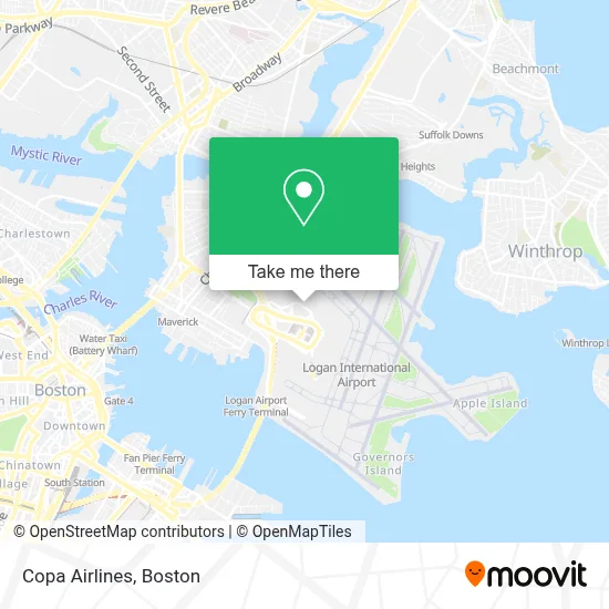
See Copa Airlines, Boston, on the map
Public Transit to Copa Airlines in Boston
Wondering how to get to Copa Airlines in Boston? Moovit helps you find the best way to get to Copa Airlines with step-by-step directions from the nearest public transit station.
Moovit provides free maps and live directions to help you navigate through your city. View schedules, routes, timetables, and find out how long does it take to get to Copa Airlines in real time.
Looking for the nearest stop or station to Copa Airlines? Check out this list of stops closest to your destination: Terminal C - Arrivals; Terminal E; Terminal C - Arrivals; Terminal C - Departures Level; Terminal C - Arrivals Level; Wood Island; Logan Airport Ferry Terminal; Lewis Mall Wharf.
Bus: 104, 450, BB, MANSFIELD TO LOGAN AIRPORT, SL3, 11, 33, 55, 66, 88, BT, DV, FH, WO, 116.Train: NEWBURYPORT/ROCKPORT.Subway: BLUE LINE.Ferry: HINGHAM/HULL FERRY, QUINCY FERRY, WINTHROP FERRY, WINTHROP/QUINCY FERRY.
Want to see if there’s another route that gets you there at an earlier time? Moovit helps you find alternative routes or times. Get directions from and directions to Copa Airlines easily from the Moovit App or Website.
We make riding to Copa Airlines easy, which is why over 1.7 million users, including users in Boston, trust Moovit as the best app for public transit. You don’t need to download an individual bus app or train app, Moovit is your all-in-one transit app that helps you find the best bus time or train time available.
For information on prices of bus, subway and train, costs and ride fares to Copa Airlines, please check the Moovit app.
Use the app to navigate to popular places including to the airport, hospital, stadium, grocery store, mall, coffee shop, school, college, and university.
Copa Airlines Address: Boston Logan International Airport, 1 Harborside Dr street in Boston
- Terminal E- Logan International Airport,
- Concord Trailways - Logan Airport - Terminal A,
- Logan Int'l-Terminal E Arrivals,
- Airport Terminal Services,
- Massport Security Badge Office,
- Silver Line Stop Terminal E,
- Logan International Airport (Terminal E), Ma,
- Currency Exchange - Terminal E,
- Airport Shuttle Route #11,
- Qatar Airways,
- Airport Shuttle Bus 66,
- SATA Terminal E,
- Logan Int'l-Terminal E Lot 2 (Parking Terminal E),
- Concord Coach Lines: Boston - Bangor,
- Logan Express,
- Logan Airport Central Parking,
- Silver Line Stop Terminal C,
- Hilton Boston Logan Airport,
- Boston Logan Taxi Stand Terminal C,
- Designated Smoking Area
Places Near Copa Airlines (Boston)
- Isabella Stewart Gardner Museum, Boston,
- Cheers, Boston,
- Seaport District, Boston,
- House Of Blues, Boston,
- Boston Common, Boston,
- Wilbur Theatre, Boston,
- Leader Bank Pavilion (Leader Bank Pavillion), Boston,
- Faneuil Hall, Boston,
- Boston Medical Center, Boston,
- Quincy Market, Boston,
- Boston Children's Hospital, Boston,
- Massachusetts General Hospital, Boston,
- North End, Boston,
- Boston Convention & Exhibition Center, Boston,
- Museum Of Science, Boston,
- Mgm Music Hall, Boston,
- Wang Theater, Boston,
- Castle Island, Boston,
- Prudential Center, Boston,
- Td Garden, Boston
How to get to popular places in Boston with public transit
Get around Boston by public transit!
Traveling around Boston has never been so easy. See step by step directions as you travel to any attraction, street or major public transit station. View bus and train schedules, arrival times, service alerts and detailed routes on a map, so you know exactly how to get to anywhere in Boston.
When traveling to any destination around Boston use Moovit's Live Directions with Get Off Notifications to know exactly where and how far to walk, how long to wait for your line, and how many stops are left. Moovit will alert you when it's time to get off — no need to constantly re-check whether yours is the next stop.
Wondering how to use public transit in Boston or how to pay for public transit in Boston? Moovit public transit app can help you navigate your way with public transit easily, and at minimum cost. It includes public transit fees, ticket prices, and costs. Looking for a map of Boston public transit lines? Moovit public transit app shows all public transit maps in Boston with all Bus, Train, Subway and Ferry routes and stops on an interactive map.
Boston has 4 transit type(s), including: Bus, Train, Subway and Ferry, operated by several transit agencies, including MBTA, Southeastern Regional Transit Authority, MetroWest Regional Transit Authority, Rhode Island Public Transit Authority, WRTA, Lowell Regional Transit Authority, Merrimack Valley Transit, Montachusett Regional Transit Authority, Cape Cod Regional Transit Authority, Brockton Area Transit Authority, Martha's Vineyard Transit Authority, the WAVE - Nantucket Regional Transit Authority, GATRA, Cape Ann Transportation Authority and Massport