Directions to Copa Ccpr (Orleans) with public transportation
The following transit lines have routes that pass near Copa Ccpr
How to get to Copa Ccpr by bus?
Click on the bus route to see step by step directions with maps, line arrival times and updated time schedules.
From Parque Shopping Boulevard, Xaxim
57 minFrom Barigui, Araucária
56 minFrom Rua Parnaíba, São Francisco
32 minFrom Rua 24 de Maio, Centro
32 minFrom Rua Atílio Bório, Alto Da Rua XV
39 minFrom Avenida Presidente Getúlio Vargas, Água Verde
40 minFrom Hospital do Idoso Zilda Arns, Pinheirinho
56 minFrom Estação Tubo Dom Pedro, Vila Izabel
44 minFrom Avenida Comendador Franco 1341, Jardim Botânico
49 minFrom Rua Lothário Boutin 90, Pinheirinho
54 min
Bus stops near Copa Ccpr in Orleans
Bus lines to Copa Ccpr in Orleans
- J62 CAMPO LARGO / GUADALUPE, Terminal Guadalupe → Terminal Campo Largo,VIEW
- 870 SÃO BRAZ, São Braz → Praça Tiradentes,VIEW
- 889 MAD. SÃO BRAZ, Praça Rui Barbosa ↺ São Braz (Circular),VIEW
- X43 ESPECIAL BRF / COPEL, Terminal Campo Comprido → BRF / Copel,VIEW
- 817 SATURNO / VENEZA, Terminal Santa Felicidade → Terminal Campina do Siqueira,VIEW
What are the closest stations to Copa Ccpr?
The closest stations to Copa Ccpr are:
- Rod. BR-277, 3213 is 175 meters away, 3 min walk.
- Marginal da Rod. BR-277, 3100 is 218 meters away, 3 min walk.
- Rua Capitão Domingos Castellano, 571 is 626 meters away, 9 min walk.
Which bus lines stop near Copa Ccpr?
These bus lines stop near Copa Ccpr: 040 INTERBAIRROS IV, J62 CAMPO LARGO / GUADALUPE.
What’s the nearest bus station to Copa Ccpr in Orleans?
The nearest bus stations to Copa Ccpr in Orleans are Rod. BR-277, 3213 and Marginal da Rod. BR-277, 3100. The closest one is a 3 min walk away.
What time is the first bus to Copa Ccpr in Orleans?
The 889 MAD. SÃO BRAZ is the first bus that goes to Copa Ccpr in Orleans. It stops nearby at 3:20 AM.
What time is the last bus to Copa Ccpr in Orleans?
The 889 MAD. SÃO BRAZ is the last bus that goes to Copa Ccpr in Orleans. It stops nearby at 2:43 AM.
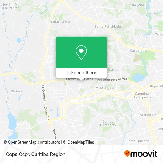
See Copa Ccpr, Orleans, on the map
Public Transit to Copa Ccpr in Orleans
Wondering how to get to Copa Ccpr in Orleans? Moovit helps you find the best way to get to Copa Ccpr with step-by-step directions from the nearest public transit station.
Moovit provides free maps and live directions to help you navigate through your city. View schedules, routes, timetables, and find out how long does it take to get to Copa Ccpr in real time.
Looking for the nearest stop or station to Copa Ccpr? Check out this list of stops closest to your destination: Rod. BR-277; Marginal da Rod. BR-277; Rua Capitão Domingos Castellano.
Bus: 040 INTERBAIRROS IV, J62 CAMPO LARGO / GUADALUPE, 870 SÃO BRAZ, 889 MAD. SÃO BRAZ, X43 ESPECIAL BRF / COPEL, 817 SATURNO / VENEZA.
Want to see if there’s another route that gets you there at an earlier time? Moovit helps you find alternative routes or times. Get directions from and directions to Copa Ccpr easily from the Moovit App or Website.
We make riding to Copa Ccpr easy, which is why over 1.5 million users, including users in Orleans, trust Moovit as the best app for public transit. You don’t need to download an individual bus app or train app, Moovit is your all-in-one transit app that helps you find the best bus time or train time available.
For information on prices of bus, costs and ride fares to Copa Ccpr, please check the Moovit app.
Use the app to navigate to popular places including to the airport, hospital, stadium, grocery store, mall, coffee shop, school, college, and university.
Copa Ccpr Address: Rua Adolpho Bressan, Orleans Curitiba-PR 81200-380 street in Orleans
- Inpaijus,
- Atlas Copco Brasil,
- Rodovia Curitiba - Ponta Grossa Br-277 km 97 3001,
- BRF,
- Atlas Copco,
- Marginal Rodovia BR- 277 3047,
- Sinuelo,
- Salão de Atos - Parque Barigui,
- Posture Pilates e Qualidade de Vida,
- Motel Emoções,
- Ipiranga,
- Manguss Soluções Criativas,
- Rua adolpho bressan 609,
- Mandalla Gastronomia,
- Lopes & Iglesias,
- Mecânica Czeckailo,
- Rodovia BR 277 3112,
- Gabifer Planejados,
- Marcenaria Kofanovski,
- Limpeza e Organização Vargas
Places Near Copa Ccpr (Orleans)
- Pontifícia Universidade Católica do Paraná (PUCPR), Prado Velho,
- Shopping Palladium, Portão,
- Rua Martim Afonso 558, Mercês,
- Hospital Erasto Gaertner, Jardim Das Américas,
- Jardim Botânico de Curitiba PR, Centro,
- Hospital Nossa Senhora Das Graças, Mercês,
- Hospital Universitário Evangélico de Curitiba, Bigorrilho,
- Arena Da Baixada - Curitiba,
- Hospital de Clínicas (HC - UFPR), Centro,
- Hospital Da Cruz Vermelha, Batel,
- Hospital Madalena Sofia, Bairro Alto,
- Campo Largo, Campo,
- Shopping Estação, Rebouças,
- Parque Barigui, Mercês,
- Hospital do Rocio, Campo,
- Park Shopping Barigüi, Mossunguê,
- Jockey Plaza Shopping Center, Tarumã,
- Hospital Angelina Caron, Campina Grande Do Sul,
- Hhhhh, Fazendinha,
- Rua General Mário Tourinho, Campina Do Siqueira
How to get to popular places in Curitiba Region with public transit
Get around Orleans by public transit!
Traveling around Orleans has never been so easy. See step by step directions as you travel to any attraction, street or major public transit station. View bus and train schedules, arrival times, service alerts and detailed routes on a map, so you know exactly how to get to anywhere in Orleans.
When traveling to any destination around Orleans use Moovit's Live Directions with Get Off Notifications to know exactly where and how far to walk, how long to wait for your line, and how many stops are left. Moovit will alert you when it's time to get off — no need to constantly re-check whether yours is the next stop.
Wondering how to use public transit in Orleans or how to pay for public transit in Orleans? Moovit public transit app can help you navigate your way with public transit easily, and at minimum cost. It includes public transit fees, ticket prices, and costs. Looking for a map of Orleans public transit lines? Moovit public transit app shows all public transit maps in Orleans with all Bus and Cable Car routes and stops on an interactive map.
Curitiba Region has 2 transit type(s), including: Bus and Cable Car, operated by several transit agencies, including Sistema Integrado de Mobilidade (URBS), Sistema Integrado de Mobilidade (AMEP), URBS (Cartões bancários e Dinheiro), URBS (Cartões bancários / Cartão URBS), AMEP (Cartões bancários / Cartão MetroCard), AMEP (Cartões bancários / Cartão MetroCard / Dinheiro), Viação Colombo (Dinheiro), TRIAR (Cartão TRIAR / Dinheiro), Empresa Curitiba Cerro Azul (Dinheiro), Expresso Nossa Senhora da Penha (Dinheiro), Empresa Campo Alto Tijucas (Dinheiro), Auto Viação São José (Cartão VEM / Dinheiro), BRT S/A (Cartão VEM / Dinheiro), TransPiedade (Cartão Cidadão / Dinheiro) and Oceânica Sul (Cartão Transporte / Dinheiro)