Directions to Copacabana with public transportation
The following transit lines have routes that pass near Copacabana
 Bus: 2740D (EXECUTIVO), 455, 457, 473, 740D.
- Metro: L1, L4.
- Funicular: PAVÃO-PAVÃOZINHO.
How to get to Copacabana by bus?
Click on the bus route to see step by step directions with maps, line arrival times and updated time schedules.
From Rua Afonso Pena
42 minFrom Quinta Da Boa Vista
42 minFrom Largo Da Carioca
26 minFrom Benfica
50 minFrom 760D Niterói X Galeão
51 minFrom Rua Corrêa Dutra
24 minFrom Rodoviária Novo Rio Av. Francisco Bicalho, No 01
30 minFrom Charitas
64 minFrom Triagem
47 minFrom UFF - Universidade Federal Fluminense
59 min
How to get to Copacabana by metro?
Click on the metro route to see step by step directions with maps, line arrival times and updated time schedules.
Bus stops near Copacabana
Metro station near Copacabana
- Cantagalo, 15 min walk,VIEW
Funicular station near Copacabana
- Estação 3, 19 min walk,VIEW
Bus lines to Copacabana
- 104, Terminal Gentileza (Feira Livre),VIEW
- 169, Terminal Gentileza,VIEW
- 455, Méier (Via Praia Do Flamengo),VIEW
- 456, Norte Shopping,VIEW
- 457, Copacabana,VIEW
- SN 457, Abolição,VIEW
- 483, Ipanema (Via Bonsucesso / Central),VIEW
- SN 483, Ipanema,VIEW
- SV 483, Penha,VIEW
- 485, Ipanema,VIEW
- 486, Fundão,VIEW
- 557, Copacabana (Faixa Reversível),VIEW
- 558, Cidade De Deus,VIEW
- 740D, Charitas (Via Central),VIEW
- 100 - TRO1, General Osório,VIEW
- VAN 2101, Circular Via Vidigal / Copacabana / Rocinha,VIEW
- 2740D (EXECUTIVO), Charitas,VIEW
- 415, Usina (Via Praia Do Flamengo),VIEW
- SN 415, Usina,VIEW
- 426, Jardim De Alah,VIEW
What are the closest stations to Copacabana?
The closest stations to Copacabana are:
- BRS 1 / 3 / I - Constante Ramos is 100 meters away, 2 min walk.
- BRS 2 - Figueiredo Magalhães is 101 meters away, 2 min walk.
- BRS 1 3 - Raimundo Correia is 205 meters away, 4 min walk.
- BRS 2 - Constante Ramos is 208 meters away, 4 min walk.
- Avenida Atlântica | Santa Clara is 326 meters away, 5 min walk.
- Rua Figueiredo De Magalhães | Rua Domingos Ferreira is 452 meters away, 7 min walk.
- Cantagalo is 1154 meters away, 15 min walk.
- Estação 3 is 1422 meters away, 19 min walk.
Which bus lines stop near Copacabana?
These bus lines stop near Copacabana: 2740D (EXECUTIVO), 455, 457, 473, 740D.
Which metro line stops near Copacabana?
L1, L4 (Jardim Oceânico)
What’s the nearest metro station to Copacabana?
The nearest metro station to Copacabana is Cantagalo. It’s a 15 min walk away.
What’s the nearest bus station to Copacabana?
The nearest bus stations to Copacabana are BRS 1 / 3 / I - Constante Ramos and BRS 2 - Figueiredo Magalhães. The closest one is a 2 min walk away.
What’s the nearest funicular station to Copacabana?
The nearest funicular station to Copacabana is Estação 3. It’s a 19 min walk away.
What time is the first metro to Copacabana?
The L1, L4 is the first metro that goes to Copacabana. It stops nearby at 5:17 AM.
What time is the last metro to Copacabana?
The L1, L4 is the last metro that goes to Copacabana. It stops nearby at 12:25 AM.
What time is the first bus to Copacabana?
The VAN 2101 is the first bus that goes to Copacabana. It stops nearby at 3:00 AM.
What time is the last bus to Copacabana?
The SN 554 is the last bus that goes to Copacabana. It stops nearby at 3:46 AM.
What time is the first funicular to Copacabana?
The PAVÃO-PAVÃOZINHO is the first funicular that goes to Copacabana. It stops nearby at 6:00 AM.
What time is the last funicular to Copacabana?
The PAVÃO-PAVÃOZINHO is the last funicular that goes to Copacabana. It stops nearby at 12:00 AM.
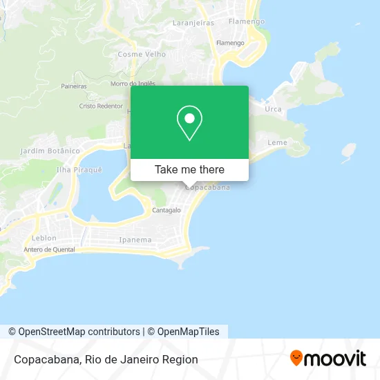
See Copacabana on the map
Public Transportation to Copacabana
Wondering how to get to Copacabana? Moovit helps you find the best way to get to Copacabana with step-by-step directions from the nearest public transit station.
Moovit provides free maps and live directions to help you navigate through your city. View schedules, routes, timetables, and find out how long does it take to get to Copacabana in real time.
Looking for the nearest stop or station to Copacabana? Check out this list of stops closest to your destination: BRS 1 / 3 / I - Constante Ramos; BRS 2 - Figueiredo Magalhães; BRS 1 3 - Raimundo Correia; BRS 2 - Constante Ramos; Avenida Atlântica | Santa Clara; Rua Figueiredo De Magalhães | Rua Domingos Ferreira; Cantagalo; Estação 3.
Bus: 2740D (EXECUTIVO), 455, 457, 473, 740D, 415, SN 415, 426, 435, 104, 169, 456, SP 404, SPA 483, SPB 483, 484, 552, 584.Metro: L1, L4.Funicular: PAVÃO-PAVÃOZINHO.
Want to see if there’s another route that gets you there at an earlier time? Moovit helps you find alternative routes or times. Get directions from and directions to Copacabana easily from the Moovit App or Website.
We make riding to Copacabana easy, which is why over 1.5 million users, including users in Copacabana, trust Moovit as the best app for public transit. You don’t need to download an individual bus app or train app, Moovit is your all-in-one transit app that helps you find the best bus time or train time available.
For information on prices of bus and metro, costs and ride fares to Copacabana, please check the Moovit app.
Use the app to navigate to popular places including to the airport, hospital, stadium, grocery store, mall, coffee shop, school, college, and university.
Location: Copacabana, Rio de Janeiro Region
- Avenida Nossa Senhora de Copacabana 794 Sala 304,
- 606,
- Santander Van Gogh,
- Zinzane,
- Copa Info,
- Casas Bahia,
- First Class Cama Mesa e Banho,
- ODT Digital Radiologia Diagnóstica,
- Supermercado Zona Sul,
- Banco Itau Personnalite ag. 4095,
- Pão & Companhia,
- Supermercado Pão de Açúcar - Copacabana,
- Taco,
- Rua Dias da Rocha 31 C,
- Lojas Renner,
- Previdência Social - Copacabana,
- C&A,
- Bodytech,
- Citibank,
- Lojas Americanas
Places Near Copacabana
- Hospital Federal Cardoso Fontes, Jacarepaguá,
- Avenida Venezuela 134, Saúde,
- Shopping Rio Sul, Botafogo,
- Shopping RioSul, Botafogo,
- Shopping Nova América, Del Castilho,
- Hospital Federal Do Andaraí, Andaraí,
- Feirão De Malhas, Duque De Caxias,
- Rodoviária Novo Rio (Rodoviária do Rio de Janeiro), Santo Cristo,
- Rio De Janeiro,
- Praia do Arpoador, Ipanema,
- Rua Ulysses Guimarães 16, Cidade Nova,
- Rua Licínio Cardoso, São Francisco Xavier,
- Feira Livre da Gloria, Glória,
- Norte Shopping, Cachambi,
- Avenida Rio Branco, Centro,
- Museu Do Amanhã, Centro,
- Niterói, Niterói,
- Hospital Pedro Ernesto, Vila Isabel,
- Hospital Municipal Ronaldo Gazolla, Acari,
- Shopping Downtown, Barra Da Tijuca
How to get to popular places in Rio de Janeiro Region with public transit
Get around Copacabana by public transit!
Traveling around Copacabana has never been so easy. See step by step directions as you travel to any attraction, street or major public transit station. View bus and train schedules, arrival times, service alerts and detailed routes on a map, so you know exactly how to get to anywhere in Copacabana.
When traveling to any destination around Copacabana use Moovit's Live Directions with Get Off Notifications to know exactly where and how far to walk, how long to wait for your line, and how many stops are left. Moovit will alert you when it's time to get off — no need to constantly re-check whether yours is the next stop.
Wondering how to use public transit in Copacabana or how to pay for public transit in Copacabana? Moovit public transit app can help you navigate your way with public transit easily, and at minimum cost. It includes public transit fees, ticket prices, and costs. Looking for a map of Copacabana public transit lines? Moovit public transit app shows all public transit maps in Copacabana with all Bus, Train, Metro, Light Rail, Ferry, Cable Car, Gondola and Funicular routes and stops on an interactive map.
Rio de Janeiro Region has 8 transit type(s), including: Bus, Train, Metro, Light Rail, Ferry, Cable Car, Gondola and Funicular, operated by several transit agencies, including TrensRJ, Metrô Rio, VLT Carioca, Barcas Rio, BRT MOBI-Rio, Auto Viação Alpha, Auto Viação Tijuca, Gire Transportes, Transurb, Viação Nossa Senhora das Graças, Consórcio INTERSUL, Braso Lisboa (Municipal), Caprichosa Auto Ônibus, Auto Viação Três Amigos and Rodoviária Âncora Matias
Public transit lines with stations closest to Copacabana
Metro lines with stations closest to Copacabana
Bus lines with stations closest to Copacabana
BRS 1 / 3 / I - Constante Ramos
- 104Terminal Gentileza - São Conrado (Brs 1 - Via Copacabana / Niemeyer)
- 169Terminal Gentileza - General Osório (BRS 1 - via Aterro)
- 455Méier - Copacabana (Brs 3 - Via Central / Rio Sul)
- 456LECD132 - Norte Shopping - Copacabana (Brs 3 - via Vila Isabel / Estácio / Santa Bárbara)
- 457Abolição - Copacabana (Brs 3 - Via Túnel Santa Bárbara)
BRS 1 3 - Raimundo Correia
- SP 404Caju - Leblon (Brs 3 - Via Túnel Santa Bárbara)
- SPA 483Fiocruz - Ipanema (Brs 3 - Via Expressa / Aterro)
- SPB 483Ramos - Ipanema (Brs 3 - Via Expressa / Aterro)
- 484Olaria - Ipanema (Brs 3 - Via Av. Brasil / Central / Aterro)
- 552Terminal Alvorada - Rio Sul (BRS 3 - via Praia da Barra / Niemeyer)