How to get to Coperativa by bus?
Click on the bus route to see step by step directions with maps, line arrival times and updated time schedules.
From 20 de Noviembre 1323_1, Aguascalientes
36 minFrom UMAA, Aguascalientes
39 minFrom Fracc. Paso de Argenta, Aguascalientes
62 minFrom Boulevard Juan Pablo II, Aguascalientes
63 minFrom Clínica y Maternidad Santa Fe, Aguascalientes
64 minFrom Preparatoria Petroleos, Aguascalientes
41 minFrom Fraccionamiento Vistas del Sur, Aguascalientes
67 minFrom Av Siglo XXI, Aguascalientes
41 minFrom Cetis 80, Aguascalientes
65 minFrom Centro De Convenciones De La Isla San Marcos, Aguascalientes
72 min
Bus stops near Coperativa in Aguascalientes
Bus lines to Coperativa in Aguascalientes
What are the closest stations to Coperativa?
The closest stations to Coperativa are:
- Cultura Maya, 255 is 134 meters away, 2 min walk.
- Cultura Maya Con Cultura Nazca is 358 meters away, 5 min walk.
- Avenida Rodolfo Landeros Gallegos, 1708 is 358 meters away, 5 min walk.
Which bus lines stop near Coperativa?
These bus lines stop near Coperativa: RUTA 09, RUTA 16, RUTA 42, RUTA 45.
What’s the nearest bus station to Coperativa in Aguascalientes?
The nearest bus station to Coperativa in Aguascalientes is Cultura Maya, 255. It’s a 2 min walk away.
What time is the first bus to Coperativa in Aguascalientes?
The RUTA 42 is the first bus that goes to Coperativa in Aguascalientes. It stops nearby at 5:50 AM.
What time is the last bus to Coperativa in Aguascalientes?
The RUTA 45 is the last bus that goes to Coperativa in Aguascalientes. It stops nearby at 10:25 PM.
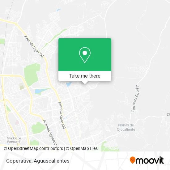
See Coperativa, Aguascalientes, on the map
Public Transit to Coperativa in Aguascalientes
Wondering how to get to Coperativa in Aguascalientes? Moovit helps you find the best way to get to Coperativa with step-by-step directions from the nearest public transit station.
Moovit provides free maps and live directions to help you navigate through your city. View schedules, routes, timetables, and find out how long does it take to get to Coperativa in real time.
Looking for the nearest stop or station to Coperativa? Check out this list of stops closest to your destination: Cultura Maya; Cultura Maya Con Cultura Nazca; Avenida Rodolfo Landeros Gallegos.
Bus: RUTA 09, RUTA 16, RUTA 42, RUTA 45, RUTA 48.
Want to see if there’s another route that gets you there at an earlier time? Moovit helps you find alternative routes or times. Get directions from and directions to Coperativa easily from the Moovit App or Website.
We make riding to Coperativa easy, which is why over 1.7 million users, including users in Aguascalientes, trust Moovit as the best app for public transit. You don’t need to download an individual bus app or train app, Moovit is your all-in-one transit app that helps you find the best bus time or train time available.
For information on prices of bus, costs and ride fares to Coperativa, please check the Moovit app.
Use the app to navigate to popular places including to the airport, hospital, stadium, grocery store, mall, coffee shop, school, college, and university.
Coperativa Address: Calle Cultura Totonaca, Fracc Mirador de las Culturas, 20174 Aguascalientes, Aguascalientes street in Aguascalientes
- Ictea Plantel Mirador De Las Culturas II,
- Club de Nutrición,
- Venta de Zapatos,
- Mirador de las Culturas II,
- Lonches Mirella,
- Venta DE3 Paletas y Dulces,
- Cooperativa Escolar Alejandro Topete del Valle T.V.,
- Cooperativa T m,
- Alejandro Topete Del Valle,
- Venta de Choco Bananas y Mangonadas,
- Tiendita de Liz,
- Venta de Comida,
- Paletería,
- Dulcería Tomi,
- Expendio de Pan Binbo,
- Papeleria Madeleine,
- Gorditas Rafita,
- Calle Villas de Cancun,
- Calle Cultura Maya 251 239,
- Venta de Mangonadas y Dulces
Places Near Coperativa (Aguascalientes)
- Centro Comercial Altaria, Aguascalientes,
- Isla San Marcos, Aguascalientes,
- Terminal De Combis, Aguascalientes,
- Universidad Autónoma de Aguascalientes, Aguascalientes,
- ESPACIOS, Aguascalientes,
- Ciudad industrial, Aguascalientes,
- Blvd. Luis Donaldo Colosio, Aguascalientes,
- Agropecuario, Aguascalientes,
- clinica 3 uaa, Aguascalientes,
- La Isla San Marcos, Aguascalientes,
- Imss Clinica 1, Aguascalientes,
- Parque Las Tres Centurias, Aguascalientes,
- Nuevo Hospital Hidalgo, Aguascalientes,
- Central De Autobuses, Aguascalientes,
- Jesús María, Aguascalientes,
- Villas de Nuestra Señora de la Asunción, Aguascalientes,
- Aeropuerto de Aguascalientes S.A. de C.V., Aguascalientes,
- Hospital Imss No. 3, Aguascalientes,
- Villasuncion, Aguascalientes,
- Centro, Aguascalientes
How to get to popular places in Aguascalientes with public transit
Get around Aguascalientes by public transit!
Traveling around Aguascalientes has never been so easy. See step by step directions as you travel to any attraction, street or major public transit station. View bus and train schedules, arrival times, service alerts and detailed routes on a map, so you know exactly how to get to anywhere in Aguascalientes.
When traveling to any destination around Aguascalientes use Moovit's Live Directions with Get Off Notifications to know exactly where and how far to walk, how long to wait for your line, and how many stops are left. Moovit will alert you when it's time to get off — no need to constantly re-check whether yours is the next stop.
Wondering how to use public transit in Aguascalientes or how to pay for public transit in Aguascalientes? Moovit public transit app can help you navigate your way with public transit easily, and at minimum cost. It includes public transit fees, ticket prices, and costs. Looking for a map of Aguascalientes public transit lines? Moovit public transit app shows all public transit maps in Aguascalientes with all bus routes and stops on an interactive map.
Aguascalientes has 1 transit type(s), including: bus, operated by several transit agencies, including Coordinación General de Movilidad