How to get to Corbignano by bus?
Click on the bus route to see step by step directions with maps, line arrival times and updated time schedules.
From UCI Cinemas il Magnifico, Florence
71 minFrom Degli Strozzi Square, Florence
56 minFrom Visarno Hippodrome, Florence
54 minFrom San Bartolo A Cintoia, Florence
66 minFrom Pratese Street, Florence
76 minFrom Giovanni Meyer Square, Florence
55 minFrom Madonna del Pagano Street, Florence
70 minFrom Talenti (Talenti Avenue), Florence
77 minFrom Sanctuary of the Madonna del Sasso, Pontassieve
125 minFrom Cavallaccio Street, Florence
70 min
How to get to Corbignano by train?
Click on the train route to see step by step directions with maps, line arrival times and updated time schedules.
Train stations near Corbignano in Florence
Bus stop near Corbignano in Florence
- D'Annunzio Ponte A Mensola, 10 min walk,VIEW
What are the closest stations to Corbignano?
The closest stations to Corbignano are:
- Le Cure is 430 meters away, 6 min walk.
- D'Annunzio Ponte A Mensola is 730 meters away, 10 min walk.
- Firenze Rovezzano is 2784 meters away, 36 min walk.
- Florence Campo di Marte is 3661 meters away, 47 min walk.
Which bus line stops near Corbignano?
10 (Settignano)
Which train line stops near Corbignano?
R (Foligno)
What’s the nearest train station to Corbignano in Florence?
The nearest train station to Corbignano in Florence is Le Cure. It’s a 6 min walk away.
What’s the nearest bus station to Corbignano in Florence?
The nearest bus station to Corbignano in Florence is D'Annunzio Ponte A Mensola. It’s a 10 min walk away.
What time is the first train to Corbignano in Florence?
The R is the first train that goes to Corbignano in Florence. It stops nearby at 6:06 AM.
What time is the last train to Corbignano in Florence?
The R is the last train that goes to Corbignano in Florence. It stops nearby at 11:39 PM.
What time is the first bus to Corbignano in Florence?
The 10 is the first bus that goes to Corbignano in Florence. It stops nearby at 6:10 AM.
What time is the last bus to Corbignano in Florence?
The 10 is the last bus that goes to Corbignano in Florence. It stops nearby at 12:43 AM.
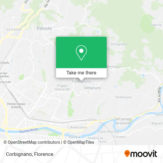
See Corbignano, Florence, on the map
Public Transit to Corbignano in Florence
Wondering how to get to Corbignano in Florence? Moovit helps you find the best way to get to Corbignano with step-by-step directions from the nearest public transit station.
Moovit provides free maps and live directions to help you navigate through your city. View schedules, routes, timetables, and find out how long does it take to get to Corbignano in real time.
Looking for the nearest stop or station to Corbignano? Check out this list of stops closest to your destination: Le Cure; D'Annunzio Ponte A Mensola; Firenze Rovezzano; Florence Campo di Marte.
Bus: 10, 22.Train: R.
Want to see if there’s another route that gets you there at an earlier time? Moovit helps you find alternative routes or times. Get directions from and directions to Corbignano easily from the Moovit App or Website.
We make riding to Corbignano easy, which is why over 1.5 million users, including users in Florence, trust Moovit as the best app for public transit. You don’t need to download an individual bus app or train app, Moovit is your all-in-one transit app that helps you find the best bus time or train time available.
For information on prices of bus and train, costs and ride fares to Corbignano, please check the Moovit app.
Use the app to navigate to popular places including to the airport, hospital, stadium, grocery store, mall, coffee shop, school, college, and university.
Corbignano Address: Via di Corbignano street in Florence
- Index SAS by Ancilla Antonini and Co,
- Villa I Tatti,
- Enrico Pieragnoli Street, 21,
- 21 Pieragnoli Street,
- Vincigliata Adventure Park,
- Vincigliata Castle,
- San Martino a Mensola Street 4,
- San Giuseppe Church,
- Adelaide Placci Foundation,
- Feliceto Road / Desiderio da Settignano Square,
- Field of Mars,
- Lions Club Florence Michelangelo,
- Villa Desiderio,
- Bibi Graetz Agricultural Farm,
- Villa Viviani,
- Villa Viviani Settignanella S.R.L.,
- Family Nation,
- Vincigliata,
- Gabriele D'Annunzio Street / Old Settignano Road,
- Hareka Consulting Sas by Pierangelo Bartolozzi & C.
Places Near Corbignano (Florence)
- Artemio Franchi Municipal Stadium, Florence,
- IKEA Florence, Sesto Fiorentino,
- Campi Bisenzio, Campi Bisenzio,
- Visarno Hippodrome, Florence,
- Michelangelo Square, Florence,
- I Gigli, Campi Bisenzio,
- Mandela Forum (Nelson Mandela Forum), Florence,
- Piero Palagi Hospital Facility-Florence, Florence,
- Torregalli Hospital Scandicci *, Scandicci,
- Visarno Arena, Florence,
- Nelson Mandela Forum, Florence,
- Michelangelo Square, Florence,
- OOO, Florence,
- Asmana, Campi Bisenzio,
- Cascine Park, Florence,
- Santa Maria Nuova Hospital, Florence,
- Field of Mars, Florence,
- Tobacco Manufacture, Florence,
- Verdi Theater, Florence,
- Santa Maria Novella Station, Florence
How to get to popular places in Florence with public transit
Get around Florence by public transit!
Traveling around Florence has never been so easy. See step by step directions as you travel to any attraction, street or major public transit station. View bus and train schedules, arrival times, service alerts and detailed routes on a map, so you know exactly how to get to anywhere in Florence.
When traveling to any destination around Florence use Moovit's Live Directions with Get Off Notifications to know exactly where and how far to walk, how long to wait for your line, and how many stops are left. Moovit will alert you when it's time to get off — no need to constantly re-check whether yours is the next stop.
Wondering how to use public transit in Florence or how to pay for public transit in Florence? Moovit public transit app can help you navigate your way with public transit easily, and at minimum cost. It includes public transit fees, ticket prices, and costs. Looking for a map of Florence public transit lines? Moovit public transit app shows all public transit maps in Florence with all Bus, Train, Light Rail, Ferry and Funicular routes and stops on an interactive map.
Florence has 5 transit type(s), including: Bus, Train, Light Rail, Ferry and Funicular, operated by several transit agencies, including Florence Urban - Tuscan Bus Lines, GEST, Livorno and Province - Tuscan Bus Lines, Arezzo, Florence and Provinces - Tuscan Bus Lines, Prato and Province - Tuscan Bus Lines, Lucca and Province - Tuscan Bus Lines, Massa, Carrara and Province - Tuscan Bus Lines, Pisa and Province - Tuscan Bus Lines, Grosseto, Siena and Provinces - Tuscan Bus Lines, Arezzo, Siena and Provinces - Tuscan Bus Lines, Florence and Province - Tuscan Bus Lines, Pistoia and Province - Tuscan Bus Lines, Siena and Province - Tuscan Bus Lines, Arezzo and Province - Tuscan Bus Lines and Trenitalia