How to get to Corsi Antonio by bus?
Click on the bus route to see step by step directions with maps, line arrival times and updated time schedules.
From Gioacchino Rossini Street / Giuseppe Ferrata Street, Viterbo
54 minFrom Belcolle Hospital, Viterbo
57 minFrom ENEA Casaccia Research Center, Roma
125 minFrom New Tavern, Roma
118 minFrom San Martino Al Cimino, Viterbo
285 minFrom Bracciano Lakeside, Bracciano
178 minFrom Tuscia Thermal Baths, Viterbo
53 minFrom Vallelunga Racetrack, Campagnano Di Roma
117 minFrom Santa Claus Kingdom, Vetralla
23 minFrom Viterbo Historic Center, Viterbo
57 min
Bus stops near Corsi Antonio in Sutri
Bus lines to Corsi Antonio in Sutri
- COTRAL, Viterbo - Bassano Romano,VIEW
- COTRAL, Caprarola - Monterosi,VIEW
- COTRAL, Ronciglione - Bassano Romano,VIEW
- COTRAL, Fonte Vivola - Viterbo,VIEW
- COTRAL, Viterbo - Osteria Nuova,VIEW
- COTRAL, Blera - Roma Saxa Rubra,VIEW
- COTRAL, Ronciglione - Roma Saxa Rubra,VIEW
- COTRAL, Vetralla - Roma Saxa Rubra,VIEW
- COTRAL, Viterbo - Roma Cornelia,VIEW
- COTRAL, Viterbo - Castel Sant'Elia,VIEW
- COTRAL, Terme Di Viterbo - Roma Saxa Rubra,VIEW
- COTRAL, Ronciglione - Capranica - Station,VIEW
- COTRAL, Viterbo - Roma Saxa Rubra,VIEW
- COTRAL, Roma Saxa Rubra - Viterbo,VIEW
- COTRAL, Roma Saxa Rubra - Viterbo Thermal Baths,VIEW
- COTRAL, Roma Cornelia - Viterbo,VIEW
- COTRAL, Roma Saxa Rubra - Bassano Romano,VIEW
- COTRAL, Roma Saxa Rubra - Ronciglione,VIEW
- COTRAL, Castel Sant'elia - Viterbo,VIEW
- COTRAL, Roma Saxa Rubra - Blera,VIEW
What are the closest stations to Corsi Antonio?
The closest stations to Corsi Antonio are:
- Sutri | Cassia Street Bassanese Street is 488 meters away, 7 min walk.
- Sutri | Cassia Street (Km 47) is 499 meters away, 7 min walk.
- Sutri | Bassanese Street Cassia Street is 553 meters away, 8 min walk.
Which bus line stops near Corsi Antonio?
COTRAL (Viterbo via Riello→Rome | Saxa Rubra (Arrivals))
What’s the nearest bus station to Corsi Antonio in Sutri?
The nearest bus stations to Corsi Antonio in Sutri are Sutri | Cassia Street Bassanese Street and Sutri | Cassia Street (Km 47). The closest one is a 7 min walk away.
What time is the first bus to Corsi Antonio in Sutri?
The COTRAL is the first bus that goes to Corsi Antonio in Sutri. It stops nearby at 6:12 AM.
What time is the last bus to Corsi Antonio in Sutri?
The COTRAL is the last bus that goes to Corsi Antonio in Sutri. It stops nearby at 10:14 PM.
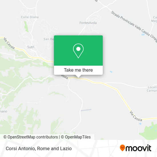
See Corsi Antonio, Sutri, on the map
Public Transit to Corsi Antonio in Sutri
Wondering how to get to Corsi Antonio in Sutri? Moovit helps you find the best way to get to Corsi Antonio with step-by-step directions from the nearest public transit station.
Moovit provides free maps and live directions to help you navigate through your city. View schedules, routes, timetables, and find out how long does it take to get to Corsi Antonio in real time.
Looking for the nearest stop or station to Corsi Antonio? Check out this list of stops closest to your destination: Sutri | Cassia Street Bassanese Street; Sutri | Cassia Street (Km 47); Sutri | Bassanese Street Cassia Street.
Bus: COTRAL, SITBUS, SITBUS.
Want to see if there’s another route that gets you there at an earlier time? Moovit helps you find alternative routes or times. Get directions from and directions to Corsi Antonio easily from the Moovit App or Website.
We make riding to Corsi Antonio easy, which is why over 1.5 million users, including users in Sutri, trust Moovit as the best app for public transit. You don’t need to download an individual bus app or train app, Moovit is your all-in-one transit app that helps you find the best bus time or train time available.
For information on prices of bus, costs and ride fares to Corsi Antonio, please check the Moovit app.
Use the app to navigate to popular places including to the airport, hospital, stadium, grocery store, mall, coffee shop, school, college, and university.
Corsi Antonio Address: Strada Provinciale Sutrina, 01015 Sutri street in Sutri
- IP,
- Falcinelli Nurseries by Marco Falcinelli,
- National Golf,
- Life B&B,
- Jasmine Garden,
- Flaro S.,
- Paolo Marinilli,
- Liutprando,
- Trappicò,
- Iocchi National Golf,
- Cucinart,
- Francesco Calcagni Automotive,
- Il Mitreo,
- Pietrobono Antonio Caravan Shop,
- Torre del Piancastagno Relais,
- Roman Amphitheater of Sutri,
- SS Cassia, km 46.700,
- Repower,
- Ancient Borgo of Sutri,
- N'Uovo Wine and Kitchen
Places Near Corsi Antonio (Sutri)
- Cristo Re Hospital, Roma,
- Olympic Stadium, Rome, Roma,
- Gemelli Polyclinic, Roma,
- The Sail, Roma,
- Scuderie Del Quirinale, Roma,
- Tor Vergata, Roma,
- Auditorium Music Park, Roma,
- Paths, Roma,
- Roma Est Shopping Center, Roma,
- Casilino Polyclinic, Roma,
- Tiber Island, Roma,
- Santa Maria Maggiore, Roma,
- Termini Station, Roma,
- Sandro Pertini Hospital, Roma,
- The Wow Side, Fiumicino,
- Gravity, Roma,
- Trastevere Quarter, Roma,
- Villa Borghese, Roma,
- Coppedè Quarter, Roma,
- IDI (Dermopatico Dell'Immacolata Institute), Roma
How to get to popular places in Rome and Lazio with public transit
Get around Sutri by public transit!
Traveling around Sutri has never been so easy. See step by step directions as you travel to any attraction, street or major public transit station. View bus and train schedules, arrival times, service alerts and detailed routes on a map, so you know exactly how to get to anywhere in Sutri.
When traveling to any destination around Sutri use Moovit's Live Directions with Get Off Notifications to know exactly where and how far to walk, how long to wait for your line, and how many stops are left. Moovit will alert you when it's time to get off — no need to constantly re-check whether yours is the next stop.
Wondering how to use public transit in Sutri or how to pay for public transit in Sutri? Moovit public transit app can help you navigate your way with public transit easily, and at minimum cost. It includes public transit fees, ticket prices, and costs. Looking for a map of Sutri public transit lines? Moovit public transit app shows all public transit maps in Sutri with all Bus, Train, Metro, Light Rail, Ferry, Funicular and Gondola routes and stops on an interactive map.
Rome and Lazio has 7 transit type(s), including: Bus, Train, Metro, Light Rail, Ferry, Funicular and Gondola, operated by several transit agencies, including ATAC, Cotral, Trenitalia, Troiani Transportation Services, BIS, ATR Mobility, Tuscia, Shuttle, Seatour, Troiani Bus Lines, CSC Mobility, Terravision, ATRAL, Tambus and Sitbus