Directions to France Course (Roma) with public transportation
The following transit lines have routes that pass near France Course
 Bus: 223, 32, 69, C3, 201.
- Metro: A.
How to get to France Course by bus?
Click on the bus route to see step by step directions with maps, line arrival times and updated time schedules.
How to get to France Course by metro?
Click on the metro route to see step by step directions with maps, line arrival times and updated time schedules.
Bus stops near France Course in Roma
- Francia Avenue/Flaminio Bridge, 2 min walk,
- Tor Di Quinto/Lupi, 6 min walk,
- Tor Di Quinto/Riano, 6 min walk,
- Francia Avenue/Flaminia, 6 min walk,
- Riano, 7 min walk,
- XVII Olympics/Austria, 8 min walk,
- Milvian Bridge, 10 min walk,
Light Rail stations near France Course in Roma
- Mancini, 15 min walk,
Bus lines to France Course in Roma
- C3, Tiburtina Station (Metro B),
- 201, Venezuela/India,
- 223, La Giustiniana Station (FL3),
- 69, Largo Pugliese,
- 32, Saxa Rubra Station,
- 200, Prima Porta Station,
- N201, Piazza Venezia,
- 226, Grottarossa/Istituto Asisium,
- G05, Grottarossa Depot - Piazza Mancini,
- COTRAL, Morlupo - Rome Cipro,
- COTRAL, Manziana - Roma Cornelia,
- COTRAL, Ponzano Primare - Roma Cipro,
- COTRAL, Allumiere - Roma Cornelia,
- COTRAL, Blera - Roma Cornelia,
- COTRAL, Civita Castellana - Roma Cornelia,
- COTRAL, Manziana - Roma Saxa Rubra,
- COTRAL, Viterbo - Roma Cornelia,
- G50, Grottarossa Station,
- COTRAL, Viterbo via Riello,
- COTRAL, Civita via Terni via Palombara,
What are the closest stations to France Course?
The closest stations to France Course are:
- Francia Avenue/Flaminio Bridge is 140 meters away, 2 min walk.
- Tor Di Quinto/Lupi is 395 meters away, 6 min walk.
- Tor Di Quinto/Riano is 440 meters away, 6 min walk.
- Francia Avenue/Flaminia is 454 meters away, 6 min walk.
- Riano is 487 meters away, 7 min walk.
- XVII Olympics/Austria is 595 meters away, 8 min walk.
- Milvian Bridge is 746 meters away, 10 min walk.
- Mancini is 1145 meters away, 15 min walk.
Which bus lines stop near France Course?
These bus lines stop near France Course: 223, 32, 69.
Which metro line stops near France Course?
A (Battistini)
What’s the nearest light rail station to France Course in Roma?
The nearest light rail station to France Course in Roma is Mancini. It’s a 15 min walk away.
What’s the nearest bus station to France Course in Roma?
The nearest bus station to France Course in Roma is Francia Avenue/Flaminio Bridge. It’s a 2 min walk away.
What time is the first light rail to France Course in Roma?
The 2 is the first light rail that goes to France Course in Roma. It stops nearby at 5:16 AM.
What time is the last light rail to France Course in Roma?
The 2 is the last light rail that goes to France Course in Roma. It stops nearby at 12:27 AM.
What time is the first bus to France Course in Roma?
The N201 is the first bus that goes to France Course in Roma. It stops nearby at 3:03 AM.
What time is the last bus to France Course in Roma?
The N201 is the last bus that goes to France Course in Roma. It stops nearby at 3:17 AM.
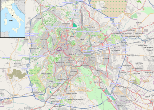
See France Course, Roma, on the map
Public Transit to France Course in Roma
Wondering how to get to France Course in Roma? Moovit helps you find the best way to get to France Course with step-by-step directions from the nearest public transit station.
Moovit provides free maps and live directions to help you navigate through your city. View schedules, routes, timetables, and find out how long does it take to get to France Course in real time.
Looking for the nearest stop or station to France Course? Check out this list of stops closest to your destination: Francia Avenue/Flaminio Bridge; Tor Di Quinto/Lupi; Tor Di Quinto/Riano; Francia Avenue/Flaminia; Riano; XVII Olympics/Austria; Milvian Bridge; Mancini.
Bus: 223, 32, 69, C3, 201, 200, N201, 226, G05, COTRAL, COTRAL, COTRAL, COTRAL, G50, COTRAL, COTRAL, COTRAL, COTRAL, 188.Metro: A.
Want to see if there’s another route that gets you there at an earlier time? Moovit helps you find alternative routes or times. Get directions from and directions to France Course easily from the Moovit App or Website.
We make riding to France Course easy, which is why over 1.5 million users, including users in Roma, trust Moovit as the best app for public transit. You don’t need to download an individual bus app or train app, Moovit is your all-in-one transit app that helps you find the best bus time or train time available.
For information on prices of bus and metro, costs and ride fares to France Course, please check the Moovit app.
Use the app to navigate to popular places including to the airport, hospital, stadium, grocery store, mall, coffee shop, school, college, and university.
France Course Address: Corso di Francia, Roma RM, Italia street in Roma
- France Course / Flaminio Bridge,
- Tor di Quinto Avenue & Lupi Pietro Street,
- Toca Bar,
- Tammaro Store,
- Atac Bus Stop Tor di Quinto Riano,
- From Giorgione - The Messy,
- France Course / Flaminio Bridge,
- Polygraphic Circle,
- Brothers La Bufala,
- Bimbilandia,
- Sports Club of the Italian Air Force,
- Ponte Milvio Sports Club,
- Riano Street 15,
- Salvo D'Acquisto Riverfront 21,
- Ponte Milvio Market,
- Water and Soap,
- Arpea,
- Tor di Quinto Avenue 47,
- ASL Roma 1 - Tor Di Quinto Polyclinic,
- Enel X
Places Near France Course (Roma)
- Tiber Island, Roma,
- Olympic Stadium, Rome, Roma,
- Gravity, Roma,
- Santa Maria Maggiore, Roma,
- Villa Borghese, Roma,
- Basilica of Santa Maria Maggiore, Roma,
- The Wow Side, Fiumicino,
- Auditorium Music Park, Roma,
- Foro Italico, Roma,
- Basilica of Saint Paul Outside the Walls, Roma,
- Tor Vergata, Roma,
- Cristo Re Hospital, Roma,
- Casilino Polyclinic, Roma,
- Scuderie Del Quirinale, Roma,
- Roma Est Shopping Center, Roma,
- Trastevere Quarter, Roma,
- Trastevere, Roma,
- Coppedè Quarter, Roma,
- IDI (Dermopatico Dell'Immacolata Institute), Roma,
- Paths, Roma
How to get to popular places in Rome and Lazio with public transit
Get around Roma by public transit!
Traveling around Roma has never been so easy. See step by step directions as you travel to any attraction, street or major public transit station. View bus and train schedules, arrival times, service alerts and detailed routes on a map, so you know exactly how to get to anywhere in Roma.
When traveling to any destination around Roma use Moovit's Live Directions with Get Off Notifications to know exactly where and how far to walk, how long to wait for your line, and how many stops are left. Moovit will alert you when it's time to get off — no need to constantly re-check whether yours is the next stop.
Wondering how to use public transit in Roma or how to pay for public transit in Roma? Moovit public transit app can help you navigate your way with public transit easily, and at minimum cost. It includes public transit fees, ticket prices, and costs. Looking for a map of Roma public transit lines? Moovit public transit app shows all public transit maps in Roma with all Bus, Train, Metro, Light Rail, Ferry, Funicular and Gondola routes and stops on an interactive map.
Rome and Lazio has 7 transit type(s), including: Bus, Train, Metro, Light Rail, Ferry, Funicular and Gondola, operated by several transit agencies, including ATAC, Cotral, Trenitalia, Troiani Transportation Services, BIS, ATR Mobility, Tuscia, Shuttle, Seatour, Troiani Bus Lines, CSC Mobility, Terravision, ATRAL, Tambus and Sitbus