Directions to Costelabecorancho (Nova Iguaçu) with public transportation
The following transit lines have routes that pass near Costelabecorancho
 Bus: 607I, 605I, 015.
- Train: RAMAL JAPERI.
How to get to Costelabecorancho by bus?
Click on the bus route to see step by step directions with maps, line arrival times and updated time schedules.
From Shopping Nova Iguaçu, Nova Iguaçu
48 minFrom Junta Militar de Nova Iguaçu, Nova Iguaçu
47 minFrom Rua Estados Unidos 300, Nova Iguaçu
44 minFrom São João de Meriti, Nova Iguaçu
35 minFrom Hospital da Posse (HGNI), Nova Iguaçu
45 minFrom Centro - Nova Iguaçu, Nova Iguaçu
44 minFrom Shopping Da Multidão, Nova Iguaçu
53 minFrom Topshopping, Nova Iguaçu
46 minFrom Madureira 1, Nova Iguaçu
55 minFrom Hospital Estadual Dr. Ricardo Cruz, Nova Iguaçu
49 min
How to get to Costelabecorancho by train?
Click on the train route to see step by step directions with maps, line arrival times and updated time schedules.
From Shopping Nova Iguaçu, Nova Iguaçu
61 minFrom Junta Militar de Nova Iguaçu, Nova Iguaçu
48 minFrom Rua Estados Unidos 300, Nova Iguaçu
58 minFrom São João de Meriti, Nova Iguaçu
55 minFrom Centro - Nova Iguaçu, Nova Iguaçu
52 minFrom Shopping Da Multidão, Nova Iguaçu
41 minFrom Topshopping, Nova Iguaçu
55 minFrom Madureira 1, Nova Iguaçu
46 min
Bus stops near Costelabecorancho in Nova Iguaçu
Train station near Costelabecorancho in Nova Iguaçu
- Queimados, 44 min walk,VIEW
Bus lines to Costelabecorancho in Nova Iguaçu
What are the closest stations to Costelabecorancho?
The closest stations to Costelabecorancho are:
- C.E. Raymundo Corrêa is 86 meters away, 2 min walk.
- Estrada Carlos Sampaio, 24 is 242 meters away, 4 min walk.
- Queimados is 3444 meters away, 44 min walk.
Which bus line stops near Costelabecorancho?
607I (Paraíso)
Which train line stops near Costelabecorancho?
RAMAL JAPERI (Japeri)
What’s the nearest bus station to Costelabecorancho in Nova Iguaçu?
The nearest bus station to Costelabecorancho in Nova Iguaçu is C.E. Raymundo Corrêa. It’s a 2 min walk away.
What time is the first train to Costelabecorancho in Nova Iguaçu?
The RAMAL JAPERI is the first train that goes to Costelabecorancho in Nova Iguaçu. It stops nearby at 4:17 AM.
What time is the last train to Costelabecorancho in Nova Iguaçu?
The RAMAL JAPERI is the last train that goes to Costelabecorancho in Nova Iguaçu. It stops nearby at 11:47 PM.
What time is the first bus to Costelabecorancho in Nova Iguaçu?
The 605I is the first bus that goes to Costelabecorancho in Nova Iguaçu. It stops nearby at 3:53 AM.
What time is the last bus to Costelabecorancho in Nova Iguaçu?
The 607I is the last bus that goes to Costelabecorancho in Nova Iguaçu. It stops nearby at 11:59 PM.
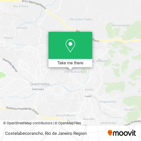
See Costelabecorancho, Nova Iguaçu, on the map
Public Transit to Costelabecorancho in Nova Iguaçu
Wondering how to get to Costelabecorancho in Nova Iguaçu? Moovit helps you find the best way to get to Costelabecorancho with step-by-step directions from the nearest public transit station.
Moovit provides free maps and live directions to help you navigate through your city. View schedules, routes, timetables, and find out how long does it take to get to Costelabecorancho in real time.
Looking for the nearest stop or station to Costelabecorancho? Check out this list of stops closest to your destination: C.E. Raymundo Corrêa; Estrada Carlos Sampaio; Queimados.
Bus: 607I, 605I, 015.Train: RAMAL JAPERI.
Want to see if there’s another route that gets you there at an earlier time? Moovit helps you find alternative routes or times. Get directions from and directions to Costelabecorancho easily from the Moovit App or Website.
We make riding to Costelabecorancho easy, which is why over 1.5 million users, including users in Nova Iguaçu, trust Moovit as the best app for public transit. You don’t need to download an individual bus app or train app, Moovit is your all-in-one transit app that helps you find the best bus time or train time available.
For information on prices of bus and train, costs and ride fares to Costelabecorancho, please check the Moovit app.
Use the app to navigate to popular places including to the airport, hospital, stadium, grocery store, mall, coffee shop, school, college, and university.
Costelabecorancho Address: Estrada de Queimados, Vila Guimarães Nova Iguaçu-RJ 26087-150 street in Nova Iguaçu
- Odairocursose,
- Rogerinho Rações,
- Banco Bradesco,
- Rua Coronel Monteiro de Barros,
- Academia Águia Fit,
- Igreja Batista de Vila Guimarães,
- Bm Negocios,
- Lira,
- Move Academia Funcional,
- Igreja Evangelica Cristo Para a as Nacoes,
- Sansake Culinária Japonesa,
- Centro Educacional José Luiz Fuly,
- Biblioteca Comunitária Paulo Sacramento,
- Estrada de Queimados, 1508,
- Estrada de Queimados,
- A&M Soluções Em Impermeabilizacao,
- Cachoeira de Jaceruba - Nova Iguaçu,
- CE José Luiz Fuly Escola Crianca Feliz,
- On Fit Academia,
- CE Souza Marques
Places Near Costelabecorancho (Nova Iguaçu)
- Museu Do Amanhã, Centro,
- Feirão De Malhas, Duque De Caxias,
- Rua Licínio Cardoso, São Francisco Xavier,
- Norte Shopping, Cachambi,
- Rodoviária Novo Rio (Rodoviária do Rio de Janeiro), Santo Cristo,
- Feira Livre da Gloria, Glória,
- Avenida Rio Branco, Centro,
- Avenida Venezuela 134, Saúde,
- Rio De Janeiro,
- Shopping Rio Sul, Botafogo,
- Praia do Arpoador, Ipanema,
- Hospital Municipal Ronaldo Gazolla, Acari,
- Hospital Pedro Ernesto, Vila Isabel,
- Shopping RioSul, Botafogo,
- Shopping Downtown, Barra Da Tijuca,
- Niterói, Niterói,
- Hospital Federal Do Andaraí, Andaraí,
- Hospital Federal Cardoso Fontes, Jacarepaguá,
- Rua Ulysses Guimarães 16, Cidade Nova,
- Shopping Nova América, Del Castilho
How to get to popular places in Rio de Janeiro Region with public transit
Get around Nova Iguaçu by public transit!
Traveling around Nova Iguaçu has never been so easy. See step by step directions as you travel to any attraction, street or major public transit station. View bus and train schedules, arrival times, service alerts and detailed routes on a map, so you know exactly how to get to anywhere in Nova Iguaçu.
When traveling to any destination around Nova Iguaçu use Moovit's Live Directions with Get Off Notifications to know exactly where and how far to walk, how long to wait for your line, and how many stops are left. Moovit will alert you when it's time to get off — no need to constantly re-check whether yours is the next stop.
Wondering how to use public transit in Nova Iguaçu or how to pay for public transit in Nova Iguaçu? Moovit public transit app can help you navigate your way with public transit easily, and at minimum cost. It includes public transit fees, ticket prices, and costs. Looking for a map of Nova Iguaçu public transit lines? Moovit public transit app shows all public transit maps in Nova Iguaçu with all Bus, Train, Metro, Light Rail, Ferry, Cable Car, Gondola and Funicular routes and stops on an interactive map.
Rio de Janeiro Region has 8 transit type(s), including: Bus, Train, Metro, Light Rail, Ferry, Cable Car, Gondola and Funicular, operated by several transit agencies, including TrensRJ, Metrô Rio, VLT Carioca, Barcas Rio, BRT MOBI-Rio, Auto Viação Alpha, Auto Viação Tijuca, Gire Transportes, Transurb, Viação Nossa Senhora das Graças, Consórcio INTERSUL, Braso Lisboa (Municipal), Caprichosa Auto Ônibus, Auto Viação Três Amigos and Rodoviária Âncora Matias