How to get to Counter by bus?
Click on the bus route to see step by step directions with maps, line arrival times and updated time schedules.
From Sunset Dr, Miami
86 minFrom Sawgrass Mall, Miami
76 minFrom Southwest Miami Senior High School, South Westside
105 minFrom Doral Academy Prep Middle /High School, North Westside
110 minFrom Santa Clara Metrorail Station, Miami
59 minFrom Morningside Park, Morningside, Fl, Miami
72 minFrom Consulado Republica Dominicana, Miami
49 minFrom Dade county courthouse, Miami
32 minFrom Jungle Island, Miami
40 minFrom NW 14th St / NW 7th Ave, Miami
48 min
How to get to Counter by train?
Click on the train route to see step by step directions with maps, line arrival times and updated time schedules.
Bus stop near Counter in Miami
- Nw 42 Ct @ Nw Tamiami Canal Dr, 17 min walk,VIEW
Train station near Counter in Miami
- Hialeah Market Station, 23 min walk,VIEW
Bus lines to Counter in Miami
- 57, 57 - Airport Station,VIEW
What are the closest stations to Counter?
The closest stations to Counter are:
- Nw 42 Ct @ Nw Tamiami Canal Dr is 1422 yards away, 17 min walk.
- Hialeah Market Station is 1938 yards away, 23 min walk.
Which bus lines stop near Counter?
These bus lines stop near Counter: 37, 57, MIA AIRPORT CONNECTOR, MIAFLAG.
Which train line stops near Counter?
ORANGE (Dadeland South Stat.rail Northbound→MIA Northbound)
Which light rail line stops near Counter?
MIA (Airport Station→Miami Intl Airport Ground Level)
What’s the nearest train station to Counter in Miami?
The nearest train station to Counter in Miami is Hialeah Market Station. It’s a 23 min walk away.
What time is the first train to Counter in Miami?
The TRIRAIL is the first train that goes to Counter in Miami. It stops nearby at 3:50 AM.
What time is the last train to Counter in Miami?
The TRIRAIL is the last train that goes to Counter in Miami. It stops nearby at 10:41 PM.
What time is the first bus to Counter in Miami?
The 57 is the first bus that goes to Counter in Miami. It stops nearby at 5:46 AM.
What time is the last bus to Counter in Miami?
The 57 is the last bus that goes to Counter in Miami. It stops nearby at 9:01 PM.
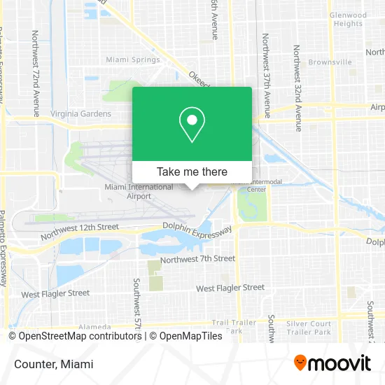
See Counter, Miami, on the map
Public Transit to Counter in Miami
Wondering how to get to Counter in Miami? Moovit helps you find the best way to get to Counter with step-by-step directions from the nearest public transit station.
Moovit provides free maps and live directions to help you navigate through your city. View schedules, routes, timetables, and find out how long does it take to get to Counter in real time.
Looking for the nearest stop or station to Counter? Check out this list of stops closest to your destination: Nw 42 Ct @ Nw Tamiami Canal Dr; Hialeah Market Station.
Bus: 37, 57, MIA AIRPORT CONNECTOR, MIAFLAG.Train: ORANGE, TRIRAIL.Light Rail: MIA.
Want to see if there’s another route that gets you there at an earlier time? Moovit helps you find alternative routes or times. Get directions from and directions to Counter easily from the Moovit App or Website.
We make riding to Counter easy, which is why over 1.5 million users, including users in Miami, trust Moovit as the best app for public transit. You don’t need to download an individual bus app or train app, Moovit is your all-in-one transit app that helps you find the best bus time or train time available.
For information on prices of bus, light rail and train, costs and ride fares to Counter, please check the Moovit app.
Use the app to navigate to popular places including to the airport, hospital, stadium, grocery store, mall, coffee shop, school, college, and university.
Counter Address: 4250 NW 20th St Miami, FL 33122 street in Miami
- the Counter,
- Counter Miami Airport,
- Boss Travel Shop,
- KFC,
- Laser Airlines,
- El Al Israel Airlines,
- entrevista con migracion,
- Little Havana To Go,
- Global Entry Enrollment Center,
- Concourse J,
- Jamba,
- VIP Lounge Miami Airport @ International Miami Airport,
- Lufthansa Business Lounge,
- Deerfield Beach Miami,
- Gilbert's Food Bar and Bakery,
- Duty Free Americas,
- COPA Airlines Flight CM-227,
- Brookstone,
- Miami International Airport - South Parking,
- Miami International Airport - Flamingo Garage
Places Near Counter (Miami)
- Wynwood, Miami,
- Miami-Dade County Courthouse, Miami,
- Little Havana, Miami,
- Aventura Mall, Miami,
- Hard Rock Stadium, Miami Gardens,
- Bayside Marketplace, Miami,
- Brickell City Centre, Miami,
- Sawgrass mall ( FL ), Miami Beach,
- Richard E. Gerstein Justice Building, Miami,
- Dolphin Mall, Miami,
- Dolphin Mall Bus, Miami,
- Miami Freedom Park, Miami,
- Marlins Park, Miami,
- Aventura Mall, Miami Beach,
- Port of Miami Cruise Terminal, Miami,
- Miami Design District, Miami,
- Miami VA Hospital, Miami,
- Sawgrass Mall, Miami,
- Keiser University Flagship Campus, West Palm Beach,
- Zoo Miami, Miami
How to get to popular places in Miami with public transit
Get around Miami by public transit!
Traveling around Miami has never been so easy. See step by step directions as you travel to any attraction, street or major public transit station. View bus and train schedules, arrival times, service alerts and detailed routes on a map, so you know exactly how to get to anywhere in Miami.
When traveling to any destination around Miami use Moovit's Live Directions with Get Off Notifications to know exactly where and how far to walk, how long to wait for your line, and how many stops are left. Moovit will alert you when it's time to get off — no need to constantly re-check whether yours is the next stop.
Wondering how to use public transit in Miami or how to pay for public transit in Miami? Moovit public transit app can help you navigate your way with public transit easily, and at minimum cost. It includes public transit fees, ticket prices, and costs. Looking for a map of Miami public transit lines? Moovit public transit app shows all public transit maps in Miami with all Bus, Train, Light Rail and Ferry routes and stops on an interactive map.
Miami has 4 transit type(s), including: Bus, Train, Light Rail and Ferry, operated by several transit agencies, including Broward County Transit, Miami-Dade Transit, Metrorail, Palm Tran, Tri-Rail, Brightline, MARTY, City of Homestead Trolley, Key West Transit, Treasure Coast Connector, GoLine IRT, Amtrak, Greyhound-us, FlixBus-us and Aventura Express Shuttle Bus