How to get to Countrybreak by bus?
Click on the bus route to see step by step directions with maps, line arrival times and updated time schedules.
From Cecytea Morelos, Aguascalientes
59 minFrom Sedesol, Aguascalientes
44 minFrom Fraccionamiento Las Cumbres II, Aguascalientes
44 minFrom Calle Proceres de la Enseñanza, Aguascalientes
61 minFrom C4, Aguascalientes
59 minFrom Villas de Nuestra Señora de la Asunción, Aguascalientes
46 minFrom Miguel Angel Barberena Vega, Aguascalientes
46 minFrom Junta Federal de Conciliacion y Arbitraje No. 24, Aguascalientes
48 minFrom Real de Haciendas, Aguascalientes
75 minFrom Umf 11, Aguascalientes
65 min
Bus stop near Countrybreak in Aguascalientes
- Avenida Eugenio Garza Sada, 122, 3 min walk,VIEW
What are the closest stations to Countrybreak?
The closest stations to Countrybreak are:
- Avenida Eugenio Garza Sada, 122 is 166 meters away, 3 min walk.
Which bus lines stop near Countrybreak?
These bus lines stop near Countrybreak: RUTA 19, RUTA 28.
What’s the nearest bus station to Countrybreak in Aguascalientes?
The nearest bus station to Countrybreak in Aguascalientes is Avenida Eugenio Garza Sada, 122. It’s a 3 min walk away.
What time is the first bus to Countrybreak in Aguascalientes?
The RUTA 19 is the first bus that goes to Countrybreak in Aguascalientes. It stops nearby at 6:15 AM.
What time is the last bus to Countrybreak in Aguascalientes?
The RUTA 19 is the last bus that goes to Countrybreak in Aguascalientes. It stops nearby at 9:59 PM.
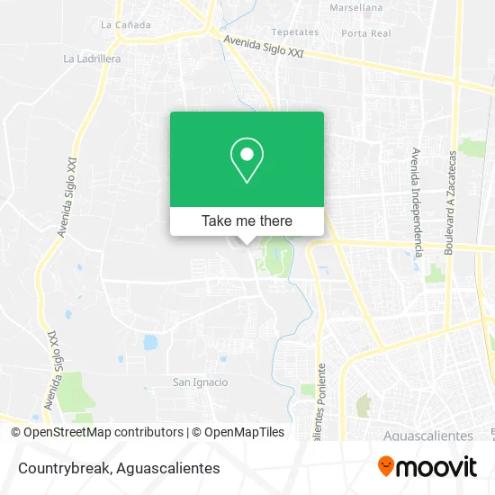
See Countrybreak, Aguascalientes, on the map
Public Transit to Countrybreak in Aguascalientes
Wondering how to get to Countrybreak in Aguascalientes? Moovit helps you find the best way to get to Countrybreak with step-by-step directions from the nearest public transit station.
Moovit provides free maps and live directions to help you navigate through your city. View schedules, routes, timetables, and find out how long does it take to get to Countrybreak in real time.
Looking for the nearest stop or station to Countrybreak? Check out this list of stops closest to your destination: Avenida Eugenio Garza Sada.
Bus: RUTA 19, RUTA 28.
Want to see if there’s another route that gets you there at an earlier time? Moovit helps you find alternative routes or times. Get directions from and directions to Countrybreak easily from the Moovit App or Website.
We make riding to Countrybreak easy, which is why over 1.5 million users, including users in Aguascalientes, trust Moovit as the best app for public transit. You don’t need to download an individual bus app or train app, Moovit is your all-in-one transit app that helps you find the best bus time or train time available.
For information on prices of bus, costs and ride fares to Countrybreak, please check the Moovit app.
Use the app to navigate to popular places including to the airport, hospital, stadium, grocery store, mall, coffee shop, school, college, and university.
Countrybreak Address: Avenida Eugenio Garza Sada 124, Condominio La Plazuela, 20329 Pocitos, Aguascalientes street in Aguascalientes
- Ags Flowers México,
- Garza Sada 128,
- La Taquería San Ignacio,
- Snap Detallado Automotriz,
- Fs Salón,
- Thunder Wings,
- Escuela de Taekwondo Taekyon,
- Dviaje,
- Birrieria Serna,
- Disfraces El Boton de Inés,
- MoneyGram,
- Tech Mahindra Aguascalientes,
- Casa Mezquite,
- Preparatoria Entorno,
- Cavalia Residencial,
- PEMEX,
- La Plazuela, aguascalientes,
- Campestre Santa Maria,
- Kinder Villa de la Asunción Pocitos,
- Condominio Santa Maria
Places Near Countrybreak (Aguascalientes)
- Jesús María, Aguascalientes,
- Hospital Imss No. 3, Aguascalientes,
- Imss Clinica 1, Aguascalientes,
- Terminal De Combis, Aguascalientes,
- Aeropuerto de Aguascalientes S.A. de C.V., Aguascalientes,
- Universidad Autónoma de Aguascalientes, Aguascalientes,
- Centro, Aguascalientes,
- Villasuncion, Aguascalientes,
- Ciudad industrial, Aguascalientes,
- Nuevo Hospital Hidalgo, Aguascalientes,
- ESPACIOS, Aguascalientes,
- La Isla San Marcos, Aguascalientes,
- Centro Comercial Altaria, Aguascalientes,
- Isla San Marcos, Aguascalientes,
- Parque Las Tres Centurias, Aguascalientes,
- Central De Autobuses, Aguascalientes,
- Agropecuario, Aguascalientes,
- clinica 3 uaa, Aguascalientes,
- Blvd. Luis Donaldo Colosio, Aguascalientes,
- Villas de Nuestra Señora de la Asunción, Aguascalientes
How to get to popular places in Aguascalientes with public transit
Get around Aguascalientes by public transit!
Traveling around Aguascalientes has never been so easy. See step by step directions as you travel to any attraction, street or major public transit station. View bus and train schedules, arrival times, service alerts and detailed routes on a map, so you know exactly how to get to anywhere in Aguascalientes.
When traveling to any destination around Aguascalientes use Moovit's Live Directions with Get Off Notifications to know exactly where and how far to walk, how long to wait for your line, and how many stops are left. Moovit will alert you when it's time to get off — no need to constantly re-check whether yours is the next stop.
Wondering how to use public transit in Aguascalientes or how to pay for public transit in Aguascalientes? Moovit public transit app can help you navigate your way with public transit easily, and at minimum cost. It includes public transit fees, ticket prices, and costs. Looking for a map of Aguascalientes public transit lines? Moovit public transit app shows all public transit maps in Aguascalientes with all bus routes and stops on an interactive map.
Aguascalientes has 1 transit type(s), including: bus, operated by several transit agencies, including Coordinación General de Movilidad