How to get to County Wide Pest Control by bus?
Click on the bus route to see step by step directions with maps, line arrival times and updated time schedules.
From Opa-Locka, FL, Miami
44 minFrom Pembroke Lakes Mall Shopping Center, Miramar-Pembroke Pines
72 minFrom Hialeah, FL, Hialeah
83 minFrom F.I.U, Miami
60 minFrom Mall at 163rd Street, Miami
62 minFrom Walmart Supercenter, Miami
61 minFrom Memorial West Hospital, Miramar-Pembroke Pines
66 minFrom 16900 NW 12th Ave, Miami Gardens
45 minFrom T.J. Maxx, Miami
49 minFrom Century Village Pembroke Pines, Miramar-Pembroke Pines
113 min
Bus stops near County Wide Pest Control in Miami Gardens
Bus lines to County Wide Pest Control in Miami Gardens
What are the closest stations to County Wide Pest Control?
The closest stations to County Wide Pest Control are:
- Nw 199 St & Nw 42 Av is 615 yards away, 8 min walk.
- Nw 42 Av & Nw 200 St is 687 yards away, 9 min walk.
- Nw 37 Av & Nw 191 St is 1154 yards away, 14 min walk.
Which bus lines stop near County Wide Pest Control?
These bus lines stop near County Wide Pest Control: 183, 199, 27, 32.
What’s the nearest bus station to County Wide Pest Control in Miami Gardens?
The nearest bus station to County Wide Pest Control in Miami Gardens is Nw 199 St & Nw 42 Av. It’s a 8 min walk away.
What time is the first bus to County Wide Pest Control in Miami Gardens?
The 27 is the first bus that goes to County Wide Pest Control in Miami Gardens. It stops nearby at 3:51 AM.
What time is the last bus to County Wide Pest Control in Miami Gardens?
The 27 is the last bus that goes to County Wide Pest Control in Miami Gardens. It stops nearby at 2:56 AM.
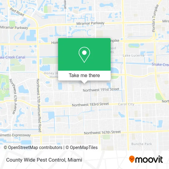
See County Wide Pest Control, Miami Gardens, on the map
Public Transit to County Wide Pest Control in Miami Gardens
Wondering how to get to County Wide Pest Control in Miami Gardens? Moovit helps you find the best way to get to County Wide Pest Control with step-by-step directions from the nearest public transit station.
Moovit provides free maps and live directions to help you navigate through your city. View schedules, routes, timetables, and find out how long does it take to get to County Wide Pest Control in real time.
Looking for the nearest stop or station to County Wide Pest Control? Check out this list of stops closest to your destination: Nw 199 St & Nw 42 Av; Nw 42 Av & Nw 200 St; Nw 37 Av & Nw 191 St.
Bus: 183, 199, 27, 32.
Want to see if there’s another route that gets you there at an earlier time? Moovit helps you find alternative routes or times. Get directions from and directions to County Wide Pest Control easily from the Moovit App or Website.
We make riding to County Wide Pest Control easy, which is why over 1.5 million users, including users in Miami Gardens, trust Moovit as the best app for public transit. You don’t need to download an individual bus app or train app, Moovit is your all-in-one transit app that helps you find the best bus time or train time available.
For information on prices of bus, costs and ride fares to County Wide Pest Control, please check the Moovit app.
Use the app to navigate to popular places including to the airport, hospital, stadium, grocery store, mall, coffee shop, school, college, and university.
County Wide Pest Control Address: 4031 NW 194th St Miami Gardens, FL 33055 street in Miami Gardens
- NW 42nd Ave / NW 191st St,
- NW 39th Ave,
- Florida Truck Road Ser,
- Jamor Cruises,
- Perry Locksmiths,
- Shula's Bar & Grill,
- Solid Blend Cigars,
- Lighthouse Christian Faith,
- Miami Gardens Superb Locksmith,
- Gwen Cromartie,
- NW 37th Ave / NW 197th St,
- UPS Access Point,
- Ily Beauty,
- Botanica Yemaya,
- ATM,
- Express Beauty Supply (Express Beauty Online Lace Wig Human Hair Extensions and Accessories),
- The Resource Room,
- Riviera Mobile Home PArk,
- NW 199th St / NW 37th Ave,
- K & N Nails
Places Near County Wide Pest Control (Miami Gardens)
- Miami Design District, Miami,
- Bayside Marketplace, Miami,
- Zoo Miami, Miami,
- Miami VA Hospital, Miami,
- Sawgrass mall ( FL ), Miami Beach,
- Little Havana, Miami,
- Keiser University Flagship Campus, West Palm Beach,
- Miami Freedom Park, Miami,
- Miami-Dade County Courthouse, Miami,
- Sawgrass Mall, Miami,
- Hard Rock Stadium, Miami Gardens,
- Dolphin Mall Bus, Miami,
- Richard E. Gerstein Justice Building, Miami,
- Port of Miami Cruise Terminal, Miami,
- Dolphin Mall, Miami,
- Aventura Mall, Miami,
- Brickell City Centre, Miami,
- Marlins Park, Miami,
- Aventura Mall, Miami Beach,
- Wynwood, Miami
How to get to popular places in Miami with public transit
Get around Miami Gardens by public transit!
Traveling around Miami Gardens has never been so easy. See step by step directions as you travel to any attraction, street or major public transit station. View bus and train schedules, arrival times, service alerts and detailed routes on a map, so you know exactly how to get to anywhere in Miami Gardens.
When traveling to any destination around Miami Gardens use Moovit's Live Directions with Get Off Notifications to know exactly where and how far to walk, how long to wait for your line, and how many stops are left. Moovit will alert you when it's time to get off — no need to constantly re-check whether yours is the next stop.
Wondering how to use public transit in Miami Gardens or how to pay for public transit in Miami Gardens? Moovit public transit app can help you navigate your way with public transit easily, and at minimum cost. It includes public transit fees, ticket prices, and costs. Looking for a map of Miami Gardens public transit lines? Moovit public transit app shows all public transit maps in Miami Gardens with all Bus, Train, Light Rail and Ferry routes and stops on an interactive map.
Miami has 4 transit type(s), including: Bus, Train, Light Rail and Ferry, operated by several transit agencies, including Broward County Transit, Miami-Dade Transit, Metrorail, Palm Tran, Tri-Rail, Brightline, MARTY, City of Homestead Trolley, Key West Transit, Treasure Coast Connector, GoLine IRT, Amtrak, Greyhound-us, FlixBus-us and Aventura Express Shuttle Bus