How to get to Covergence by bus?
Click on the bus route to see step by step directions with maps, line arrival times and updated time schedules.
From Walmart, Fairfax County
127 minFrom Tysons Corner Center, Fairfax County
116 minFrom Walter Reed National Military Medical Center, Montgomery County
82 minFrom Leesburg VA-684, Fairfax County
124 minFrom The Ritz-Carlton, Tysons Corner, Fairfax County
114 minFrom Tysons Galleria, Fairfax County
117 minFrom Embassy Suites-Bethesda Washington DC, Montgomery County
57 minFrom Liberty Crossing, Fairfax County
181 minFrom Montgomery College-Rockville, Montgomery County
39 min
Bus stop near Covergence in Montgomery County
- River Rd+Hall Rd, 7 min walk,VIEW
Bus lines to Covergence in Montgomery County
- M82, North To Rockville,VIEW
What are the closest stations to Covergence?
The closest stations to Covergence are:
- River Rd+Hall Rd is 512 yards away, 7 min walk.
Which bus lines stop near Covergence?
These bus lines stop near Covergence: 36, M82.
What’s the nearest bus station to Covergence in Montgomery County?
The nearest bus station to Covergence in Montgomery County is River Rd+Hall Rd. It’s a 7 min walk away.
What time is the first bus to Covergence in Montgomery County?
The M82 is the first bus that goes to Covergence in Montgomery County. It stops nearby at 5:48 AM.
What time is the last bus to Covergence in Montgomery County?
The M82 is the last bus that goes to Covergence in Montgomery County. It stops nearby at 7:53 PM.
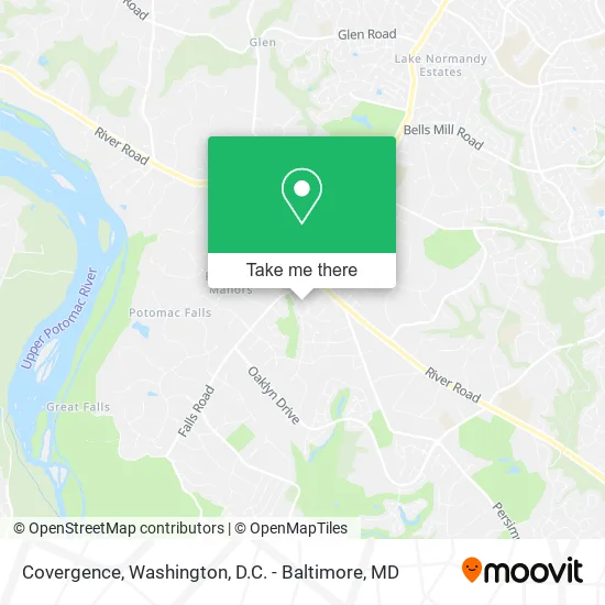
See Covergence, Montgomery County, on the map
Public Transit to Covergence in Montgomery County
Wondering how to get to Covergence in Montgomery County? Moovit helps you find the best way to get to Covergence with step-by-step directions from the nearest public transit station.
Moovit provides free maps and live directions to help you navigate through your city. View schedules, routes, timetables, and find out how long does it take to get to Covergence in real time.
Looking for the nearest stop or station to Covergence? Check out this list of stops closest to your destination: River Rd+Hall Rd.
Bus: 36, M82.
Want to see if there’s another route that gets you there at an earlier time? Moovit helps you find alternative routes or times. Get directions from and directions to Covergence easily from the Moovit App or Website.
We make riding to Covergence easy, which is why over 1.5 million users, including users in Montgomery County, trust Moovit as the best app for public transit. You don’t need to download an individual bus app or train app, Moovit is your all-in-one transit app that helps you find the best bus time or train time available.
For information on prices of bus and metro, costs and ride fares to Covergence, please check the Moovit app.
Use the app to navigate to popular places including to the airport, hospital, stadium, grocery store, mall, coffee shop, school, college, and university.
Covergence Address: 9712 Brimfield Ct Potomac, MD 20854 street in Montgomery County
- Udaya Productions,
- Emp 180 Weight Loss,
- Today Appliance Repair,
- Potomac Acuclinic,
- Sunshine Spa,
- High Security Locksmith,
- Shell,
- Vs4s,
- Alfred House Elder Care,
- Di Di 's Facial Spa,
- bp,
- 1to1 Fitness,
- Georgetown Hill Early School,
- Bethesda-Chevy Chase,
- Hill Rekey My Lock,
- Fire Wok (Firewok),
- Dan Porto - Chase Home Lending Advisor - NMLS ID,
- Potomac, Maryland,
- Falls and River,
- Falls Rd (falls road & river road)
Places Near Covergence (Montgomery County)
- Rock Creek Tennis Center, Washington,
- Sibley Memorial Hospital, Washington,
- The Anthem, Washington,
- Washington DC VA Medical Center, Washington,
- Camden Yards, Baltimore,
- Westfield Montgomery Mall, Montgomery County,
- Warner Theatre, Washington,
- Capital One Arena, Washington,
- Georgetown, Washington,
- Amazon Hq2, Arlington County,
- PG Mall, Prince George's County,
- Washington National Cathedral, Washington,
- National Theatre, Washington,
- National Zoo, Washington,
- Pennsylvania Ave NW (3rd st and pennsylvania), Washington,
- Basilica of the National Shrine, Washington,
- M&T Bank Stadium, Baltimore,
- Museum Of The Bible, Washington,
- National Museum of African American History and Culture, Washington,
- Marriott Marquis Washington, DC, Washington
How to get to popular places in Washington, D.C. - Baltimore, MD with public transit
Get around Montgomery County by public transit!
Traveling around Montgomery County has never been so easy. See step by step directions as you travel to any attraction, street or major public transit station. View bus and train schedules, arrival times, service alerts and detailed routes on a map, so you know exactly how to get to anywhere in Montgomery County.
When traveling to any destination around Montgomery County use Moovit's Live Directions with Get Off Notifications to know exactly where and how far to walk, how long to wait for your line, and how many stops are left. Moovit will alert you when it's time to get off — no need to constantly re-check whether yours is the next stop.
Wondering how to use public transit in Montgomery County or how to pay for public transit in Montgomery County? Moovit public transit app can help you navigate your way with public transit easily, and at minimum cost. It includes public transit fees, ticket prices, and costs. Looking for a map of Montgomery County public transit lines? Moovit public transit app shows all public transit maps in Montgomery County with all Bus, Train, Metro, Light Rail and Ferry routes and stops on an interactive map.
Washington, D.C. - Baltimore, MD has 5 transit type(s), including: Bus, Train, Metro, Light Rail and Ferry, operated by several transit agencies, including WMATA, Montgomery County Ride On, Fairfax Connector, TheBus, PRTC, DASH - Alexandria, Arlington Transit (ART), RTA of Central Maryland, MDOT MTA, MDOT MTA Light RailLink, MDOT MTA Commuter Bus, MDOT MTA Local Bus, FXBGO!, Virginia Railway Express (VRE) and MARC