How to get to Craft Body Scan (Craft Medical) by bus?
Click on the bus route to see step by step directions with maps, line arrival times and updated time schedules.
From Jenks Hypnosis & Training Center, Jenks
66 minFrom Skelly Field at H A Chapman Stadium, Tulsa
63 minFrom Johnson & Romero, Tulsa
66 minFrom Mission Outdoors, Tulsa
75 minFrom Shulschool, Tulsa
67 minFrom Susan Fielstra Interiors, Tulsa
77 minFrom Phoenix James, Tulsa
76 minFrom Andolini's Pizzeria (Andolinis Pizzeria), Tulsa
72 minFrom Toast on Route 66, Tulsa
77 min
Bus stops near Craft Body Scan (Craft Medical) in Tulsa
What are the closest stations to Craft Body Scan (Craft Medical)?
The closest stations to Craft Body Scan (Craft Medical) are:
- (7273) 71st & Canton Ave is 92 yards away, 2 min walk.
- (7759) Darlington Ave & 65th St Sb is 1426 yards away, 18 min walk.
Which bus line stops near Craft Body Scan (Craft Medical)?
490 (To Woodland Hills)
What’s the nearest bus station to Craft Body Scan (Craft Medical) in Tulsa?
The nearest bus station to Craft Body Scan (Craft Medical) in Tulsa is (7273) 71st & Canton Ave. It’s a 2 min walk away.
What time is the first bus to Craft Body Scan (Craft Medical) in Tulsa?
The 440 is the first bus that goes to Craft Body Scan (Craft Medical) in Tulsa. It stops nearby at 6:01 AM.
What time is the last bus to Craft Body Scan (Craft Medical) in Tulsa?
The 490 is the last bus that goes to Craft Body Scan (Craft Medical) in Tulsa. It stops nearby at 7:11 PM.
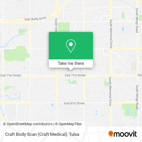
See Craft Body Scan (Craft Medical), Tulsa, on the map
Public Transit to Craft Body Scan (Craft Medical) in Tulsa
Wondering how to get to Craft Body Scan (Craft Medical) in Tulsa? Moovit helps you find the best way to get to Craft Body Scan (Craft Medical) with step-by-step directions from the nearest public transit station.
Moovit provides free maps and live directions to help you navigate through your city. View schedules, routes, timetables, and find out how long does it take to get to Craft Body Scan (Craft Medical) in real time.
Looking for the nearest stop or station to Craft Body Scan (Craft Medical)? Check out this list of stops closest to your destination: (7273) 71st & Canton Ave; (7759) Darlington Ave & 65th St Sb.
Bus: 490, 440.
Want to see if there’s another route that gets you there at an earlier time? Moovit helps you find alternative routes or times. Get directions from and directions to Craft Body Scan (Craft Medical) easily from the Moovit App or Website.
We make riding to Craft Body Scan (Craft Medical) easy, which is why over 1.5 million users, including users in Tulsa, trust Moovit as the best app for public transit. You don’t need to download an individual bus app or train app, Moovit is your all-in-one transit app that helps you find the best bus time or train time available.
For information on prices of bus, costs and ride fares to Craft Body Scan (Craft Medical), please check the Moovit app.
Use the app to navigate to popular places including to the airport, hospital, stadium, grocery store, mall, coffee shop, school, college, and university.
Craft Body Scan (Craft Medical) Address: 5711 E 71st St street in Tulsa
- Extra Space Storage,
- Wade Biswell N CPA,
- Polo Run,
- Argyle, Oklahoma,
- Home Creations,
- Craft Concierge,
- Firstitle & Abstract Service,
- Memory Care,
- Tulsa Discounted Home Rentals,
- Burch Kathy Attorney & CPA,
- Winfield Property Management,
- Gabriel Communications,
- Jack M Robinson,
- Compass Production Partners LP,
- Lynco Properties,
- Massey Mann & Associates,
- Tulsa Birth Center,
- Frank Chitwood Associates,
- Ok Lot Quiktrip,
- First American Title
Places Near Craft Body Scan (Craft Medical) (Tulsa)
- Amazon Fulfillment Center-TUL2, Tulsa,
- Broken Arrow, OK, Broken Arrow,
- Fallout Shelter, Tulsa,
- Walmart, Tulsa,
- Plaza Santa Cecilia, Tulsa,
- Hard Rock Casino, Tulsa,
- Alagon Spa (Olympus Spa), Tulsa,
- Tulsa Ok, Tulsa,
- Woodland Hills Mall, Tulsa,
- River Spirit Casino, Tulsa,
- S Garnett Rd / E 21st St, Tulsa,
- St Francis South Cardinal Building, Tulsa,
- Tulsa Zoo, Tulsa,
- 71st & Memorial, Tulsa,
- Tulsa State Fair, Tulsa,
- Osage Casino, Tulsa,
- Saint Francis Hospital, Tulsa,
- Zavala Plus, Tulsa,
- Bixby, OK, Bixby,
- St. Francis Hospital Outpatient Infusion, Tulsa
How to get to popular places in Tulsa with public transit
Get around Tulsa by public transit!
Traveling around Tulsa has never been so easy. See step by step directions as you travel to any attraction, street or major public transit station. View bus and train schedules, arrival times, service alerts and detailed routes on a map, so you know exactly how to get to anywhere in Tulsa.
When traveling to any destination around Tulsa use Moovit's Live Directions with Get Off Notifications to know exactly where and how far to walk, how long to wait for your line, and how many stops are left. Moovit will alert you when it's time to get off — no need to constantly re-check whether yours is the next stop.
Wondering how to use public transit in Tulsa or how to pay for public transit in Tulsa? Moovit public transit app can help you navigate your way with public transit easily, and at minimum cost. It includes public transit fees, ticket prices, and costs. Looking for a map of Tulsa public transit lines? Moovit public transit app shows all public transit maps in Tulsa with all bus routes and stops on an interactive map.
Tulsa has 1 transit type(s), including: bus, operated by several transit agencies, including MetroLink Tulsa and Greyhound-us