How to get to Creativ by bus?
Click on the bus route to see step by step directions with maps, line arrival times and updated time schedules.
From Pflanzen-Kölle, Heilbronn
160 minFrom Vulpiusklinik, Bad Rappenau
38 minFrom Luson Hair, Verwaltungsgemeinschaft Bad Friedrichshall
69 minFrom Slk-Kliniken Heilbronn P1, Heilbronn
152 minFrom Kaufland, Mosbach
53 minFrom Karl-Wüst-Brücke, Heilbronn
113 minFrom Salzstraße 133, Heilbronn
116 minFrom Klinikum am Gesundbrunnen, Heilbronn
154 minFrom Audi Forum Neckarsulm, Verwaltungsgemeinschaft Neckarsulm
95 minFrom Kaufland, Verwaltungsgemeinschaft Neckarsulm
97 min
How to get to Creativ by train?
Click on the train route to see step by step directions with maps, line arrival times and updated time schedules.
From Vulpiusklinik, Bad Rappenau
65 minFrom Luson Hair, Verwaltungsgemeinschaft Bad Friedrichshall
52 minFrom Kaufland, Mosbach
59 minFrom Karl-Wüst-Brücke, Heilbronn
67 minFrom Salzstraße 133, Heilbronn
62 minFrom Audi Forum Neckarsulm, Verwaltungsgemeinschaft Neckarsulm
49 minFrom Kaufland, Verwaltungsgemeinschaft Neckarsulm
57 min
Bus stop near Creativ in Verwaltungsgemeinschaft Haßmersheim
- Neckarmühlbach, Ort, 2 min walk,VIEW
Train stations near Creativ in Verwaltungsgemeinschaft Haßmersheim
Bus lines to Creativ in Verwaltungsgemeinschaft Haßmersheim
What are the closest stations to Creativ?
The closest stations to Creativ are:
- Neckarmühlbach, Ort is 78 meters away, 2 min walk.
- Gundelsheim (Neckar) is 2146 meters away, 28 min walk.
- Gundelsheim (N) is 2186 meters away, 28 min walk.
Which train line stops near Creativ?
S41 (Mosbach(Baden))
Which bus lines stop near Creativ?
These bus lines stop near Creativ: 602, 604, 684, 828.
What’s the nearest train station to Creativ in Verwaltungsgemeinschaft Haßmersheim?
The nearest train stations to Creativ in Verwaltungsgemeinschaft Haßmersheim are Gundelsheim (Neckar) and Gundelsheim (N). The closest one is a 28 min walk away.
What’s the nearest bus station to Creativ in Verwaltungsgemeinschaft Haßmersheim?
The nearest bus station to Creativ in Verwaltungsgemeinschaft Haßmersheim is Neckarmühlbach, Ort. It’s a 2 min walk away.
What time is the first train to Creativ in Verwaltungsgemeinschaft Haßmersheim?
The S41 is the first train that goes to Creativ in Verwaltungsgemeinschaft Haßmersheim. It stops nearby at 5:20 AM.
What time is the last train to Creativ in Verwaltungsgemeinschaft Haßmersheim?
The S41 is the last train that goes to Creativ in Verwaltungsgemeinschaft Haßmersheim. It stops nearby at 2:00 AM.
What time is the first bus to Creativ in Verwaltungsgemeinschaft Haßmersheim?
The 828 is the first bus that goes to Creativ in Verwaltungsgemeinschaft Haßmersheim. It stops nearby at 5:03 AM.
What time is the last bus to Creativ in Verwaltungsgemeinschaft Haßmersheim?
The 8938 is the last bus that goes to Creativ in Verwaltungsgemeinschaft Haßmersheim. It stops nearby at 12:14 AM.
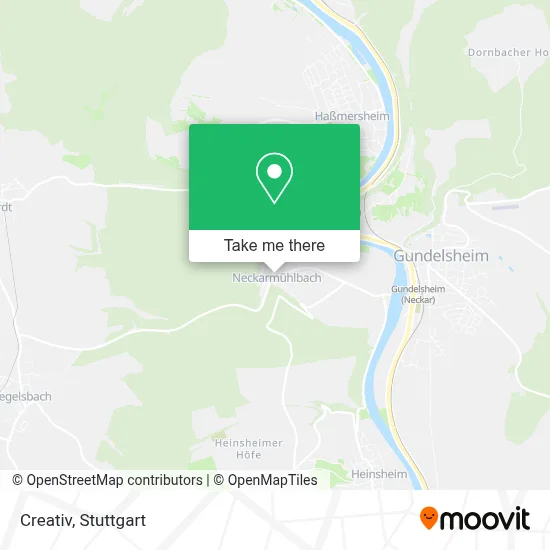
See Creativ, Verwaltungsgemeinschaft Haßmersheim, on the map
Public Transit to Creativ in Verwaltungsgemeinschaft Haßmersheim
Wondering how to get to Creativ in Verwaltungsgemeinschaft Haßmersheim? Moovit helps you find the best way to get to Creativ with step-by-step directions from the nearest public transit station.
Moovit provides free maps and live directions to help you navigate through your city. View schedules, routes, timetables, and find out how long does it take to get to Creativ in real time.
Looking for the nearest stop or station to Creativ? Check out this list of stops closest to your destination: Neckarmühlbach; Gundelsheim (Neckar); Gundelsheim (N).
Train: S41, MEX12, RB10A, RE10A, MEX12.Bus: 602, 604, 684, 828, 8938.
Want to see if there’s another route that gets you there at an earlier time? Moovit helps you find alternative routes or times. Get directions from and directions to Creativ easily from the Moovit App or Website.
We make riding to Creativ easy, which is why over 1.5 million users, including users in Verwaltungsgemeinschaft Haßmersheim, trust Moovit as the best app for public transit. You don’t need to download an individual bus app or train app, Moovit is your all-in-one transit app that helps you find the best bus time or train time available.
For information on prices of bus and train, costs and ride fares to Creativ, please check the Moovit app.
Use the app to navigate to popular places including to the airport, hospital, stadium, grocery store, mall, coffee shop, school, college, and university.
Creativ Address: Heinsheimer Straße street in Verwaltungsgemeinschaft Haßmersheim
- Holzbau Neckarmühlbach,
- Infotafel Haßmersheim Neckarmühlbach,
- Heuherberge Alten Marstall,
- Mittelalterliche Herberge,
- Neckarmühlbach,
- Maysacksche Mühle,
- Ort,
- Holzland,
- Lohnsteuerhilfeverein Baden-Württemberg,
- Buchungskontor Wagenblast,
- Leutz,
- Neckarmühlbach,
- Bogazici Dekor,
- Neckarmühlbach,
- Wetransport,
- Ev. Natur-Erlebnis-Kindergarten Pusteblume,
- Neckarmühlbach,
- Maxi-Bau Stuckateurbetrieb,
- Innenputz,
- Freiwillige Feuerwehr Haßmersheim (Abt.Neckarmühlbach)
Places Near Creativ (Verwaltungsgemeinschaft Haßmersheim)
- Klinikum Stuttgart - Katharinenhospital, Stuttgart-Mitte,
- Hanns-Martin-Schleyer-Halle (Stuttgart Hans-Martin-Schleyerhalle), Bad Cannstatt,
- Mettingen Eros-Center Puff Laufhaus, Esslingen Am Neckar,
- Mercedes-Benz Museum, Bad Cannstatt,
- Pariser Platz Stuttgart, Stuttgart-Mitte,
- Porsche Museum, Zuffenhausen,
- Wilhelma (U-Bahn Wilhelma), Bad Cannstatt,
- FlixBus Haltestelle, Stuttgart,
- Im Wizemann (Halle), Bad Cannstatt,
- Schleyerhalle, Bad Cannstatt,
- Mercedes-Benz Museum (Mercedes Museum Stuttgart), Bad Cannstatt,
- Marmorsaal Im Weissenburgpark, Stuttgart-Süd,
- Gleis 101/102 (tief), Stuttgart-Mitte,
- Hanns-Martin-Schleyer-Halle, Bad Cannstatt,
- Hauptbahnhof Stuttgart, Stuttgart-Mitte,
- Gasometer Pforzheim, Pforzheim,
- Geilhaus Haus 33a, Reutlingen-Betzingen,
- Waldfriedhof, Degerloch,
- Porsche-Arena, Bad Cannstatt,
- SI-Centrum, Möhringen
How to get to popular places in Stuttgart with public transit
Get around Verwaltungsgemeinschaft Haßmersheim by public transit!
Traveling around Verwaltungsgemeinschaft Haßmersheim has never been so easy. See step by step directions as you travel to any attraction, street or major public transit station. View bus and train schedules, arrival times, service alerts and detailed routes on a map, so you know exactly how to get to anywhere in Verwaltungsgemeinschaft Haßmersheim.
When traveling to any destination around Verwaltungsgemeinschaft Haßmersheim use Moovit's Live Directions with Get Off Notifications to know exactly where and how far to walk, how long to wait for your line, and how many stops are left. Moovit will alert you when it's time to get off — no need to constantly re-check whether yours is the next stop.
Wondering how to use public transit in Verwaltungsgemeinschaft Haßmersheim or how to pay for public transit in Verwaltungsgemeinschaft Haßmersheim? Moovit public transit app can help you navigate your way with public transit easily, and at minimum cost. It includes public transit fees, ticket prices, and costs. Looking for a map of Verwaltungsgemeinschaft Haßmersheim public transit lines? Moovit public transit app shows all public transit maps in Verwaltungsgemeinschaft Haßmersheim with all Bus, Train, Subway, Light Rail, Ferry, S-Bahn and Funicular routes and stops on an interactive map.
Stuttgart has 7 transit type(s), including: Bus, Train, Subway, Light Rail, Ferry, S-Bahn and Funicular, operated by several transit agencies, including SSB - Stadtbahn, SSB, SSB - Seilbahn / Zacke, S-Bahn Stuttgart, Rhein-Neckar-Verkehr GmbH (rnv), Karlsruher Verkehrsverbund, DB AG, DB Regiobus BW, Arverio Baden-Württemberg GmbH, DB RegioNetz Verkehrs GmbH Westfrankenbahn, DB Regio AG Baden-Württemberg, Südwestdeutsche Verkehrs-AG, DB Regio AG Mitte Region Hessen, DB and Bodensee-Oberschwaben-Bahn