Directions to Creative Art with Key (Allentown) with public transportation
The following transit lines have routes that pass near Creative Art with Key
 Bus: FLIXBUS 2651, FLIXBUS N2640, 101, 102, 107.
How to get to Creative Art with Key by bus?
Click on the bus route to see step by step directions with maps, line arrival times and updated time schedules.
From Baps Shri Swaminarayan Mandir, Edison, NJ, USA, Edison
282 minFrom Plainfield, NJ, Plainfield
249 minFrom Rutgers, New Brunswick
259 minFrom MMNJ, Parsippany-Troy Hills
254 minFrom Edison NJ, Edison
277 minFrom Robert Wood Johnson University Hospital, New Brunswick
258 minFrom Highland Park, NJ, Highland Park
270 min
Bus stops near Creative Art with Key in Allentown
Bus lines to Creative Art with Key in Allentown
What are the closest stations to Creative Art with Key?
The closest stations to Creative Art with Key are:
- 11th at Hamilton is 28 yards away, 1 min walk.
- Turner at 11th is 337 yards away, 5 min walk.
- Old Allentown Eb is 493 yards away, 7 min walk.
Which bus lines stop near Creative Art with Key?
These bus lines stop near Creative Art with Key: FLIXBUS 2651, FLIXBUS N2640.
What’s the nearest bus station to Creative Art with Key in Allentown?
The nearest bus station to Creative Art with Key in Allentown is 11th at Hamilton. It’s a 1 min walk away.
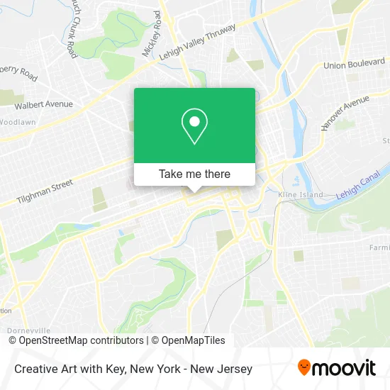
See Creative Art with Key, Allentown, on the map
Public Transit to Creative Art with Key in Allentown
Wondering how to get to Creative Art with Key in Allentown? Moovit helps you find the best way to get to Creative Art with Key with step-by-step directions from the nearest public transit station.
Moovit provides free maps and live directions to help you navigate through your city. View schedules, routes, timetables, and find out how long does it take to get to Creative Art with Key in real time.
Looking for the nearest stop or station to Creative Art with Key? Check out this list of stops closest to your destination: 11th at Hamilton; Turner at 11th; Old Allentown Eb.
Bus: FLIXBUS 2651, FLIXBUS N2640, 101, 102, 107, 210, 218, BLU.
Want to see if there’s another route that gets you there at an earlier time? Moovit helps you find alternative routes or times. Get directions from and directions to Creative Art with Key easily from the Moovit App or Website.
We make riding to Creative Art with Key easy, which is why over 1.5 million users, including users in Allentown, trust Moovit as the best app for public transit. You don’t need to download an individual bus app or train app, Moovit is your all-in-one transit app that helps you find the best bus time or train time available.
For information on prices of bus and train, costs and ride fares to Creative Art with Key, please check the Moovit app.
Use the app to navigate to popular places including to the airport, hospital, stadium, grocery store, mall, coffee shop, school, college, and university.
Creative Art with Key Address: 1036 Hamilton St Allentown, PA 18101 street in Allentown
- Perez Nancy B Od,
- G&A Barbershop,
- Risk Strategies | Joyce Insurance Group,
- Frank Armetta,
- Service Electric Customer Care Center - Allentown,
- State Farm Insurance,
- US Tax,
- H&R Block Tax Preparation Office,
- Hamilton Book and Video,
- Nails-On-The-Run,
- Excel Home Care,
- Allentown Technology Enterprise Center,
- Enjoyable Events,
- Arod Photography,
- Nieves Discipleship and Family Home Care Agency,
- The Chic Suite,
- Move Video Production Studios,
- 3diamond Real Estate Services,
- Liberty Bell Workers' Compensation Lawyers,
- PM Home Health
Places Near Creative Art with Key (Allentown)
- Times Square, Manhattan,
- 26 Federal Plaza, Manhattan,
- Rockefeller Center, Manhattan,
- 376 Hudson Street, Manhattan,
- 911 Memorial, Manhattan,
- Queens Center Mall, Queens,
- Pier 83, Manhattan,
- Katz's Deli, Manhattan,
- SoHo, Manhattan,
- Bellevue Hospital, Manhattan,
- 1 Police Plaza, Manhattan,
- Wall Street, Manhattan,
- 3 Stone St, Manhattan,
- San Gennaro Feast, Manhattan,
- Mountainside Hospital, Glen Ridge,
- Hudson Yards, Manhattan,
- 111 Centre New York City Supreme Court, Manhattan,
- Chinatown, Manhattan,
- 66 John Street, Manhattan,
- qqqq, Manhattan
How to get to popular places in New York - New Jersey with public transit
Get around Allentown by public transit!
Traveling around Allentown has never been so easy. See step by step directions as you travel to any attraction, street or major public transit station. View bus and train schedules, arrival times, service alerts and detailed routes on a map, so you know exactly how to get to anywhere in Allentown.
When traveling to any destination around Allentown use Moovit's Live Directions with Get Off Notifications to know exactly where and how far to walk, how long to wait for your line, and how many stops are left. Moovit will alert you when it's time to get off — no need to constantly re-check whether yours is the next stop.
Wondering how to use public transit in Allentown or how to pay for public transit in Allentown? Moovit public transit app can help you navigate your way with public transit easily, and at minimum cost. It includes public transit fees, ticket prices, and costs. Looking for a map of Allentown public transit lines? Moovit public transit app shows all public transit maps in Allentown with all Bus, Train, Subway, Light Rail, Ferry and Cable Car routes and stops on an interactive map.
New York - New Jersey has 6 transit type(s), including: Bus, Train, Subway, Light Rail, Ferry and Cable Car, operated by several transit agencies, including MTA Subway, Metro-North Railroad, LIRR, PATH, MTA New York City Transit - Express routes, MTA Bus, NJ Transit, NYC Ferry, NICE bus, Bee-Line Bus, NJ Transit Rail, Norwalk Transit District, Hartford Line, River Valley Transit and HART