How to get to Creative Saints Loft by bus?
Click on the bus route to see step by step directions with maps, line arrival times and updated time schedules.
From National Museum of African American History and Culture, Washington
82 minFrom Nationals Park, Washington Dc, Washington
72 minFrom Supra (Supra Restaurant), Washington
50 minFrom The Royal Sonesta Washington DC Dupont Circle (Sonesta Hotel), Washington
74 minFrom National Christmas Tree, Washington
83 minFrom 15th St NW (15th and Constitution Ave NW), Washington
82 minFrom U Street Metro Station, Washington
55 minFrom Beltsville, Maryland, Prince George's County
64 minFrom Russell Senate Office Building, Washington
58 minFrom Maketto, Washington
42 min
How to get to Creative Saints Loft by train?
Click on the train route to see step by step directions with maps, line arrival times and updated time schedules.
How to get to Creative Saints Loft by metro?
Click on the metro route to see step by step directions with maps, line arrival times and updated time schedules.
From National Museum of African American History and Culture, Washington
80 minFrom Nationals Park, Washington Dc, Washington
76 minFrom Supra (Supra Restaurant), Washington
66 minFrom The Royal Sonesta Washington DC Dupont Circle (Sonesta Hotel), Washington
75 minFrom National Christmas Tree, Washington
82 minFrom 15th St NW (15th and Constitution Ave NW), Washington
80 minFrom U Street Metro Station, Washington
56 minFrom Russell Senate Office Building, Washington
71 minFrom Maketto, Washington
83 min
Bus stops near Creative Saints Loft in Prince George's County
Train station near Creative Saints Loft in Prince George's County
- College Park Marc Sb, 36 min walk,VIEW
Metro station near Creative Saints Loft in Prince George's County
- West Hyattsville, 42 min walk,VIEW
Bus lines to Creative Saints Loft in Prince George's County
What are the closest stations to Creative Saints Loft?
The closest stations to Creative Saints Loft are:
- Rhode Island Ave & Charles Armentrout Way is 630 yards away, 8 min walk.
- Kenilworth Av+Upshur St is 1544 yards away, 19 min walk.
- College Park Marc Sb is 3068 yards away, 36 min walk.
- West Hyattsville is 3518 yards away, 42 min walk.
Which bus lines stop near Creative Saints Loft?
These bus lines stop near Creative Saints Loft: P10, P1X.
Which train line stops near Creative Saints Loft?
MARC (Inbound - Camden)
Which metro lines stop near Creative Saints Loft?
These metro lines stop near Creative Saints Loft: GREEN, YELLOW.
What’s the nearest bus station to Creative Saints Loft in Prince George's County?
The nearest bus station to Creative Saints Loft in Prince George's County is Rhode Island Ave & Charles Armentrout Way. It’s a 8 min walk away.
What time is the first metro to Creative Saints Loft in Prince George's County?
The GREEN is the first metro that goes to Creative Saints Loft in Prince George's County. It stops nearby at 5:08 AM.
What time is the last metro to Creative Saints Loft in Prince George's County?
The GREEN is the last metro that goes to Creative Saints Loft in Prince George's County. It stops nearby at 12:33 AM.
What time is the first train to Creative Saints Loft in Prince George's County?
The MARC is the first train that goes to Creative Saints Loft in Prince George's County. It stops nearby at 5:43 AM.
What time is the last train to Creative Saints Loft in Prince George's County?
The MARC is the last train that goes to Creative Saints Loft in Prince George's County. It stops nearby at 7:54 PM.
What time is the first bus to Creative Saints Loft in Prince George's County?
The P10 is the first bus that goes to Creative Saints Loft in Prince George's County. It stops nearby at 5:21 AM.
What time is the last bus to Creative Saints Loft in Prince George's County?
The P10 is the last bus that goes to Creative Saints Loft in Prince George's County. It stops nearby at 12:28 AM.
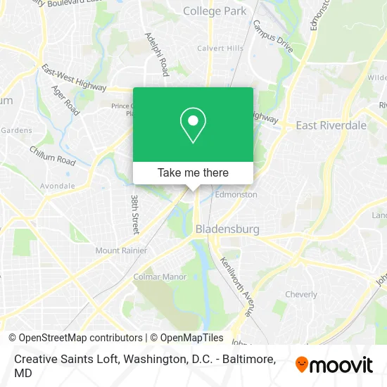
See Creative Saints Loft, Prince George's County, on the map
Public Transit to Creative Saints Loft in Prince George's County
Wondering how to get to Creative Saints Loft in Prince George's County? Moovit helps you find the best way to get to Creative Saints Loft with step-by-step directions from the nearest public transit station.
Moovit provides free maps and live directions to help you navigate through your city. View schedules, routes, timetables, and find out how long does it take to get to Creative Saints Loft in real time.
Looking for the nearest stop or station to Creative Saints Loft? Check out this list of stops closest to your destination: Rhode Island Ave & Charles Armentrout Way; Kenilworth Av+Upshur St; College Park Marc Sb; West Hyattsville.
Bus: P10, P1X, P14.Train: MARC.Metro: GREEN, YELLOW.
Want to see if there’s another route that gets you there at an earlier time? Moovit helps you find alternative routes or times. Get directions from and directions to Creative Saints Loft easily from the Moovit App or Website.
We make riding to Creative Saints Loft easy, which is why over 1.5 million users, including users in Prince George's County, trust Moovit as the best app for public transit. You don’t need to download an individual bus app or train app, Moovit is your all-in-one transit app that helps you find the best bus time or train time available.
For information on prices of bus, metro and train, costs and ride fares to Creative Saints Loft, please check the Moovit app.
Use the app to navigate to popular places including to the airport, hospital, stadium, grocery store, mall, coffee shop, school, college, and university.
Creative Saints Loft Address: 4633 42nd Pl Hyattsville, MD 20781 street in Prince George's County
- Hyattsville Auto Outlet,
- Fm Appliances,
- Streetcar 82 Brewing,
- Hyattsville District Court,
- Hyattsville District Court Building,
- 4990 Rhode Island Avenue,
- District Court of Maryland for Prince George's County (05-01),
- District Court Parking Garage,
- County Service Building,
- Community Forklift,
- Mount Hermon Lodge #179, A.F. & A.M.,
- Franklin's (Franklins),
- Wright-Way Enterprize,
- Buchanan 51st,
- Uci Washington,
- Hamilton St & Rhode Island Ave,
- Lighthouse Pool Management,
- Top of the Park,
- State Farm,
- Homes Not Borders
Places Near Creative Saints Loft (Prince George's County)
- Washington National Cathedral, Washington,
- National Zoo, Washington,
- Capital One Arena, Washington,
- Pennsylvania Ave NW (3rd st and pennsylvania), Washington,
- Washington DC VA Medical Center, Washington,
- Camden Yards, Baltimore,
- Georgetown, Washington,
- Amazon Hq2, Arlington County,
- M&T Bank Stadium, Baltimore,
- Rock Creek Tennis Center, Washington,
- Warner Theatre, Washington,
- Marriott Marquis Washington, DC, Washington,
- National Mall, Washington,
- PG Mall, Prince George's County,
- Westfield Montgomery Mall, Montgomery County,
- Sibley Memorial Hospital, Washington,
- National Museum of African American History and Culture, Washington,
- The Anthem, Washington,
- Museum Of The Bible, Washington,
- Basilica of the National Shrine, Washington
How to get to popular places in Washington, D.C. - Baltimore, MD with public transit
Get around Prince George's County by public transit!
Traveling around Prince George's County has never been so easy. See step by step directions as you travel to any attraction, street or major public transit station. View bus and train schedules, arrival times, service alerts and detailed routes on a map, so you know exactly how to get to anywhere in Prince George's County.
When traveling to any destination around Prince George's County use Moovit's Live Directions with Get Off Notifications to know exactly where and how far to walk, how long to wait for your line, and how many stops are left. Moovit will alert you when it's time to get off — no need to constantly re-check whether yours is the next stop.
Wondering how to use public transit in Prince George's County or how to pay for public transit in Prince George's County? Moovit public transit app can help you navigate your way with public transit easily, and at minimum cost. It includes public transit fees, ticket prices, and costs. Looking for a map of Prince George's County public transit lines? Moovit public transit app shows all public transit maps in Prince George's County with all Bus, Train, Metro, Light Rail and Ferry routes and stops on an interactive map.
Washington, D.C. - Baltimore, MD has 5 transit type(s), including: Bus, Train, Metro, Light Rail and Ferry, operated by several transit agencies, including WMATA, Montgomery County Ride On, Fairfax Connector, TheBus, PRTC, DASH - Alexandria, Arlington Transit (ART), RTA of Central Maryland, MDOT MTA, MDOT MTA Light RailLink, MDOT MTA Commuter Bus, MDOT MTA Local Bus, FXBGO!, Virginia Railway Express (VRE) and MARC