How to get to Creekside Chevy Chase by bus?
Click on the bus route to see step by step directions with maps, line arrival times and updated time schedules.
From Columbia MD-195, Montgomery County
58 minFrom William Hg Fitzgerald Tennis Center, Washington
48 minFrom A League of Her Own, Washington
71 minFrom Pitchers Cafe, Washington
72 minFrom The Catholic University Of America, Washington
94 minFrom American University, Washington
54 minFrom 2 Amys, Washington
60 minFrom Meridian Hill Park, Washington
59 minFrom MedStar Washington Hospital Center, Washington
86 minFrom Washington Yu Ying Public Charter School, Washington
87 min
How to get to Creekside Chevy Chase by metro?
Click on the metro route to see step by step directions with maps, line arrival times and updated time schedules.
From Columbia MD-195, Montgomery County
64 minFrom A League of Her Own, Washington
71 minFrom Pitchers Cafe, Washington
71 minFrom The Catholic University Of America, Washington
82 minFrom American University, Washington
70 minFrom 2 Amys, Washington
75 minFrom Meridian Hill Park, Washington
79 minFrom Washington Yu Ying Public Charter School, Washington
89 min
Bus stops near Creekside Chevy Chase in Montgomery County
Train station near Creekside Chevy Chase in Montgomery County
- Garrett Park Marc Eb, 36 min walk,VIEW
Metro station near Creekside Chevy Chase in Montgomery County
- Forest Glen, 46 min walk,VIEW
What are the closest stations to Creekside Chevy Chase?
The closest stations to Creekside Chevy Chase are:
- Kensington Pkwy & Glenmoor Reserve Ln is 79 yards away, 1 min walk.
- Connecticut Av & Montrose Dr is 1018 yards away, 13 min walk.
- Garrett Park Marc Eb is 3079 yards away, 36 min walk.
- Forest Glen is 3869 yards away, 46 min walk.
Which bus lines stop near Creekside Chevy Chase?
These bus lines stop near Creekside Chevy Chase: 33, 4, M22.
Which metro line stops near Creekside Chevy Chase?
RED (Glenmont)
What’s the nearest bus station to Creekside Chevy Chase in Montgomery County?
The nearest bus station to Creekside Chevy Chase in Montgomery County is Kensington Pkwy & Glenmoor Reserve Ln. It’s a 1 min walk away.
What time is the first metro to Creekside Chevy Chase in Montgomery County?
The RED is the first metro that goes to Creekside Chevy Chase in Montgomery County. It stops nearby at 5:07 AM.
What time is the last metro to Creekside Chevy Chase in Montgomery County?
The RED is the last metro that goes to Creekside Chevy Chase in Montgomery County. It stops nearby at 12:31 AM.
What time is the first train to Creekside Chevy Chase in Montgomery County?
The MARC is the first train that goes to Creekside Chevy Chase in Montgomery County. It stops nearby at 5:45 AM.
What time is the last train to Creekside Chevy Chase in Montgomery County?
The MARC is the last train that goes to Creekside Chevy Chase in Montgomery County. It stops nearby at 7:42 PM.
What time is the first bus to Creekside Chevy Chase in Montgomery County?
The M22 is the first bus that goes to Creekside Chevy Chase in Montgomery County. It stops nearby at 5:14 AM.
What time is the last bus to Creekside Chevy Chase in Montgomery County?
The M22 is the last bus that goes to Creekside Chevy Chase in Montgomery County. It stops nearby at 11:19 PM.
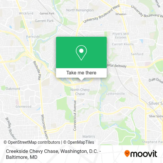
See Creekside Chevy Chase, Montgomery County, on the map
Public Transit to Creekside Chevy Chase in Montgomery County
Wondering how to get to Creekside Chevy Chase in Montgomery County? Moovit helps you find the best way to get to Creekside Chevy Chase with step-by-step directions from the nearest public transit station.
Moovit provides free maps and live directions to help you navigate through your city. View schedules, routes, timetables, and find out how long does it take to get to Creekside Chevy Chase in real time.
Looking for the nearest stop or station to Creekside Chevy Chase? Check out this list of stops closest to your destination: Kensington Pkwy & Glenmoor Reserve Ln; Connecticut Av & Montrose Dr; Garrett Park Marc Eb; Forest Glen.
Bus: 33, 4, M22.Train: MARC.Metro: RED.
Want to see if there’s another route that gets you there at an earlier time? Moovit helps you find alternative routes or times. Get directions from and directions to Creekside Chevy Chase easily from the Moovit App or Website.
We make riding to Creekside Chevy Chase easy, which is why over 1.5 million users, including users in Montgomery County, trust Moovit as the best app for public transit. You don’t need to download an individual bus app or train app, Moovit is your all-in-one transit app that helps you find the best bus time or train time available.
For information on prices of bus and metro, costs and ride fares to Creekside Chevy Chase, please check the Moovit app.
Use the app to navigate to popular places including to the airport, hospital, stadium, grocery store, mall, coffee shop, school, college, and university.
Creekside Chevy Chase Address: 3699 Glenmoor Dr Chevy Chase, MD 20815 street in Montgomery County
- Entrance I-495 E,
- Exit 33 I-495,
- Exit 33 - MD 185 (Connecticut Ave) / Kensington, Chevy Chase,
- North Chevy Chase, Maryland,
- Mic's Moving,
- 3525 Kenilworth Drwy,
- Jonica Gibsonrealtor,
- Owl & the Buffalo Books,
- Woodend Sanctuary,
- Kensington MD-185,
- Rock Creek Hills, Maryland,
- Arco Iris Somos,
- Alan Fox Consulting,
- Kensington Park,
- Washington Karate Academy,
- Reusable Pallet Cont Coalition,
- USPS Collection Box - Blue Box,
- Walter Reed National Military Medical Center,
- HHMI (Howard Hughes Medical Institute),
- Licks and Leashes
Places Near Creekside Chevy Chase (Montgomery County)
- National Mall, Washington,
- Capital One Arena, Washington,
- Westfield Montgomery Mall, Montgomery County,
- Georgetown, Washington,
- PG Mall, Prince George's County,
- Washington National Cathedral, Washington,
- National Museum of African American History and Culture, Washington,
- Museum Of The Bible, Washington,
- Camden Yards, Baltimore,
- M&T Bank Stadium, Baltimore,
- Marriott Marquis Washington, DC, Washington,
- Washington DC VA Medical Center, Washington,
- Amazon Hq2, Arlington County,
- Pennsylvania Ave NW (3rd st and pennsylvania), Washington,
- National Zoo, Washington,
- Warner Theatre, Washington,
- Sibley Memorial Hospital, Washington,
- Rock Creek Tennis Center, Washington,
- Basilica of the National Shrine, Washington,
- The Anthem, Washington
How to get to popular places in Washington, D.C. - Baltimore, MD with public transit
Get around Montgomery County by public transit!
Traveling around Montgomery County has never been so easy. See step by step directions as you travel to any attraction, street or major public transit station. View bus and train schedules, arrival times, service alerts and detailed routes on a map, so you know exactly how to get to anywhere in Montgomery County.
When traveling to any destination around Montgomery County use Moovit's Live Directions with Get Off Notifications to know exactly where and how far to walk, how long to wait for your line, and how many stops are left. Moovit will alert you when it's time to get off — no need to constantly re-check whether yours is the next stop.
Wondering how to use public transit in Montgomery County or how to pay for public transit in Montgomery County? Moovit public transit app can help you navigate your way with public transit easily, and at minimum cost. It includes public transit fees, ticket prices, and costs. Looking for a map of Montgomery County public transit lines? Moovit public transit app shows all public transit maps in Montgomery County with all Bus, Train, Metro, Light Rail and Ferry routes and stops on an interactive map.
Washington, D.C. - Baltimore, MD has 5 transit type(s), including: Bus, Train, Metro, Light Rail and Ferry, operated by several transit agencies, including WMATA, Montgomery County Ride On, Fairfax Connector, TheBus, PRTC, DASH - Alexandria, Arlington Transit (ART), RTA of Central Maryland, MDOT MTA, MDOT MTA Light RailLink, MDOT MTA Commuter Bus, MDOT MTA Local Bus, FXBGO!, Virginia Railway Express (VRE) and MARC