Directions to Crefig (Abreu E Lima) with public transportation
The following transit lines have routes that pass near Crefig
How to get to Crefig by bus?
Click on the bus route to see step by step directions with maps, line arrival times and updated time schedules.
From Vila olímpica de Rio doce, Olinda
60 minFrom Escola Técnica Estadual Chico Science, Olinda
69 minFrom Terminal Integrado da PE-15, Olinda
44 minFrom Avenida Pan Nordestina, Olinda
45 minFrom Avenida Presidente Kennedy, Olinda
64 minFrom Dois Irmãos, Dois Irmãos
67 minFrom Shopping Paulista, Paulista
37 minFrom hospital tri centenário, Olinda
74 minFrom Barraca Santa Cruz, Nova Descoberta
47 minFrom Centro Do Recife, Linha Do Tiro
59 min
Bus stops near Crefig in Abreu E Lima
Bus lines to Crefig in Abreu E Lima
What are the closest stations to Crefig?
The closest stations to Crefig are:
- Av. D, 21 | Lkdh Variedades Naturais is 185 meters away, 3 min walk.
- Av. D, 414 | Igreja Assembléia De Deus is 407 meters away, 6 min walk.
- Av. A, 925 | Lajes Bom Progresso is 2807 meters away, 36 min walk.
Which bus line stops near Crefig?
1912 CAETÉS 1 / TI ABREU E LIMA (Caetés 1 / Ti Abreu E Lima)
What’s the nearest bus station to Crefig in Abreu E Lima?
The nearest bus station to Crefig in Abreu E Lima is Av. D, 21 | Lkdh Variedades Naturais. It’s a 3 min walk away.
What time is the first bus to Crefig in Abreu E Lima?
The 1957 CAETÉS I (BACURAU) is the first bus that goes to Crefig in Abreu E Lima. It stops nearby at 3:05 AM.
What time is the last bus to Crefig in Abreu E Lima?
The 1957 CAETÉS I (BACURAU) is the last bus that goes to Crefig in Abreu E Lima. It stops nearby at 3:14 AM.
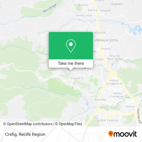
See Crefig, Abreu E Lima, on the map
Public Transit to Crefig in Abreu E Lima
Wondering how to get to Crefig in Abreu E Lima? Moovit helps you find the best way to get to Crefig with step-by-step directions from the nearest public transit station.
Moovit provides free maps and live directions to help you navigate through your city. View schedules, routes, timetables, and find out how long does it take to get to Crefig in real time.
Looking for the nearest stop or station to Crefig? Check out this list of stops closest to your destination: Av. D; Av. D; Av. A.
Bus: 1912 CAETÉS 1 / TI ABREU E LIMA, 1957 CAETÉS I (BACURAU), 1917 CAETÉS 2 / TI ABREU E LIMA.
Want to see if there’s another route that gets you there at an earlier time? Moovit helps you find alternative routes or times. Get directions from and directions to Crefig easily from the Moovit App or Website.
We make riding to Crefig easy, which is why over 1.5 million users, including users in Abreu E Lima, trust Moovit as the best app for public transit. You don’t need to download an individual bus app or train app, Moovit is your all-in-one transit app that helps you find the best bus time or train time available.
For information on prices of bus, costs and ride fares to Crefig, please check the Moovit app.
Use the app to navigate to popular places including to the airport, hospital, stadium, grocery store, mall, coffee shop, school, college, and university.
Crefig Address: Rua Cento e Trinta e Um, 155 Caetés I Abreu e Lima-PE 53530-160 street in Abreu E Lima
- Quallyflex Life,
- Conect Fibra,
- Neto Braz,
- Reciclagem Mundial,
- Mil Doces,
- Shopping Caruaru,
- Hiperbom caetes I.,
- Espetinho Conect,
- Panelada das Comadres,
- Disnove Comunicacoes,
- Igreja Do Evangelio Quadrangular,
- Dom Manolo Barbearia,
- Bomboniere Ae,
- Recanto dos Coroas.,
- Roberto & Fabio Silva Construções,
- Sá Bicicletas,
- Partido Republicano da Ordem Social - Abreu e Lima - Pé - Municipal,
- Caetes Moveis,
- Igreja Evangélica Assembléia de Deus Caetés,
- Adeltec Distribuidora
Places Near Crefig (Abreu E Lima)
- Hospital Maria Lucinda, Parnamirim,
- Hospital Universitário Oswaldo Cruz, Santo Amaro,
- hospital otavio de freitas - UTI, Tejipió,
- tuuuuu, Olinda,
- llll, Fundão,
- Shopping Recife, Boa Viagem,
- Shopping RioMar Recife, Pina,
- Marco Zero, Bairro Do Recife,
- Hospital Agamenon Magalhães, Tamarineira,
- Imbiribeira, Imbiribeira,
- SHOPPING TACARUNA, Santo Amaro,
- Hospital Altino Ventura, Iputinga,
- Imip (Instituto Materno-Infantil De Pernambuco), Coelhos,
- Arena de Pernambuco, São Lourenço Da Mata,
- Hospital Geral De Areias, Areias,
- Shopping Patteo Olinda, Olinda,
- Parque da Jaqueira, Jaqueira,
- SHOPPING GUARARAPES, Jaboatão Dos Guararapes,
- Hospital Eduardo Campus Da Pessoa Idosa, Areias,
- Centro de Convenções de Pernambuco, Olinda
How to get to popular places in Recife Region with public transit
Get around Abreu E Lima by public transit!
Traveling around Abreu E Lima has never been so easy. See step by step directions as you travel to any attraction, street or major public transit station. View bus and train schedules, arrival times, service alerts and detailed routes on a map, so you know exactly how to get to anywhere in Abreu E Lima.
When traveling to any destination around Abreu E Lima use Moovit's Live Directions with Get Off Notifications to know exactly where and how far to walk, how long to wait for your line, and how many stops are left. Moovit will alert you when it's time to get off — no need to constantly re-check whether yours is the next stop.
Wondering how to use public transit in Abreu E Lima or how to pay for public transit in Abreu E Lima? Moovit public transit app can help you navigate your way with public transit easily, and at minimum cost. It includes public transit fees, ticket prices, and costs. Looking for a map of Abreu E Lima public transit lines? Moovit public transit app shows all public transit maps in Abreu E Lima with all Bus, Train and Subway routes and stops on an interactive map.
Recife Region has 3 transit type(s), including: Bus, Train and Subway, operated by several transit agencies, including CBTU (Metrorec), BRT (Via Livre), Grande Recife, BORBOREMA IMPERIAL (TIP), BORBOREMA IMPERIAL (B.V), RODOVIÁRIA POTENGY, EMPRESA METROPOLITANA, CONSÓRCIO RECIFE, SÃO JUDAS TADEU, Expresso 1002, Rodotur Turismo, Complementar Recife, Sistema Municipal - Jaboatão, Sistema Municipal - Cabo and Sistema Municipal - Ipojuca