How to get to Crepes & Waffles by bus?
Click on the bus route to see step by step directions with maps, line arrival times and updated time schedules.
From AV LUNA PIZARRO CUADRA 6 LA VICTORIA, La Victori
35 minFrom Estadio Alejandro Villanueva, La Victori
39 minFrom plaza union, Lima
24 minFrom Universidad Nacional Mayor de San Marcos - UNMSM, Lima
51 minFrom AV PANAMERICANA SUR KM 17 5 LA CONCORDIA, Villa El S
44 minFrom Universidad Nacional Agraria La Molina - UNALM, La Molina
66 minFrom Cercado de Lima, Lima
30 minFrom AV MEXICO CDRA 14 FRENTE A GAMARRA, La Victori
36 min
How to get to Crepes & Waffles by metro?
Click on the metro route to see step by step directions with maps, line arrival times and updated time schedules.
Bus stops near Crepes & Waffles in Miraflores
Metro station near Crepes & Waffles in Miraflores
- Cabitos, 49 min walk,VIEW
Bus lines to Crepes & Waffles in Miraflores
- 1043, La Molina - S.J.L.,VIEW
- 1087, Alameda Sur (Chorrillos) - 28 De Julio (Jesús María),VIEW
- 1090, Los Horizontes (Chorrillos) - Óvalo Gutiérrez (Miraflores) ,VIEW
- 1097, Av. Santa Rosa (San Juan De Lurigancho) - Las Palmas (Pachacamac) ,VIEW
- 1110, Miraflores - VMT,VIEW
- 1111, Universitaria (Lima) - San Gabriel (Villa María Del Triunfo),VIEW
- 1113, El Triunfo (Villa María Del Triunfo) - Plaza Centro América (Miraflores),VIEW
- 1118, Av. El Triunfo (Villa María Del Triunfo) - Av. Ejercito (Miraflores),VIEW
- 1291, Ventanilla - Chorrillos,VIEW
- 1315, Jose Galvez (Pachacamac) - Óvalo Centenario (Callao),VIEW
- 1491, Puente Benavides (Surco) - Pacasmayo (Callao),VIEW
- IM18, Upc (Santiago De Surco) - Chuquitanta (San Martín De Porres),VIEW
- IO30B, San Gabriel (V.M.T.) - Parque Kennedy (Miraflores),VIEW
- OM19, Chepen (Villa El Salvador),VIEW
- C, Terminal Matellini (Chorrillos) - Estación Ramón Castilla (Centro De Lima),VIEW
- EX3, Est. Benavides (Miraflores) - Terminal Naranjal (Independencia),VIEW
- EX12, Estación Central (Lima) - Estación Benavides (Miraflores),VIEW
- SX, Terminal Naranjal (Independencia) - 28 de Julio (Miraflores),VIEW
- 1180, Pamplona Alta (San Juan De Miraflores) - Torre Blanca (Carabayllo),VIEW
- 1182, San Juan de Miraflores - Carabayllo,VIEW
What are the closest stations to Crepes & Waffles?
The closest stations to Crepes & Waffles are:
- Vía Expresa is 137 meters away, 2 min walk.
- Estación Benavides is 229 meters away, 4 min walk.
- Xxxx is 268 meters away, 4 min walk.
- Benavides is 374 meters away, 5 min walk.
- Estación 28 De Julio is 453 meters away, 7 min walk.
- Acacias is 810 meters away, 11 min walk.
- Cabitos is 3771 meters away, 49 min walk.
Which bus lines stop near Crepes & Waffles?
These bus lines stop near Crepes & Waffles: 1056, 1090, 1098, 1111, C, EX1, EX2.
Which metro line stops near Crepes & Waffles?
LINEA 1 (Bayóvar (San Juan De Lurigancho) - Separadora Industrial (Villa El Salvador))
What’s the nearest bus station to Crepes & Waffles in Miraflores?
The nearest bus station to Crepes & Waffles in Miraflores is Vía Expresa. It’s a 2 min walk away.
What time is the first metro to Crepes & Waffles in Miraflores?
The LINEA 1 is the first metro that goes to Crepes & Waffles in Miraflores. It stops nearby at 5:15 AM.
What time is the last metro to Crepes & Waffles in Miraflores?
The LINEA 1 is the last metro that goes to Crepes & Waffles in Miraflores. It stops nearby at 10:33 PM.
What time is the first bus to Crepes & Waffles in Miraflores?
The 1180 is the first bus that goes to Crepes & Waffles in Miraflores. It stops nearby at 3:54 AM.
What time is the last bus to Crepes & Waffles in Miraflores?
The 1315 is the last bus that goes to Crepes & Waffles in Miraflores. It stops nearby at 12:42 AM.
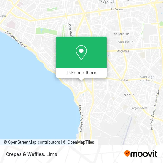
See Crepes & Waffles, Miraflores, on the map
Public Transit to Crepes & Waffles in Miraflores
Wondering how to get to Crepes & Waffles in Miraflores? Moovit helps you find the best way to get to Crepes & Waffles with step-by-step directions from the nearest public transit station.
Moovit provides free maps and live directions to help you navigate through your city. View schedules, routes, timetables, and find out how long does it take to get to Crepes & Waffles in real time.
Looking for the nearest stop or station to Crepes & Waffles? Check out this list of stops closest to your destination: Vía Expresa; Estación Benavides; Xxxx; Benavides; Estación 28 De Julio; Acacias; Cabitos.
Bus: 1056, 1090, 1098, 1111, C, EX1, EX2, 1043, 1087, 1097, 1110, EX3, EX12, SX, 1180, 1182, 1183, 1482, 1123, EX6, EX8, EX9.Metro: LINEA 1.
Want to see if there’s another route that gets you there at an earlier time? Moovit helps you find alternative routes or times. Get directions from and directions to Crepes & Waffles easily from the Moovit App or Website.
We make riding to Crepes & Waffles easy, which is why over 1.5 million users, including users in Miraflores, trust Moovit as the best app for public transit. You don’t need to download an individual bus app or train app, Moovit is your all-in-one transit app that helps you find the best bus time or train time available.
For information on prices of bus and metro, costs and ride fares to Crepes & Waffles, please check the Moovit app.
Use the app to navigate to popular places including to the airport, hospital, stadium, grocery store, mall, coffee shop, school, college, and university.
Crepes & Waffles Address: Avenida Vasco Nuñez de Balboa street in Miraflores
- La Bonbonniere - Strip Mall Balboa,
- Massamabile - Barra Italiana,
- Mercado 28,
- Ono Sushi Bar,
- La Baguette,
- Bbva Continental,
- Avenida Vasco Núñez de Balboa 770,
- Casa Prado,
- Pastelería San Antonio,
- Quinoa Cafe,
- Hotel Aloft,
- Corso de Wong Carro Alegorico 43,
- AVENIDA 28 JULIO 894,
- Av. Reducto y Av. 28 de Julio,
- Av Reducto cruce con Av 28 de Julio Miraflores,
- Av 28 de julio con reducto,
- 28 de Julio Miraflores,
- Paradero Reducto,
- Av 28 de julio 895 dpto 1809 Miraflores,
- Av Reducto 1091
Places Near Crepes & Waffles (Miraflores)
- Av. Abancay, Lima,
- Hospital Edgardo Rebagliati Martins, Jesus Mari,
- Barranco, Barranco,
- Circuito Mágico Del Agua, Lima,
- Real Plaza Puruchuco, Ate,
- av arequipa, Lima,
- Paradero Av.Brasil,
- Gamarra,
- Aeropuerto Internacional Jorge Chávez, Ventanilla,
- Pontificia Universidad Católica del Perú - PUCP, San Miguel,
- Parque Kennedy, Miraflores,
- Centro Comercial Plaza Norte, Independen,
- Miraflores, Miraflores,
- Av. La Marina, San Miguel,
- Av. Salaverry, Jesus Mari,
- Jockey Plaza, Santiago D,
- Mall Del Sur,
- Plaza San Miguel, San Miguel,
- Larcomar, Miraflores,
- Parque de las Leyendas, San Miguel
How to get to popular places in Lima with public transit
Get around Miraflores by public transit!
Traveling around Miraflores has never been so easy. See step by step directions as you travel to any attraction, street or major public transit station. View bus and train schedules, arrival times, service alerts and detailed routes on a map, so you know exactly how to get to anywhere in Miraflores.
When traveling to any destination around Miraflores use Moovit's Live Directions with Get Off Notifications to know exactly where and how far to walk, how long to wait for your line, and how many stops are left. Moovit will alert you when it's time to get off — no need to constantly re-check whether yours is the next stop.
Wondering how to use public transit in Miraflores or how to pay for public transit in Miraflores? Moovit public transit app can help you navigate your way with public transit easily, and at minimum cost. It includes public transit fees, ticket prices, and costs. Looking for a map of Miraflores public transit lines? Moovit public transit app shows all public transit maps in Miraflores with all Bus, Metro and Ferry routes and stops on an interactive map.
Lima has 3 transit type(s), including: Bus, Metro and Ferry, operated by several transit agencies, including Metro de Lima Línea 2 , Metro de Lima, Corredor Rojo, Metropolitano, Metropolitano - Alimentadores, Corredor Morado, Corredor Azul, Rutas Tradicionales, Transportes y Servicios La Esperanza S.A., Las Flores S.A., Virgen de la Asunción S.A., Consorcio HAM, Transportes y Service Canadá S.A., ETUL4SA and ETUCHISA