Directions to Cromstrijen with public transportation
The following transit lines have routes that pass near Cromstrijen
 Bus: 164, 669, 664, N67, MAAT.
How to get to Cromstrijen by bus?
Click on the bus route to see step by step directions with maps, line arrival times and updated time schedules.
Bus stops near Cromstrijen
- Numansdorp, Fortlaan, 5 min walk,
- Numansdorp, Burg. De Zeeuwstraat, 7 min walk,
- Numansdorp, Hallinxweg, 13 min walk,
Bus lines to Cromstrijen
- 164, Zuid-Beijerland R. Van Dorplaan,
- 669, Willemstad Steenpad,
- 664, Numansdorp Viaduct A29,
- N67, Heinenoord Busstation,
- MAAT, Numansdorp Weth. V.D. Veldenweg,
What are the closest stations to Cromstrijen?
The closest stations to Cromstrijen are:
- Numansdorp, Fortlaan is 319 meters away, 5 min walk.
- Numansdorp, Burg. De Zeeuwstraat is 476 meters away, 7 min walk.
- Numansdorp, Hallinxweg is 943 meters away, 13 min walk.
Which bus line stops near Cromstrijen?
164 (Zuid-Beijerland R. Van Dorplaan)
What’s the nearest bus station to Cromstrijen?
The nearest bus station to Cromstrijen is Numansdorp, Fortlaan. It’s a 5 min walk away.
What time is the first bus to Cromstrijen?
The N67 is the first bus that goes to Cromstrijen. It stops nearby at 5:37 AM.
What time is the last bus to Cromstrijen?
The 164 is the last bus that goes to Cromstrijen. It stops nearby at 12:50 AM.
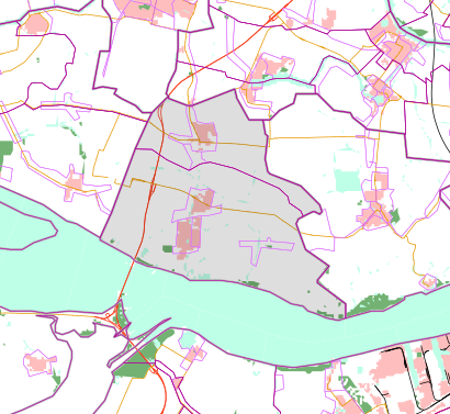
See Cromstrijen on the map
Public Transportation to Cromstrijen
Wondering how to get to Cromstrijen? Moovit helps you find the best way to get to Cromstrijen with step-by-step directions from the nearest public transit station.
Moovit provides free maps and live directions to help you navigate through your city. View schedules, routes, timetables, and find out how long does it take to get to Cromstrijen in real time.
Looking for the nearest stop or station to Cromstrijen? Check out this list of stops closest to your destination: Numansdorp; Numansdorp; Numansdorp.
Bus: 164, 669, 664, N67, MAAT.
Want to see if there’s another route that gets you there at an earlier time? Moovit helps you find alternative routes or times. Get directions from and directions to Cromstrijen easily from the Moovit App or Website.
We make riding to Cromstrijen easy, which is why over 1.5 million users, including users in Netherlands, trust Moovit as the best app for public transit. You don’t need to download an individual bus app or train app, Moovit is your all-in-one transit app that helps you find the best bus time or train time available.
For information on prices of bus and metro, costs and ride fares to Cromstrijen, please check the Moovit app.
Use the app to navigate to popular places including to the airport, hospital, stadium, grocery store, mall, coffee shop, school, college, and university.
Location: Netherlands
Popular routes to Cromstrijen
Popular routes from Cromstrijen
- Korendijk,
- Strijen,
- Oud-Beijerland,
- Binnenmaas,
- Barendrecht,
- Spijkenisse,
- Albrandswaard,
- Moerdijk,
- Oostflakkee,
- Halderberge,
- Zwijndrecht,
- Rotterdam,
- Dordrecht,
- Ridderkerk,
- Steenbergen,
- Middelharnis,
- Hendrik-Ido-Ambacht,
- Bernisse,
- Papendrecht,
- Vlaardingen
Places Near Cromstrijen
- Diergaarde Blijdorp, Rotterdam,
- Maasstad Ziekenhuis, Rotterdam,
- Dappermarkt, Amsterdam,
- OLVG Oost, Amsterdam,
- Ziggo Dome, Amsterdam,
- St. Antonius Ziekenhuis, Nieuwegein,
- Johan Cruijff Arena, Amsterdam,
- Erasmus MC, Rotterdam,
- Brabanthallen, 'S-Hertogenbosch,
- OLVG West, Amsterdam,
- Mall of the Netherlands, Leidschendam-Voorburg,
- Rcn De Schotsman, Noord-Beveland,
- IKEA, Amsterdam,
- Euromast, Rotterdam,
- Jan Bik Amsterdam, Amsterdam,
- Kaufland Nordhorn, Bentheimer Straße 118 48529 Nordhorn,
- Feyenoord Stadion (De Kuip), Rotterdam,
- Fenixloodsen, Rotterdam,
- Het Concertgebouw, Amsterdam,
- Kralingse Bos, Rotterdam
How to get to popular places in Netherlands with public transit
Get around Netherlands by public transit!
Traveling around Netherlands has never been so easy. See step by step directions as you travel to any attraction, street or major public transit station. View bus and train schedules, arrival times, service alerts and detailed routes on a map, so you know exactly how to get to anywhere in Netherlands.
When traveling to any destination around Netherlands use Moovit's Live Directions with Get Off Notifications to know exactly where and how far to walk, how long to wait for your line, and how many stops are left. Moovit will alert you when it's time to get off — no need to constantly re-check whether yours is the next stop.
Wondering how to use public transit in Netherlands or how to pay for public transit in Netherlands? Moovit public transit app can help you navigate your way with public transit easily, and at minimum cost. It includes public transit fees, ticket prices, and costs. Looking for a map of Netherlands public transit lines? Moovit public transit app shows all public transit maps in Netherlands with all Bus, Train, Metro, Light Rail and Ferry routes and stops on an interactive map.
Netherlands has 5 transit type(s), including: Bus, Train, Metro, Light Rail and Ferry, operated by several transit agencies, including NS, GVB, U-OV, HTM, RET, De Lijn, Connexxion, Arriva, Breng, EBS, Bravo (Hermes), Hermes, Qbuzz, Bravo (Arriva) and allGo