How to get to Cropsalsa by bus?
Click on the bus route to see step by step directions with maps, line arrival times and updated time schedules.
From Los Berrocales, Área Metropolitana De Madrid Y Corredor Del Henares
72 minFrom El Cañaveral, Área Metropolitana De Madrid Y Corredor Del Henares
92 minFrom Mejorada del Campo, Mejorada Del Campo
93 minFrom Ensanche de Vallecas, Madrid
54 minFrom Rivas Vaciamadrid, Cuenca Del Henares
56 minFrom Centro Comercial H2O, Rivas-Vaciamadrid
80 minFrom Auditorio Miguel Ríos, Cuenca Del Henares
60 minFrom Cañaveral, Área Metropolitana De Madrid Y Corredor Del Henares
82 minFrom IKEA Ensanche de Vallecas, Madrid
61 min
How to get to Cropsalsa by metro?
Click on the metro route to see step by step directions with maps, line arrival times and updated time schedules.
From Los Berrocales, Área Metropolitana De Madrid Y Corredor Del Henares
147 minFrom Ensanche de Vallecas, Madrid
126 minFrom Rivas Vaciamadrid, Cuenca Del Henares
56 minFrom Centro Comercial H2O, Rivas-Vaciamadrid
40 minFrom Auditorio Miguel Ríos, Cuenca Del Henares
50 minFrom IKEA Ensanche de Vallecas, Madrid
138 min
Bus stops near Cropsalsa in Arganda Del Rey
Metro station near Cropsalsa in Arganda Del Rey
- Arganda Del Rey, 29 min walk,VIEW
What are the closest stations to Cropsalsa?
The closest stations to Cropsalsa are:
- Vda. Yeguas - Av. Guijar is 435 meters away, 6 min walk.
- Alcotán - Av. Valdearganda is 845 meters away, 11 min walk.
- Arganda Del Rey is 2222 meters away, 29 min walk.
Which bus lines stop near Cropsalsa?
These bus lines stop near Cropsalsa: 1, 312A, 330.
Which metro line stops near Cropsalsa?
M-9 (Arganda del Rey)
What’s the nearest metro station to Cropsalsa in Arganda Del Rey?
The nearest metro station to Cropsalsa in Arganda Del Rey is Arganda Del Rey. It’s a 29 min walk away.
What’s the nearest bus station to Cropsalsa in Arganda Del Rey?
The nearest bus station to Cropsalsa in Arganda Del Rey is Vda. Yeguas - Av. Guijar. It’s a 6 min walk away.
What time is the first metro to Cropsalsa in Arganda Del Rey?
The M-9 is the first metro that goes to Cropsalsa in Arganda Del Rey. It stops nearby at 6:05 AM.
What time is the last metro to Cropsalsa in Arganda Del Rey?
The M-9 is the last metro that goes to Cropsalsa in Arganda Del Rey. It stops nearby at 1:51 AM.
What time is the first bus to Cropsalsa in Arganda Del Rey?
The 1 is the first bus that goes to Cropsalsa in Arganda Del Rey. It stops nearby at 6:59 AM.
What time is the last bus to Cropsalsa in Arganda Del Rey?
The 1 is the last bus that goes to Cropsalsa in Arganda Del Rey. It stops nearby at 11:02 PM.
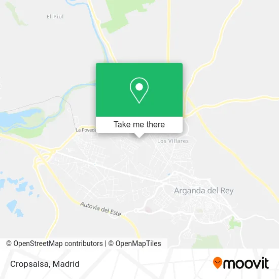
See Cropsalsa, Arganda Del Rey, on the map
Public Transit to Cropsalsa in Arganda Del Rey
Wondering how to get to Cropsalsa in Arganda Del Rey? Moovit helps you find the best way to get to Cropsalsa with step-by-step directions from the nearest public transit station.
Moovit provides free maps and live directions to help you navigate through your city. View schedules, routes, timetables, and find out how long does it take to get to Cropsalsa in real time.
Looking for the nearest stop or station to Cropsalsa? Check out this list of stops closest to your destination: Vda. Yeguas - Av. Guijar; Alcotán - Av. Valdearganda; Arganda Del Rey.
Bus: 1, 312A, 330, 4.Metro: M-9.
Want to see if there’s another route that gets you there at an earlier time? Moovit helps you find alternative routes or times. Get directions from and directions to Cropsalsa easily from the Moovit App or Website.
We make riding to Cropsalsa easy, which is why over 1.5 million users, including users in Arganda Del Rey, trust Moovit as the best app for public transit. You don’t need to download an individual bus app or train app, Moovit is your all-in-one transit app that helps you find the best bus time or train time available.
For information on prices of bus and metro, costs and ride fares to Cropsalsa, please check the Moovit app.
Use the app to navigate to popular places including to the airport, hospital, stadium, grocery store, mall, coffee shop, school, college, and university.
Cropsalsa Address: Avenida del Guijar, 33 28500 Arganda del Rey street in Arganda Del Rey
- Metaluis 86,
- Insaplas,
- Edoba Bellas Artes,
- Aluma 3,
- Gráficas Zafiro,
- Multiembalajes S.L.,
- Electro Ventajas,
- 28quinientosdescomplic,
- Truck Madrid,
- Moquetas Santos Martínez,
- Jake-Café,
- Citadex Ibérica,
- Iberautor Promociones Culturales,
- Jesus Docio Camacho,
- Construcción y Desarrollo de Piscinas de Luxe,
- Talleres M. Mariscal,
- Avenida del Guijar 3,
- Calle Abedul 19,
- Plasticom Velilla,
- Ind.I.A
Places Near Cropsalsa (Arganda Del Rey)
- Centro Comercial Islazul, Área Metropolitana De Madrid Y Corredor Del Henares,
- Nassica, Área Metropolitana De Madrid Y Corredor Del Henares,
- Centro Comercial La Gavia, Área Metropolitana De Madrid Y Corredor Del Henares,
- Plaza Mayor, Madrid,
- Calle de López de Hoyos 169, Madrid,
- Hospital Universitario Ramón y Cajal, Madrid,
- Rastro De Madrid, Área Metropolitana De Madrid Y Corredor Del Henares,
- Centro Comercial Oasiz Madrid, Área Metropolitana De Madrid Y Corredor Del Henares,
- Palacio De Vistalegre, Área Metropolitana De Madrid Y Corredor Del Henares,
- Mercadillo de Majadahonda, Majadahonda,
- Wizink Center, Madrid,
- Centro Comercial La Vaguada, Área Metropolitana De Madrid Y Corredor Del Henares,
- Hospital Clínico Universitario San Carlos, Madrid,
- Sala La Riviera, Madrid,
- Plenilunio, Área Metropolitana De Madrid Y Corredor Del Henares,
- Tres Aguas, Alcorcón,
- Estacion de Chamartin, Madrid,
- Hospital Universitario La Paz, Madrid,
- Mendez Alvaro, Madrid,
- Estadio Wanda Metropolitano, Área Metropolitana De Madrid Y Corredor Del Henares
How to get to popular places in Madrid with public transit
Get around Arganda Del Rey by public transit!
Traveling around Arganda Del Rey has never been so easy. See step by step directions as you travel to any attraction, street or major public transit station. View bus and train schedules, arrival times, service alerts and detailed routes on a map, so you know exactly how to get to anywhere in Arganda Del Rey.
When traveling to any destination around Arganda Del Rey use Moovit's Live Directions with Get Off Notifications to know exactly where and how far to walk, how long to wait for your line, and how many stops are left. Moovit will alert you when it's time to get off — no need to constantly re-check whether yours is the next stop.
Wondering how to use public transit in Arganda Del Rey or how to pay for public transit in Arganda Del Rey? Moovit public transit app can help you navigate your way with public transit easily, and at minimum cost. It includes public transit fees, ticket prices, and costs. Looking for a map of Arganda Del Rey public transit lines? Moovit public transit app shows all public transit maps in Arganda Del Rey with all Bus, Train, Metro and Light Rail routes and stops on an interactive map.
Madrid has 4 transit type(s), including: Bus, Train, Metro and Light Rail, operated by several transit agencies, including Metro de Madrid, Metro Ligero, Tranvía de Parla, Renfe Cercanías - Servicios de Autobús especiales, Renfe Cercanias, Renfe Cercanías, EMT, Interurbanos, Urbanos de Alcalá de Henares, Urbanos de Alcobendas, Urbanos de Alcorcón, Urbanos de Algete, Urbanos de Aranjuez, Urbanos de Arganda del Rey and Urbanos de Arroyomolinos