How to get to Crownstone, Llc by bus?
Click on the bus route to see step by step directions with maps, line arrival times and updated time schedules.
From PGCC, Prince George's County
338 minFrom Joint Base Andrews, Prince George's County
230 minFrom Clinton, MD, Prince George's County
210 minFrom Marlboro Pike, Prince George's County
221 minFrom Largo, Maryland, Prince George's County
200 minFrom Prince George's Community College, Prince George's County
338 minFrom Waldorf, MD, Charles County
389 minFrom Upper Marlboro Courthouse, Prince George's County
310 minFrom Andrews Air Force Base, Prince George's County
229 min
Bus stops near Crownstone, Llc in Calvert County
Bus lines to Crownstone, Llc in Calvert County
What are the closest stations to Crownstone, Llc?
The closest stations to Crownstone, Llc are:
- Skinner's Turn Rd. And Route 2 is 47 yards away, 1 min walk.
- Route 2 And Mount Harmony Rd. is 820 yards away, 10 min walk.
Which bus lines stop near Crownstone, Llc?
These bus lines stop near Crownstone, Llc: 820, PINK.
What’s the nearest bus station to Crownstone, Llc in Calvert County?
The nearest bus station to Crownstone, Llc in Calvert County is Skinner's Turn Rd. And Route 2. It’s a 1 min walk away.
What time is the first bus to Crownstone, Llc in Calvert County?
The PINK is the first bus that goes to Crownstone, Llc in Calvert County. It stops nearby at 6:46 AM.
What time is the last bus to Crownstone, Llc in Calvert County?
The PINK is the last bus that goes to Crownstone, Llc in Calvert County. It stops nearby at 4:30 PM.
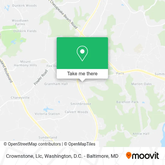
See Crownstone, Llc, Calvert County, on the map
Public Transit to Crownstone, Llc in Calvert County
Wondering how to get to Crownstone, Llc in Calvert County? Moovit helps you find the best way to get to Crownstone, Llc with step-by-step directions from the nearest public transit station.
Moovit provides free maps and live directions to help you navigate through your city. View schedules, routes, timetables, and find out how long does it take to get to Crownstone, Llc in real time.
Looking for the nearest stop or station to Crownstone, Llc? Check out this list of stops closest to your destination: Skinner's Turn Rd. And Route 2; Route 2 And Mount Harmony Rd..
Bus: 820, PINK, ORANGE.
Want to see if there’s another route that gets you there at an earlier time? Moovit helps you find alternative routes or times. Get directions from and directions to Crownstone, Llc easily from the Moovit App or Website.
We make riding to Crownstone, Llc easy, which is why over 1.7 million users, including users in Calvert County, trust Moovit as the best app for public transit. You don’t need to download an individual bus app or train app, Moovit is your all-in-one transit app that helps you find the best bus time or train time available.
For information on prices of bus and metro, costs and ride fares to Crownstone, Llc, please check the Moovit app.
Use the app to navigate to popular places including to the airport, hospital, stadium, grocery store, mall, coffee shop, school, college, and university.
Crownstone, Llc Address: 206 E Mount Harmony Rd street in Calvert County
- The Wesley School,
- Caliber Collision 3061,
- Andi St Germain Photography,
- Link Exclusives Llc,
- The Muffler Shop,
- Bartlett Tree Experts,
- Maryland Chevelle Club,
- Underdog Racing Development, Llc,
- The Mealing Manor,
- Southern Md Cpr & First Aid Training,
- Primelending,
- Carey Law Office, Llc.,
- Cotton's Septic,
- Chesapeake Neuro-Behavioral Health,
- Camden Pet Hospital,
- Ag Calvert Llc,
- Hot Tubs Inc,
- Swt Fitness "Sistas Work Together",
- Results Health & Fitness Club - Owings,
- Results Health & Fitness Club
Places Near Crownstone, Llc (Calvert County)
- Georgetown, Washington,
- M&T Bank Stadium, Baltimore,
- Capital One Arena, Washington,
- Pennsylvania Ave NW (3rd st and pennsylvania), Washington,
- Marriott Marquis Washington, DC, Washington,
- Museum Of The Bible, Washington,
- Amazon Hq2, Arlington County,
- PG Mall, Prince George's County,
- Westfield Montgomery Mall, Montgomery County,
- The Anthem, Washington,
- National Zoo, Washington,
- National Museum of African American History and Culture, Washington,
- Camden Yards, Baltimore,
- Basilica of the National Shrine, Washington,
- Washington National Cathedral, Washington,
- Warner Theatre, Washington,
- National Theatre, Washington,
- Washington DC VA Medical Center, Washington,
- Sibley Memorial Hospital, Washington,
- Rock Creek Tennis Center, Washington
How to get to popular places in Washington, D.C. - Baltimore, MD with public transit
Get around Calvert County by public transit!
Traveling around Calvert County has never been so easy. See step by step directions as you travel to any attraction, street or major public transit station. View bus and train schedules, arrival times, service alerts and detailed routes on a map, so you know exactly how to get to anywhere in Calvert County.
When traveling to any destination around Calvert County use Moovit's Live Directions with Get Off Notifications to know exactly where and how far to walk, how long to wait for your line, and how many stops are left. Moovit will alert you when it's time to get off — no need to constantly re-check whether yours is the next stop.
Wondering how to use public transit in Calvert County or how to pay for public transit in Calvert County? Moovit public transit app can help you navigate your way with public transit easily, and at minimum cost. It includes public transit fees, ticket prices, and costs. Looking for a map of Calvert County public transit lines? Moovit public transit app shows all public transit maps in Calvert County with all Bus, Train, Metro, Light Rail and Ferry routes and stops on an interactive map.
Washington, D.C. - Baltimore, MD has 5 transit type(s), including: Bus, Train, Metro, Light Rail and Ferry, operated by several transit agencies, including WMATA, Montgomery County Ride On, Fairfax Connector, TheBus, PRTC, DASH - Alexandria, Arlington Transit (ART), RTA of Central Maryland, MDOT MTA, MDOT MTA Light RailLink, MDOT MTA Commuter Bus, MDOT MTA Local Bus, FXBGO!, Virginia Railway Express (VRE) and MARC