Bus stop near Cru at SWCC in Tazewell County
- Southwest Virginia Community College (Tazewell Hall), 5 min walk,VIEW
Bus lines to Cru at SWCC in Tazewell County
- SWVCC EAGLE EXPRESS - BUCHANAN COUNTY, Swvcc - Tazewell Hall,VIEW
- SWVCC EAGLE EXPRESS - DICKENSON/RUSSELL COUNTY, Clinchco,VIEW
- SWVCC EAGLE EXPRESS - RUSSELL COUNTY, Dante Post Office,VIEW
- SWVCC EAGLE EXPRESS TAZEWELL COUNTY, Pocahontas-Indian Princess Apts,VIEW
- 4 SEASONS RICHLANDS TO TAZEWELL CONNECTOR, Southwest Virginia Community College,VIEW
- SWCC YMCA,
- Small Business Development Center-SWCC,
- Southwest Virginia Community College Educational Active Foundation,
- Physical Plant,
- Headstart Center,
- Buchanan Hall,
- Faculty/Staff Parking,
- Eagle Café at Southwest Virginia Community College,
- Shelter,
- Reserved Parking,
- Dellinger Hall,
- Follett,
- Campus Bo 635 Communit,
- Southwest Virginia Community College,
- Tazewell Hall,
- Caboose,
- Vistior Parking,
- Faculty/Staff Parking,
- Palph B. Davis Hall,
- Faculty/Staff Parking
Places Near Cru at SWCC (Tazewell County)
- PG Mall, Prince George's County,
- M&T Bank Stadium, Baltimore,
- Capital One Arena, Washington,
- National Zoo, Washington,
- Sibley Memorial Hospital, Washington,
- Marriott Marquis Washington, DC, Washington,
- Pennsylvania Ave NW (3rd st and pennsylvania), Washington,
- National Museum of African American History and Culture, Washington,
- Amazon Hq2, Arlington County,
- Camden Yards, Baltimore,
- Warner Theatre, Washington,
- Museum Of The Bible, Washington,
- Rock Creek Tennis Center, Washington,
- Washington DC VA Medical Center, Washington,
- National Theatre, Washington,
- Westfield Montgomery Mall, Montgomery County,
- Washington National Cathedral, Washington,
- The Anthem, Washington,
- Georgetown, Washington,
- Basilica of the National Shrine, Washington
How to get to popular places in Washington, D.C. - Baltimore, MD with public transit
What are the closest stations to Cru at SWCC?
The closest stations to Cru at SWCC are:
- Southwest Virginia Community College (Tazewell Hall) is 339 yards away, 5 min walk.
What’s the nearest bus station to Cru at SWCC in Tazewell County?
The nearest bus station to Cru at SWCC in Tazewell County is Southwest Virginia Community College (Tazewell Hall). It’s a 5 min walk away.
What time is the first bus to Cru at SWCC in Tazewell County?
The SWVCC EAGLE EXPRESS TAZEWELL COUNTY is the first bus that goes to Cru at SWCC in Tazewell County. It stops nearby at 7:43 AM.
What time is the last bus to Cru at SWCC in Tazewell County?
The SWVCC EAGLE EXPRESS TAZEWELL COUNTY is the last bus that goes to Cru at SWCC in Tazewell County. It stops nearby at 4:32 PM.
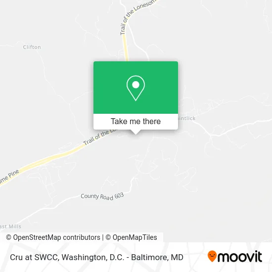
See Cru at SWCC, Tazewell County, on the map
Public Transit to Cru at SWCC in Tazewell County
Wondering how to get to Cru at SWCC in Tazewell County? Moovit helps you find the best way to get to Cru at SWCC with step-by-step directions from the nearest public transit station.
Moovit provides free maps and live directions to help you navigate through your city. View schedules, routes, timetables, and find out how long does it take to get to Cru at SWCC in real time.
Looking for the nearest stop or station to Cru at SWCC? Check out this list of stops closest to your destination: Southwest Virginia Community College (Tazewell Hall).
Want to see if there’s another route that gets you there at an earlier time? Moovit helps you find alternative routes or times. Get directions from and directions to Cru at SWCC easily from the Moovit App or Website.
We make riding to Cru at SWCC easy, which is why over 1.5 million users, including users in Tazewell County, trust Moovit as the best app for public transit. You don’t need to download an individual bus app or train app, Moovit is your all-in-one transit app that helps you find the best bus time or train time available.
Use the app to navigate to popular places including to the airport, hospital, stadium, grocery store, mall, coffee shop, school, college, and university.
Cru at SWCC Address: 724 Community College Rd Cedar Bluff, VA 24609 street in Tazewell County
Get around Tazewell County by public transit!
Traveling around Tazewell County has never been so easy. See step by step directions as you travel to any attraction, street or major public transit station. View bus and train schedules, arrival times, service alerts and detailed routes on a map, so you know exactly how to get to anywhere in Tazewell County.
When traveling to any destination around Tazewell County use Moovit's Live Directions with Get Off Notifications to know exactly where and how far to walk, how long to wait for your line, and how many stops are left. Moovit will alert you when it's time to get off — no need to constantly re-check whether yours is the next stop.
Wondering how to use public transit in Tazewell County or how to pay for public transit in Tazewell County? Moovit public transit app can help you navigate your way with public transit easily, and at minimum cost. It includes public transit fees, ticket prices, and costs. Looking for a map of Tazewell County public transit lines? Moovit public transit app shows all public transit maps in Tazewell County with all Bus, Train, Metro, Light Rail and Ferry routes and stops on an interactive map.
Washington, D.C. - Baltimore, MD has 5 transit type(s), including: Bus, Train, Metro, Light Rail and Ferry, operated by several transit agencies, including WMATA, Montgomery County Ride On, Fairfax Connector, TheBus, PRTC, DASH - Alexandria, Arlington Transit (ART), RTA of Central Maryland, MDOT MTA, MDOT MTA Light RailLink, MDOT MTA Commuter Bus, MDOT MTA Local Bus, FXBGO!, Virginia Railway Express (VRE) and MARC
Public transit lines with stations closest to Cru at SWCC in Tazewell County
Bus lines with stations closest to Cru at SWCC in Tazewell County
Southwest Virginia Community College (Tazewell Hall)
 SWVCC EAGLE EXPRESS - BUCHANAN COUNTYSwVCC Eagle Express - Buchanan County
- SWVCC EAGLE EXPRESS - DICKENSON/RUSSELL COUNTYSwVCC Eagle Express - Dickenson/Russell County
- SWVCC EAGLE EXPRESS - RUSSELL COUNTYSWVCC Eagle Express - Russell County
- SWVCC EAGLE EXPRESS TAZEWELL COUNTYSwVCC Eagle Express Tazewell County
- 4 SEASONS RICHLANDS TO TAZEWELL CONNECTOR4 Seasons Richlands to Tazewell Connector