How to get to Cs-One by bus?
Click on the bus route to see step by step directions with maps, line arrival times and updated time schedules.
From Thon Partner Stavanger Forum Hotel, Stavanger
54 minFrom Kilden Kjøpesenter, Stavanger
38 minFrom Lagårdsveien 78-80, Stavanger
39 minFrom Tjodhallen (Kjølv Egelands hus - UiS), Stavanger
51 minFrom Øksnevad Vgs, Klepp
75 minFrom Solastranden, Sola
74 minFrom Tjensvoll Gravkapell, Stavanger
51 minFrom Forum Expo, Stavanger
52 minFrom Statens Vegvesen, Stavanger
39 min
How to get to Cs-One by train?
Click on the train route to see step by step directions with maps, line arrival times and updated time schedules.
Train station near Cs-One in Sandnes
- Sandnes Sentrum Stasjon, 27 min walk,VIEW
Bus lines to Cs-One in Sandnes
What are the closest stations to Cs-One?
The closest stations to Cs-One are:
- Prestholsteigen is 229 meters away, 4 min walk.
- Dyre Vaas Vei is 1046 meters away, 14 min walk.
- Sandnes Sentrum Stasjon is 2021 meters away, 27 min walk.
Which bus lines stop near Cs-One?
These bus lines stop near Cs-One: 2, 5.
Which train line stops near Cs-One?
L5 (Egersund)
What’s the nearest train station to Cs-One in Sandnes?
The nearest train station to Cs-One in Sandnes is Sandnes Sentrum Stasjon. It’s a 27 min walk away.
What’s the nearest bus station to Cs-One in Sandnes?
The nearest bus station to Cs-One in Sandnes is Prestholsteigen. It’s a 4 min walk away.
What time is the first train to Cs-One in Sandnes?
The L5 is the first train that goes to Cs-One in Sandnes. It stops nearby at 9:03 AM.
What time is the last train to Cs-One in Sandnes?
The L5 is the last train that goes to Cs-One in Sandnes. It stops nearby at 12:05 AM.
What time is the first bus to Cs-One in Sandnes?
The 2 is the first bus that goes to Cs-One in Sandnes. It stops nearby at 3:24 AM.
What time is the last bus to Cs-One in Sandnes?
The 2 is the last bus that goes to Cs-One in Sandnes. It stops nearby at 3:54 AM.
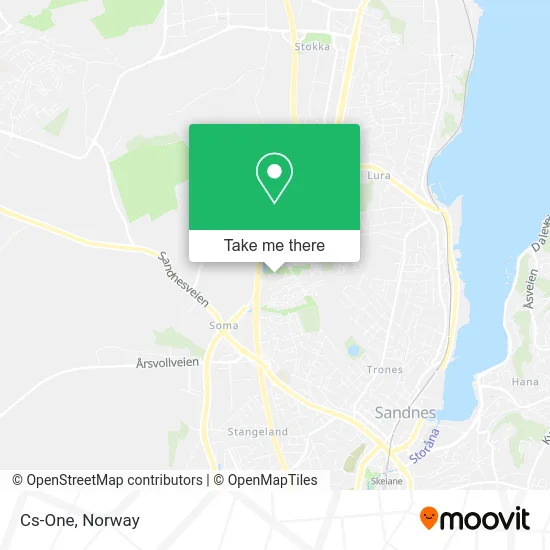
See Cs-One, Sandnes, on the map
Public Transit to Cs-One in Sandnes
Wondering how to get to Cs-One in Sandnes? Moovit helps you find the best way to get to Cs-One with step-by-step directions from the nearest public transit station.
Moovit provides free maps and live directions to help you navigate through your city. View schedules, routes, timetables, and find out how long does it take to get to Cs-One in real time.
Looking for the nearest stop or station to Cs-One? Check out this list of stops closest to your destination: Prestholsteigen; Dyre Vaas Vei; Sandnes Sentrum Stasjon.
Bus: 2, 5, X40.Train: L5, F5.
Want to see if there’s another route that gets you there at an earlier time? Moovit helps you find alternative routes or times. Get directions from and directions to Cs-One easily from the Moovit App or Website.
We make riding to Cs-One easy, which is why over 1.5 million users, including users in Sandnes, trust Moovit as the best app for public transit. You don’t need to download an individual bus app or train app, Moovit is your all-in-one transit app that helps you find the best bus time or train time available.
For information on prices of bus and train, costs and ride fares to Cs-One, please check the Moovit app.
Use the app to navigate to popular places including to the airport, hospital, stadium, grocery store, mall, coffee shop, school, college, and university.
Cs-One Address: Prestholsteigen 17 4313 Sandnes street in Sandnes
- Loyning Ståle Alexander Løyning,
- Fuel-Service Sørlandet og Vestlandet,
- Erna Nessa,
- Smeaheia Skolesjakk,
- Opamp Engineering,
- Spring Bygg,
- Transportsentralen Nord Jæren,
- Fine Design AS,
- Myrtun,
- Fuglestad Transport,
- Unilabs Røntgen,
- Tulipanveien Lekeplass,
- Trim Towers,
- Unilabs Røntgen Sandnes,
- Sats Trim Towers,
- Kraft Bank ASA,
- Kolibri Medical Group,
- Larsamyrå 18,
- Kjøkkenmagi Kvingedal,
- Nye Sandnes Ulf Stadion
Places Near Cs-One (Sandnes)
- Voldsløkka, Oslo,
- Vestby Outlet Store, Vestby,
- Tyholttårnet, Trondheim,
- Quality Hotel Edvard Grieg, Bergen,
- Drammen Sykehus, Drammen,
- Ikea Leangen, Trondheim,
- Nylandsbrua, Oslo,
- Jekta Storsenter, Tromsø,
- IKEA, Bergen,
- Ulriken, Bergen,
- IKEA, Oslo,
- DFDS Seaways, Oslo,
- Lovisenberg Diakonale Sykehus, Oslo,
- Bjerke Travbane, Oslo,
- Color Line Terminal, Oslo,
- Radiumhospitalet, Oslo,
- Oslo S spor 19 (Trelastgata), Oslo,
- Ullevål Stadion (T), Oslo,
- Haukeland Universitetssjukehus, Bergen,
- Rikshospitalet (trikk), Oslo
How to get to popular places in Norway with public transit
Get around Sandnes by public transit!
Traveling around Sandnes has never been so easy. See step by step directions as you travel to any attraction, street or major public transit station. View bus and train schedules, arrival times, service alerts and detailed routes on a map, so you know exactly how to get to anywhere in Sandnes.
When traveling to any destination around Sandnes use Moovit's Live Directions with Get Off Notifications to know exactly where and how far to walk, how long to wait for your line, and how many stops are left. Moovit will alert you when it's time to get off — no need to constantly re-check whether yours is the next stop.
Wondering how to use public transit in Sandnes or how to pay for public transit in Sandnes? Moovit public transit app can help you navigate your way with public transit easily, and at minimum cost. It includes public transit fees, ticket prices, and costs. Looking for a map of Sandnes public transit lines? Moovit public transit app shows all public transit maps in Sandnes with all Bus, Train, Subway, Light Rail, Ferry and Cable Car routes and stops on an interactive map.
Norway has 6 transit type(s), including: Bus, Train, Subway, Light Rail, Ferry and Cable Car, operated by several transit agencies, including Ruter, Skyss, AtB, Flytoget, Vy Tåg, SJ, Go-Ahead Norge AS, SJ Nord, Vestfold Kollektivtrafikk as, Snelandia, Innlandstrafikk, FRAM, FlixBus, Kolumbus and Brakar