Directions to Custom Creations (Boston) with public transportation
The following transit lines have routes that pass near Custom Creations
 Bus: 01, 03, 09, FH, 02.
- Train: FRAMINGHAM/WORCESTER, LAKE SHORE LIMITED.
How to get to Custom Creations by bus?
Click on the bus route to see step by step directions with maps, line arrival times and updated time schedules.
From Babson College, Wellesley
47 minFrom Newton-Wellesley Hospital, Newton
55 minFrom Staples Corporate HQ, Framingham
37 minFrom I-95 / Route 128 & Route 16 Interchange (Exit 21), Newton
52 minFrom Bose Corp, Framingham
49 minFrom Lasell College, Newton
69 minFrom Newton Wellesley Hospital Green Building, Newton
55 minFrom Boston Children's Hospital at Waltham, Waltham
139 minFrom Boston Marriott Newton, Newton
78 minFrom Wellesley, MA, Wellesley
50 min
How to get to Custom Creations by train?
Click on the train route to see step by step directions with maps, line arrival times and updated time schedules.
Bus stops near Custom Creations in Boston
Train stations near Custom Creations in Boston
Bus lines to Custom Creations in Boston
What are the closest stations to Custom Creations?
The closest stations to Custom Creations are:
- Natick Mall - Wegmans is 562 yards away, 7 min walk.
- Shoppers World Shelter is 1059 yards away, 13 min walk.
- Overflow Parking Lot (Fh) is 1229 yards away, 15 min walk.
- West Natick is 3229 yards away, 38 min walk.
- Framingham Amtrak is 4192 yards away, 50 min walk.
Which bus lines stop near Custom Creations?
These bus lines stop near Custom Creations: 01, 03, 09, FH.
Which train line stops near Custom Creations?
FRAMINGHAM/WORCESTER (#521 | Worcester)
What’s the nearest bus station to Custom Creations in Boston?
The nearest bus station to Custom Creations in Boston is Natick Mall - Wegmans. It’s a 7 min walk away.
What time is the first train to Custom Creations in Boston?
The FRAMINGHAM/WORCESTER is the first train that goes to Custom Creations in Boston. It stops nearby at 4:55 AM.
What time is the last train to Custom Creations in Boston?
The LAKE SHORE LIMITED is the last train that goes to Custom Creations in Boston. It stops nearby at 8:00 PM.
What time is the first bus to Custom Creations in Boston?
The FH is the first bus that goes to Custom Creations in Boston. It stops nearby at 3:00 AM.
What time is the last bus to Custom Creations in Boston?
The FH is the last bus that goes to Custom Creations in Boston. It stops nearby at 2:15 AM.
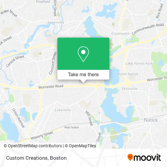
See Custom Creations, Boston, on the map
Public Transit to Custom Creations in Boston
Wondering how to get to Custom Creations in Boston? Moovit helps you find the best way to get to Custom Creations with step-by-step directions from the nearest public transit station.
Moovit provides free maps and live directions to help you navigate through your city. View schedules, routes, timetables, and find out how long does it take to get to Custom Creations in real time.
Looking for the nearest stop or station to Custom Creations? Check out this list of stops closest to your destination: Natick Mall - Wegmans; Shoppers World Shelter; Overflow Parking Lot (Fh); West Natick; Framingham Amtrak.
Bus: 01, 03, 09, FH, 02, 10, FLIXBUS 2611.Train: FRAMINGHAM/WORCESTER, LAKE SHORE LIMITED.
Want to see if there’s another route that gets you there at an earlier time? Moovit helps you find alternative routes or times. Get directions from and directions to Custom Creations easily from the Moovit App or Website.
We make riding to Custom Creations easy, which is why over 1.5 million users, including users in Boston, trust Moovit as the best app for public transit. You don’t need to download an individual bus app or train app, Moovit is your all-in-one transit app that helps you find the best bus time or train time available.
For information on prices of bus, train and subway, costs and ride fares to Custom Creations, please check the Moovit app.
Use the app to navigate to popular places including to the airport, hospital, stadium, grocery store, mall, coffee shop, school, college, and university.
Custom Creations Address: 1245 Worcester St Natick, MA 01760 street in Boston
- Cellaxs Phone Repair-Natick Mall,
- ecco,
- Brazilias Boutique,
- An Kong Spa,
- Gilly Hicks,
- Odessa Shoe Repair,
- Cotton On,
- Inpopnito,
- Offline,
- Aerie Store,
- Shi by Journeys,
- ATHLETA,
- Miniso,
- MICHAEL KORS,
- Cajun Cafe,
- GEOX,
- Le Boutique Instyle,
- Blue Dalia Restaurant & Tequila Bar,
- Food Court,
- Nori Sushi Natick
Places Near Custom Creations (Boston)
- Td Garden, Boston,
- Boston Common, Boston,
- Wilbur Theatre, Boston,
- North End, Boston,
- Seaport District, Boston,
- Wang Theater, Boston,
- City Hall Plaza, Boston,
- Cheers, Boston,
- Museum Of Science, Boston,
- Castle Island, Boston,
- Quincy Market, Boston,
- House Of Blues, Boston,
- Boston Children's Hospital, Boston,
- Leader Bank Pavilion (Leader Bank Pavillion), Boston,
- Massachusetts General Hospital, Boston,
- Mgm Music Hall, Boston,
- Boston Convention & Exhibition Center, Boston,
- Boston Medical Center, Boston,
- Prudential Center, Boston,
- Faneuil Hall, Boston
How to get to popular places in Boston with public transit
Get around Boston by public transit!
Traveling around Boston has never been so easy. See step by step directions as you travel to any attraction, street or major public transit station. View bus and train schedules, arrival times, service alerts and detailed routes on a map, so you know exactly how to get to anywhere in Boston.
When traveling to any destination around Boston use Moovit's Live Directions with Get Off Notifications to know exactly where and how far to walk, how long to wait for your line, and how many stops are left. Moovit will alert you when it's time to get off — no need to constantly re-check whether yours is the next stop.
Wondering how to use public transit in Boston or how to pay for public transit in Boston? Moovit public transit app can help you navigate your way with public transit easily, and at minimum cost. It includes public transit fees, ticket prices, and costs. Looking for a map of Boston public transit lines? Moovit public transit app shows all public transit maps in Boston with all Bus, Train, Subway and Ferry routes and stops on an interactive map.
Boston has 4 transit type(s), including: Bus, Train, Subway and Ferry, operated by several transit agencies, including MBTA, Southeastern Regional Transit Authority, MetroWest Regional Transit Authority, Rhode Island Public Transit Authority, WRTA, Lowell Regional Transit Authority, Merrimack Valley Transit, Montachusett Regional Transit Authority, Cape Cod Regional Transit Authority, Brockton Area Transit Authority, Martha's Vineyard Transit Authority, the WAVE - Nantucket Regional Transit Authority, GATRA, Cape Ann Transportation Authority and Massport