Directions to Custom Jewelry Designs (Harrisonburg) with public transportation
The following transit lines have routes that pass near Custom Jewelry Designs
 Bus: BRCC NORTH, 1, 1-B, EXT 1, 4.
Bus stops near Custom Jewelry Designs in Harrisonburg
Bus lines to Custom Jewelry Designs in Harrisonburg
- 1, Route 1,VIEW
- 1-B, Route 1-B,VIEW
- EXT 1, Extended Route 1,VIEW
- 4, Route 4,VIEW
- 4-B, Route 4-B,VIEW
- EXT 4, Extended Route 4,VIEW
- 6, Route 6,VIEW
- 6-B, Route 6-B,VIEW
- EXT 6, Extended Route 6,VIEW
- 5, Route 5,VIEW
- 5-B, Route 5-B,VIEW
- EXT 5, Extended Route 5,VIEW
- 2, Route 2,VIEW
- 2-B, Route 2-B,VIEW
- EXT 2, Extended Route 2,VIEW
- 3, Route 3,VIEW
- 3-B, Route 3-B,VIEW
- EXT 3, Extended Route 3,VIEW
- Rutherford Deyerle House,
- First Step A Respnse To DMSTC Vlnce,
- Elm Office Complex,
- Truist Bank,
- Harrisonburg Music School,
- Judith G Weaver Licensed Prof,
- Visible Changes,
- David Martin Lawyer,
- Advanced Electrolysis of Harrisonburg,
- Green Hummingbird Fair Trade Clothing,
- Halcyon Videogames,
- Eastside Church,
- Artisans Downtown,
- Young Life of Harrisonburg Rockingham,
- Column Construction,
- Rocktown Choppers,
- Alcova Mortgage - Harrisonburg,
- Responsive Management,
- Hoover Penrod,
- Hannah W Hutman Attorney
Places Near Custom Jewelry Designs (Harrisonburg)
- Amazon Hq2, Arlington County,
- Marriott Marquis Washington, DC, Washington,
- The Anthem, Washington,
- National Zoo, Washington,
- Washington DC VA Medical Center, Washington,
- Rock Creek Tennis Center, Washington,
- Georgetown, Washington,
- National Mall, Washington,
- Camden Yards, Baltimore,
- National Museum of African American History and Culture, Washington,
- Sibley Memorial Hospital, Washington,
- Warner Theatre, Washington,
- Westfield Montgomery Mall, Montgomery County,
- Pennsylvania Ave NW (3rd st and pennsylvania), Washington,
- Washington National Cathedral, Washington,
- PG Mall, Prince George's County,
- M&T Bank Stadium, Baltimore,
- Capital One Arena, Washington,
- Museum Of The Bible, Washington,
- Basilica of the National Shrine, Washington
How to get to popular places in Washington, D.C. - Baltimore, MD with public transit
What are the closest stations to Custom Jewelry Designs?
The closest stations to Custom Jewelry Designs are:
- South Main St. Across From City Hall is 171 yards away, 3 min walk.
- South Liberty St. @ Daily News Record is 404 yards away, 5 min walk.
- East Market St. @ Mason St. (West) is 488 yards away, 6 min walk.
- East Market St. @ Urban Exchange is 521 yards away, 7 min walk.
- M.L.King Way @ South Main St. is 776 yards away, 10 min walk.
Which bus line stops near Custom Jewelry Designs?
BRCC NORTH (Brcc)
What’s the nearest bus station to Custom Jewelry Designs in Harrisonburg?
The nearest bus station to Custom Jewelry Designs in Harrisonburg is South Main St. Across From City Hall. It’s a 3 min walk away.
What time is the first bus to Custom Jewelry Designs in Harrisonburg?
The 2 is the first bus that goes to Custom Jewelry Designs in Harrisonburg. It stops nearby at 6:30 AM.
What time is the last bus to Custom Jewelry Designs in Harrisonburg?
The 5-B is the last bus that goes to Custom Jewelry Designs in Harrisonburg. It stops nearby at 10:43 PM.
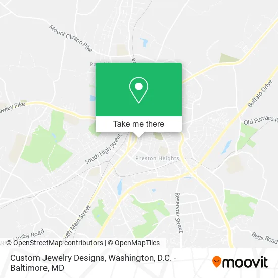
See Custom Jewelry Designs, Harrisonburg, on the map
Public Transit to Custom Jewelry Designs in Harrisonburg
Wondering how to get to Custom Jewelry Designs in Harrisonburg? Moovit helps you find the best way to get to Custom Jewelry Designs with step-by-step directions from the nearest public transit station.
Moovit provides free maps and live directions to help you navigate through your city. View schedules, routes, timetables, and find out how long does it take to get to Custom Jewelry Designs in real time.
Looking for the nearest stop or station to Custom Jewelry Designs? Check out this list of stops closest to your destination: South Main St. Across From City Hall; South Liberty St. @ Daily News Record; East Market St. @ Mason St. (West); East Market St. @ Urban Exchange; M.L.King Way @ South Main St..
Bus: BRCC NORTH, 1, 1-B, EXT 1, 4, 4-B, 6, 6-B, EXT 6, 5, 5-B, EXT 5, 2, 2-B, EXT 2, 3, 3-B, EXT 3.
Want to see if there’s another route that gets you there at an earlier time? Moovit helps you find alternative routes or times. Get directions from and directions to Custom Jewelry Designs easily from the Moovit App or Website.
We make riding to Custom Jewelry Designs easy, which is why over 1.5 million users, including users in Harrisonburg, trust Moovit as the best app for public transit. You don’t need to download an individual bus app or train app, Moovit is your all-in-one transit app that helps you find the best bus time or train time available.
For information on prices of train and bus, costs and ride fares to Custom Jewelry Designs, please check the Moovit app.
Use the app to navigate to popular places including to the airport, hospital, stadium, grocery store, mall, coffee shop, school, college, and university.
Custom Jewelry Designs Address: 311 S Federal St Harrisonburg, VA 22801 street in Harrisonburg
Get around Harrisonburg by public transit!
Traveling around Harrisonburg has never been so easy. See step by step directions as you travel to any attraction, street or major public transit station. View bus and train schedules, arrival times, service alerts and detailed routes on a map, so you know exactly how to get to anywhere in Harrisonburg.
When traveling to any destination around Harrisonburg use Moovit's Live Directions with Get Off Notifications to know exactly where and how far to walk, how long to wait for your line, and how many stops are left. Moovit will alert you when it's time to get off — no need to constantly re-check whether yours is the next stop.
Wondering how to use public transit in Harrisonburg or how to pay for public transit in Harrisonburg? Moovit public transit app can help you navigate your way with public transit easily, and at minimum cost. It includes public transit fees, ticket prices, and costs. Looking for a map of Harrisonburg public transit lines? Moovit public transit app shows all public transit maps in Harrisonburg with all Bus, Train, Metro, Light Rail and Ferry routes and stops on an interactive map.
Washington, D.C. - Baltimore, MD has 5 transit type(s), including: Bus, Train, Metro, Light Rail and Ferry, operated by several transit agencies, including WMATA, Montgomery County Ride On, Fairfax Connector, TheBus, PRTC, DASH - Alexandria, Arlington Transit (ART), RTA of Central Maryland, MDOT MTA, MDOT MTA Light RailLink, MDOT MTA Commuter Bus, MDOT MTA Local Bus, FXBGO!, Virginia Railway Express (VRE) and MARC