How to get to Custom Stone & Tile by bus?
Click on the bus route to see step by step directions with maps, line arrival times and updated time schedules.
Bus stops near Custom Stone & Tile in Roanoke
Bus lines to Custom Stone & Tile in Roanoke
What are the closest stations to Custom Stone & Tile?
The closest stations to Custom Stone & Tile are:
- Williamson Sb at Yardley is 34 yards away, 1 min walk.
- Williamson Nb at Maplelawn is 187 yards away, 3 min walk.
- Hershberger Wb at Hubert/Winsloe is 302 yards away, 4 min walk.
- Hershberger Eb at Hubert/Winsloe is 313 yards away, 4 min walk.
Which bus line stops near Custom Stone & Tile?
25 (25 - Third Street Station To Airport)
What’s the nearest bus station to Custom Stone & Tile in Roanoke?
The nearest bus station to Custom Stone & Tile in Roanoke is Williamson Sb at Yardley. It’s a 1 min walk away.
What time is the first bus to Custom Stone & Tile in Roanoke?
The 26 is the first bus that goes to Custom Stone & Tile in Roanoke. It stops nearby at 5:48 AM.
What time is the last bus to Custom Stone & Tile in Roanoke?
The 21 is the last bus that goes to Custom Stone & Tile in Roanoke. It stops nearby at 8:40 PM.
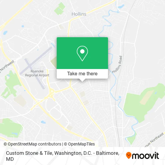
See Custom Stone & Tile, Roanoke, on the map
Public Transit to Custom Stone & Tile in Roanoke
Wondering how to get to Custom Stone & Tile in Roanoke? Moovit helps you find the best way to get to Custom Stone & Tile with step-by-step directions from the nearest public transit station.
Moovit provides free maps and live directions to help you navigate through your city. View schedules, routes, timetables, and find out how long does it take to get to Custom Stone & Tile in real time.
Looking for the nearest stop or station to Custom Stone & Tile? Check out this list of stops closest to your destination: Williamson Sb at Yardley; Williamson Nb at Maplelawn; Hershberger Wb at Hubert/Winsloe; Hershberger Eb at Hubert/Winsloe.
Bus: 25, 22, 21, 26.
Want to see if there’s another route that gets you there at an earlier time? Moovit helps you find alternative routes or times. Get directions from and directions to Custom Stone & Tile easily from the Moovit App or Website.
We make riding to Custom Stone & Tile easy, which is why over 1.5 million users, including users in Roanoke, trust Moovit as the best app for public transit. You don’t need to download an individual bus app or train app, Moovit is your all-in-one transit app that helps you find the best bus time or train time available.
For information on prices of bus and train, costs and ride fares to Custom Stone & Tile, please check the Moovit app.
Use the app to navigate to popular places including to the airport, hospital, stadium, grocery store, mall, coffee shop, school, college, and university.
Custom Stone & Tile Address: 3404 Birchlawn Ave NW Roanoke, VA 24012 street in Roanoke
- Valley View,
- Home Remodeling Concepts,
- Hurt Counseling Center,
- Emmanuel Wesleyan Church,
- Weight Watchers,
- El Puente Immigrant Connection,
- Oakdale,
- Chad Portnova C&M Enterprises,
- Espinosa Construction,
- St. Thomas of Canterbury Anglican Catholic Church,
- Auto Detailing Perfection,
- Preston Estates,
- Milner, James B,
- Camacho Contractors,
- Friendship Retirement Community Independent Living Apartments,
- EC 's,
- Wellington I - IV,
- Yardley Square,
- New Harvest Family Worship,
- Lamano Agency
Places Near Custom Stone & Tile (Roanoke)
- PG Mall, Prince George's County,
- Rock Creek Tennis Center, Washington,
- Sibley Memorial Hospital, Washington,
- M&T Bank Stadium, Baltimore,
- Amazon Hq2, Arlington County,
- Warner Theatre, Washington,
- Pennsylvania Ave NW (3rd st and pennsylvania), Washington,
- Westfield Montgomery Mall, Montgomery County,
- Basilica of the National Shrine, Washington,
- The Anthem, Washington,
- Washington National Cathedral, Washington,
- Museum Of The Bible, Washington,
- National Zoo, Washington,
- Marriott Marquis Washington, DC, Washington,
- Camden Yards, Baltimore,
- Capital One Arena, Washington,
- Washington DC VA Medical Center, Washington,
- Georgetown, Washington,
- National Museum of African American History and Culture, Washington,
- National Mall, Washington
How to get to popular places in Washington, D.C. - Baltimore, MD with public transit
Get around Roanoke by public transit!
Traveling around Roanoke has never been so easy. See step by step directions as you travel to any attraction, street or major public transit station. View bus and train schedules, arrival times, service alerts and detailed routes on a map, so you know exactly how to get to anywhere in Roanoke.
When traveling to any destination around Roanoke use Moovit's Live Directions with Get Off Notifications to know exactly where and how far to walk, how long to wait for your line, and how many stops are left. Moovit will alert you when it's time to get off — no need to constantly re-check whether yours is the next stop.
Wondering how to use public transit in Roanoke or how to pay for public transit in Roanoke? Moovit public transit app can help you navigate your way with public transit easily, and at minimum cost. It includes public transit fees, ticket prices, and costs. Looking for a map of Roanoke public transit lines? Moovit public transit app shows all public transit maps in Roanoke with all Bus, Train, Metro, Light Rail and Ferry routes and stops on an interactive map.
Washington, D.C. - Baltimore, MD has 5 transit type(s), including: Bus, Train, Metro, Light Rail and Ferry, operated by several transit agencies, including WMATA, Montgomery County Ride On, Fairfax Connector, TheBus, PRTC, DASH - Alexandria, Arlington Transit (ART), RTA of Central Maryland, MDOT MTA, MDOT MTA Light RailLink, MDOT MTA Commuter Bus, MDOT MTA Local Bus, FXBGO!, Virginia Railway Express (VRE) and MARC