How to get to Cyber Gun by bus?
Click on the bus route to see step by step directions with maps, line arrival times and updated time schedules.
From L'Archimiste, Reims
42 minFrom Dr Dessertenne, Sillery
34 minFrom Point.P-Reims la Pompelle, Reims
68 minFrom Spirit S Art, Sillery
38 minFrom Relais Nautique, Sillery
36 minFrom Kiloutou, Reims
56 minFrom Mousse Pierre, Sillery
34 minFrom Taissy, Taissy
26 minFrom Le Relais de, Sillery
44 minFrom Tours in Champagne - Stéphane Demissy, Sillery
36 min
Bus stops near Cyber Gun in Reims
Bus lines to Cyber Gun in Reims
- O1, Moulin Housse,VIEW
- TRAM, Leon Blum,VIEW
- U1, C.C. Cernay,VIEW
- U2, Route De Witry,VIEW
- U8, La Couturelle,VIEW
- U9, C.C. Cormontreuil,VIEW
- U3, Maurencienne,VIEW
- U7, Hopital Debre,VIEW
- C, Gare Centre,VIEW
- 20, U20-GARE CLAIRMARAIS <> FACULTE DES SCIENCES,VIEW
- E1, EXPRESS 1 - CORMICY <> GARE CLAIRMARAIS,VIEW
- E6, EXPRESS 6 - VILLE EN TARDENOIS <> GARE CLAIRMARAIS,VIEW
- E7, EXPRESS 7 - FISMES <> GARE CLAIRMARAIS,VIEW
- 22, U22-NEUVILETTE MAIRIE <> ROYALE,VIEW
- 23, U23-ODILE MADELIN <> ROYALE,VIEW
- E5, Cathedrale,VIEW
- U4, Orgeval,VIEW
- U6, Croix Blandin,VIEW
- E2, St-Etienne/Sui.,VIEW
- E3, Saint-Symphorien,VIEW
What are the closest stations to Cyber Gun?
The closest stations to Cyber Gun are:
- Opera-Cathedrale is 422 meters away, 6 min walk.
- Vernouillet is 469 meters away, 7 min walk.
- Etape is 613 meters away, 8 min walk.
- Gare Clairmarais is 674 meters away, 9 min walk.
- Royale is 753 meters away, 10 min walk.
- Cathedrale is 774 meters away, 11 min walk.
- Gare De Reims - Centre is 804 meters away, 11 min walk.
- Saint-Symphorien is 848 meters away, 11 min walk.
Which bus lines stop near Cyber Gun?
These bus lines stop near Cyber Gun: O1, U9.
What’s the nearest bus station to Cyber Gun in Reims?
The nearest bus station to Cyber Gun in Reims is Opera-Cathedrale. It’s a 6 min walk away.
What time is the first light rail to Cyber Gun in Reims?
The TRAM is the first light rail that goes to Cyber Gun in Reims. It stops nearby at 5:14 AM.
What time is the last light rail to Cyber Gun in Reims?
The TRAM is the last light rail that goes to Cyber Gun in Reims. It stops nearby at 12:57 AM.
What time is the first bus to Cyber Gun in Reims?
The U9 is the first bus that goes to Cyber Gun in Reims. It stops nearby at 5:21 AM.
What time is the last bus to Cyber Gun in Reims?
The O1 is the last bus that goes to Cyber Gun in Reims. It stops nearby at 12:43 AM.
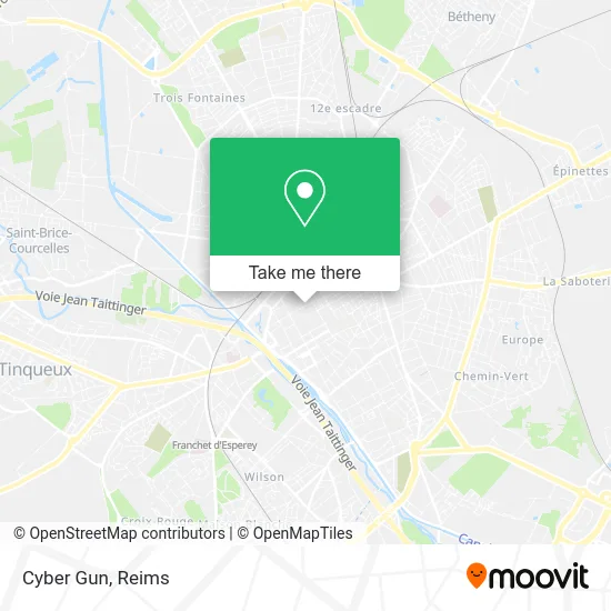
See Cyber Gun, Reims, on the map
Public Transit to Cyber Gun in Reims
Wondering how to get to Cyber Gun in Reims? Moovit helps you find the best way to get to Cyber Gun with step-by-step directions from the nearest public transit station.
Moovit provides free maps and live directions to help you navigate through your city. View schedules, routes, timetables, and find out how long does it take to get to Cyber Gun in real time.
Looking for the nearest stop or station to Cyber Gun? Check out this list of stops closest to your destination: Opera-Cathedrale; Vernouillet; Etape; Gare Clairmarais; Royale; Cathedrale; Gare De Reims - Centre; Saint-Symphorien.
Bus: O1, U9, TRAM, U1, U2, U8, U3, U7, C, 20, E1, E6, E7, 22, 23, E5.
Want to see if there’s another route that gets you there at an earlier time? Moovit helps you find alternative routes or times. Get directions from and directions to Cyber Gun easily from the Moovit App or Website.
We make riding to Cyber Gun easy, which is why over 1.5 million users, including users in Reims, trust Moovit as the best app for public transit. You don’t need to download an individual bus app or train app, Moovit is your all-in-one transit app that helps you find the best bus time or train time available.
For information on prices of bus, costs and ride fares to Cyber Gun, please check the Moovit app.
Use the app to navigate to popular places including to the airport, hospital, stadium, grocery store, mall, coffee shop, school, college, and university.
Cyber Gun Address: 26 Rue de l'Étape 51100 Reims street in Reims
- Lilou dit Non,
- Optique Lafayette Reims,
- Gie de la Galerie de L Étape,
- Le Quetzal,
- Bédérama,
- Gatsbi,
- Minelli,
- La Grignotte,
- Bdj Reims,
- Les Gourmandises de Gauthier,
- Sarl K2m,
- Le Temps et L or,
- L Univers du Mobile,
- Appartement 16,
- Le Comptoir de Mathilde Reims,
- Boutique Terre de Fées Reims,
- So Fille,
- Camif Habitat,
- Caroll,
- Fonciere Investissement
Places Near Cyber Gun (Reims)
- E. Leclerc Champfleury, Champfleury,
- Tinqueux, Tinqueux,
- Leclerc, Saint-Brice-Courcelles,
- Parc de Champagne, Reims,
- Hôpital Debré, Reims,
- La Neuvillette, Reims,
- Moulin De La Housse, Reims,
- Bétheny, Bétheny,
- Ikea, Thillois,
- Campus Croix Rouge, Reims,
- Cormontreuil, Reims,
- Gare Tgv, Bezannes,
- Polyclinique Reims Bezannes, Bezannes,
- Hôpital Maison Blanche, Reims,
- St Remi, Reims,
- Bezannes, Bezannes,
- Parc Des Expositions, Reims,
- Croix Blandin, Reims,
- Carrefour, Tinqueux,
- CHU, Reims
How to get to popular places in Reims with public transit
Get around Reims by public transit!
Traveling around Reims has never been so easy. See step by step directions as you travel to any attraction, street or major public transit station. View bus and train schedules, arrival times, service alerts and detailed routes on a map, so you know exactly how to get to anywhere in Reims.
When traveling to any destination around Reims use Moovit's Live Directions with Get Off Notifications to know exactly where and how far to walk, how long to wait for your line, and how many stops are left. Moovit will alert you when it's time to get off — no need to constantly re-check whether yours is the next stop.
Wondering how to use public transit in Reims or how to pay for public transit in Reims? Moovit public transit app can help you navigate your way with public transit easily, and at minimum cost. It includes public transit fees, ticket prices, and costs. Looking for a map of Reims public transit lines? Moovit public transit app shows all public transit maps in Reims with all Bus and Light Rail routes and stops on an interactive map.
Reims has 2 transit type(s), including: Bus and Light Rail, operated by several transit agencies, including Transdev Reims