How to get to Cycle by bus?
Click on the bus route to see step by step directions with maps, line arrival times and updated time schedules.
From W Woolbright Rd / Jog Rd, Boynton Beach-Delray Beach
105 minFrom Mizner Park, Boca Raton
61 minFrom Pretty in Palm Beach, Boynton Beach-Delray Beach
74 minFrom Tri-Rail-Deerfield Beach Station, Deerfield Beach
123 minFrom Bethesda Hospital East-ER, Boynton Beach-Delray Beach
58 minFrom DXN Florida, Boynton Beach-Delray Beach
97 minFrom Boca Raton, FL, Boca Raton
59 minFrom Sensual Asian Massage, Boca Raton
71 min
How to get to Cycle by train?
Click on the train route to see step by step directions with maps, line arrival times and updated time schedules.
Bus stop near Cycle in Boca Raton
- CONGRESS AVE at CLINT MOORE RD, 14 min walk,VIEW
Train station near Cycle in Boca Raton
- Boca Raton Station, 39 min walk,VIEW
Bus lines to Cycle in Boca Raton
- 2, Rt 2 Northbound,VIEW
What are the closest stations to Cycle?
The closest stations to Cycle are:
- CONGRESS AVE at CLINT MOORE RD is 1122 yards away, 14 min walk.
- Boca Raton Station is 3250 yards away, 39 min walk.
Which bus lines stop near Cycle?
These bus lines stop near Cycle: 2, 94.
Which train line stops near Cycle?
TRIRAIL (Southbound To Miami Airport)
What’s the nearest bus station to Cycle in Boca Raton?
The nearest bus station to Cycle in Boca Raton is CONGRESS AVE at CLINT MOORE RD. It’s a 14 min walk away.
What time is the first train to Cycle in Boca Raton?
The TRIRAIL is the first train that goes to Cycle in Boca Raton. It stops nearby at 4:28 AM.
What time is the last train to Cycle in Boca Raton?
The TRIRAIL is the last train that goes to Cycle in Boca Raton. It stops nearby at 11:03 PM.
What time is the first bus to Cycle in Boca Raton?
The 2 is the first bus that goes to Cycle in Boca Raton. It stops nearby at 5:52 AM.
What time is the last bus to Cycle in Boca Raton?
The 2 is the last bus that goes to Cycle in Boca Raton. It stops nearby at 9:49 PM.
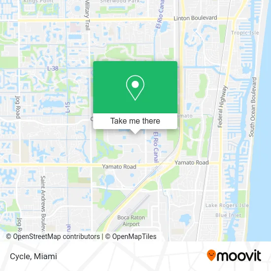
See Cycle, Boca Raton, on the map
Public Transit to Cycle in Boca Raton
Wondering how to get to Cycle in Boca Raton? Moovit helps you find the best way to get to Cycle with step-by-step directions from the nearest public transit station.
Moovit provides free maps and live directions to help you navigate through your city. View schedules, routes, timetables, and find out how long does it take to get to Cycle in real time.
Looking for the nearest stop or station to Cycle? Check out this list of stops closest to your destination: CONGRESS AVE at CLINT MOORE RD; Boca Raton Station.
Bus: 2, 94.Train: TRIRAIL.
Want to see if there’s another route that gets you there at an earlier time? Moovit helps you find alternative routes or times. Get directions from and directions to Cycle easily from the Moovit App or Website.
We make riding to Cycle easy, which is why over 1.5 million users, including users in Boca Raton, trust Moovit as the best app for public transit. You don’t need to download an individual bus app or train app, Moovit is your all-in-one transit app that helps you find the best bus time or train time available.
For information on prices of bus and train, costs and ride fares to Cycle, please check the Moovit app.
Use the app to navigate to popular places including to the airport, hospital, stadium, grocery store, mall, coffee shop, school, college, and university.
Cycle Address: 990 S Rogers Cir Boca Raton, FL 33487 street in Boca Raton
- Florida Elite Martial Arts,
- The Silverlogic,
- Ashley Chaiken Z & A Associates,
- Ras Title,
- Heroes Lawn Care,
- Top Dog Video,
- Chiropractor After Car Accident,
- GLM Healthcare Services,
- Sound Local Locksmith,
- Next Job at Home,
- South Florida Medical Corporation,
- Irecovery,
- Bluenergy Solar,
- Cold Air 117,
- Quickliquidity,
- Gelt Financial,
- Esr Employer Solutions Resources (Best Medical Resources),
- United Insurance Experts,
- Bello Estate Management,
- Tree Nation
Places Near Cycle (Boca Raton)
- Dolphin Mall Bus, Miami,
- Hard Rock Stadium, Miami Gardens,
- Little Havana, Miami,
- Zoo Miami, Miami,
- Miami Freedom Park, Miami,
- Aventura Mall, Miami,
- Miami VA Hospital, Miami,
- Aventura Mall, Miami Beach,
- Bayside Marketplace, Miami,
- Richard E. Gerstein Justice Building, Miami,
- Sawgrass Mall, Miami,
- Dolphin Mall, Miami,
- Keiser University Flagship Campus, West Palm Beach,
- Brickell City Centre, Miami,
- Sawgrass mall ( FL ), Miami Beach,
- Wynwood, Miami,
- Port of Miami Cruise Terminal, Miami,
- Miami-Dade County Courthouse, Miami,
- Miami Design District, Miami,
- Marlins Park, Miami
How to get to popular places in Miami with public transit
Get around Boca Raton by public transit!
Traveling around Boca Raton has never been so easy. See step by step directions as you travel to any attraction, street or major public transit station. View bus and train schedules, arrival times, service alerts and detailed routes on a map, so you know exactly how to get to anywhere in Boca Raton.
When traveling to any destination around Boca Raton use Moovit's Live Directions with Get Off Notifications to know exactly where and how far to walk, how long to wait for your line, and how many stops are left. Moovit will alert you when it's time to get off — no need to constantly re-check whether yours is the next stop.
Wondering how to use public transit in Boca Raton or how to pay for public transit in Boca Raton? Moovit public transit app can help you navigate your way with public transit easily, and at minimum cost. It includes public transit fees, ticket prices, and costs. Looking for a map of Boca Raton public transit lines? Moovit public transit app shows all public transit maps in Boca Raton with all Bus, Train, Light Rail and Ferry routes and stops on an interactive map.
Miami has 4 transit type(s), including: Bus, Train, Light Rail and Ferry, operated by several transit agencies, including Broward County Transit, Miami-Dade Transit, Metrorail, Palm Tran, Tri-Rail, Brightline, MARTY, City of Homestead Trolley, Key West Transit, Treasure Coast Connector, GoLine IRT, Amtrak, Greyhound-us, FlixBus-us and Aventura Express Shuttle Bus