How to get to Cypsa by bus?
Click on the bus route to see step by step directions with maps, line arrival times and updated time schedules.
From Centro Comercial Loranca, Área Metropolitana De Madrid Y Corredor Del Henares
93 minFrom Cobo Calleja, Fuenlabrada
80 minFrom Tejidos Paredes, Fuenlabrada
81 minFrom Centro Comercial Xanadú, Arroyomolinos
107 minFrom Hospital HM Puerta del Sur, Móstoles
86 minFrom Fuenlabrada-Madrid, Fuenlabrada
44 minFrom FABRIK, Humanes De Madrid
40 minFrom Hospital Universitario De Fuenlabrada., Área Metropolitana De Madrid Y Corredor Del Henares
51 minFrom Avenida del Vivero S/N, Fuenlabrada
57 minFrom Piscinas Municipales De Fuenlabrada, Área Metropolitana De Madrid Y Corredor Del Henares
46 min
Bus stops near Cypsa in Griñón
Bus lines to Cypsa in Griñón
What are the closest stations to Cypsa?
The closest stations to Cypsa are:
- Av. Cañada Toledana - Jardines Alhambra is 215 meters away, 4 min walk.
- Av. Humanes - Luna is 681 meters away, 9 min walk.
Which bus line stops near Cypsa?
468 (Pza. Alcalde Juan Vergara - Leganés→Rafael Alberti - Pablo Neruda)
What’s the nearest bus station to Cypsa in Griñón?
The nearest bus station to Cypsa in Griñón is Av. Cañada Toledana - Jardines Alhambra. It’s a 4 min walk away.
What time is the first bus to Cypsa in Griñón?
The N807 is the first bus that goes to Cypsa in Griñón. It stops nearby at 3:20 AM.
What time is the last bus to Cypsa in Griñón?
The N807 is the last bus that goes to Cypsa in Griñón. It stops nearby at 3:20 AM.
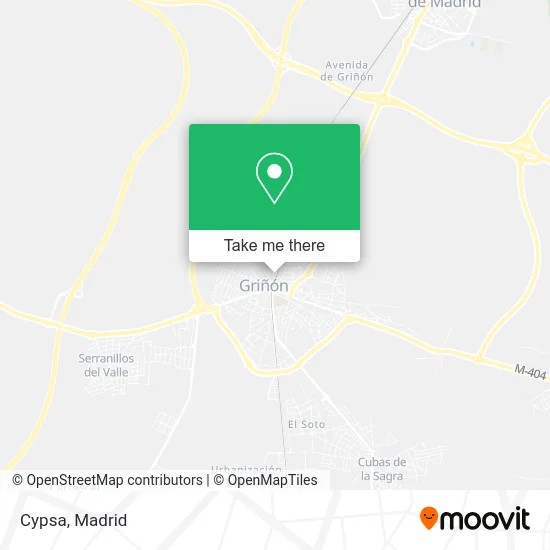
See Cypsa, Griñón, on the map
Public Transit to Cypsa in Griñón
Wondering how to get to Cypsa in Griñón? Moovit helps you find the best way to get to Cypsa with step-by-step directions from the nearest public transit station.
Moovit provides free maps and live directions to help you navigate through your city. View schedules, routes, timetables, and find out how long does it take to get to Cypsa in real time.
Looking for the nearest stop or station to Cypsa? Check out this list of stops closest to your destination: Av. Cañada Toledana - Jardines Alhambra; Av. Humanes - Luna.
Bus: 468, 460, 470, N807.
Want to see if there’s another route that gets you there at an earlier time? Moovit helps you find alternative routes or times. Get directions from and directions to Cypsa easily from the Moovit App or Website.
We make riding to Cypsa easy, which is why over 1.5 million users, including users in Griñón, trust Moovit as the best app for public transit. You don’t need to download an individual bus app or train app, Moovit is your all-in-one transit app that helps you find the best bus time or train time available.
For information on prices of bus and metro, costs and ride fares to Cypsa, please check the Moovit app.
Use the app to navigate to popular places including to the airport, hospital, stadium, grocery store, mall, coffee shop, school, college, and university.
Cypsa Address: Urbanización Nuevo Griñón, 6 28971 Griñón street in Griñón
- La Nueva Cubierta,
- Chester Grinon,
- Gooding Grinon,
- Feria,
- Puesto Ahmed,
- Thermas Grinon,
- Stefan Toader,
- Golden Spa,
- R.B.P. e Hijos Artesano,
- Calle Jardines de la Granja,
- Fundacion Pia Autonoma Virgen de los Dolores,
- Clínica Dental Savigna,
- Huve Sociedad Patrimonial,
- Amazon Locker-Apaolaza,
- Aralla Aerocetreria,
- Lemas Artesanias,
- Polígono Industrial Goñi s/n,
- Agrupación Deportiva Venture,
- Alimentación Express a,
- Electricista Madrid
Places Near Cypsa (Griñón)
- Rastro De Madrid, Área Metropolitana De Madrid Y Corredor Del Henares,
- Calle de López de Hoyos 169, Madrid,
- Sala La Riviera, Madrid,
- Hospital Clínico Universitario San Carlos, Madrid,
- Hospital Universitario Ramón y Cajal, Madrid,
- Centro Comercial La Gavia, Área Metropolitana De Madrid Y Corredor Del Henares,
- Plaza Mayor, Madrid,
- Nassica, Área Metropolitana De Madrid Y Corredor Del Henares,
- Hospital Universitario La Paz, Madrid,
- Plenilunio, Área Metropolitana De Madrid Y Corredor Del Henares,
- Centro Comercial Oasiz Madrid, Área Metropolitana De Madrid Y Corredor Del Henares,
- Tres Aguas, Alcorcón,
- Wizink Center, Madrid,
- Estadio Wanda Metropolitano, Área Metropolitana De Madrid Y Corredor Del Henares,
- Centro Comercial Islazul, Área Metropolitana De Madrid Y Corredor Del Henares,
- Centro Comercial La Vaguada, Área Metropolitana De Madrid Y Corredor Del Henares,
- Palacio De Vistalegre, Área Metropolitana De Madrid Y Corredor Del Henares,
- Estacion de Chamartin, Madrid,
- Mendez Alvaro, Madrid,
- Mercadillo de Majadahonda, Majadahonda
How to get to popular places in Madrid with public transit
Get around Griñón by public transit!
Traveling around Griñón has never been so easy. See step by step directions as you travel to any attraction, street or major public transit station. View bus and train schedules, arrival times, service alerts and detailed routes on a map, so you know exactly how to get to anywhere in Griñón.
When traveling to any destination around Griñón use Moovit's Live Directions with Get Off Notifications to know exactly where and how far to walk, how long to wait for your line, and how many stops are left. Moovit will alert you when it's time to get off — no need to constantly re-check whether yours is the next stop.
Wondering how to use public transit in Griñón or how to pay for public transit in Griñón? Moovit public transit app can help you navigate your way with public transit easily, and at minimum cost. It includes public transit fees, ticket prices, and costs. Looking for a map of Griñón public transit lines? Moovit public transit app shows all public transit maps in Griñón with all Bus, Train, Metro and Light Rail routes and stops on an interactive map.
Madrid has 4 transit type(s), including: Bus, Train, Metro and Light Rail, operated by several transit agencies, including Metro de Madrid, Metro Ligero, Tranvía de Parla, Renfe Cercanías - Servicios de Autobús especiales, Renfe Cercanias, Renfe Cercanías, EMT, Interurbanos, Urbanos de Alcalá de Henares, Urbanos de Alcobendas, Urbanos de Alcorcón, Urbanos de Algete, Urbanos de Aranjuez, Urbanos de Arganda del Rey and Urbanos de Arroyomolinos