Directions to DAMAR Charter School (Indianapolis City (Balance)) with public transportation
The following transit lines have routes that pass near DAMAR Charter School
 Bus: 24.
How to get to DAMAR Charter School by bus?
Click on the bus route to see step by step directions with maps, line arrival times and updated time schedules.
From Indianapolis, Indianapolis City (Balance)
108 minFrom Envive Healthcare, Indianapolis City (Balance)
121 minFrom Rockitcoin, Indianapolis City (Balance)
108 minFrom Budget, Indianapolis City (Balance)
91 minFrom Amazon Fulfillment IND4, Indianapolis City (Balance)
149 minFrom S Harding St / W Raymond St, Indianapolis City (Balance)
62 minFrom I-465 at 10th Street, Indianapolis City (Balance)
105 minFrom Lynhurst And Rockville Road, Indianapolis City (Balance)
109 min
Bus stop near DAMAR Charter School in Indianapolis City (Balance)
- Gatwick Dr & Decatur Blvd, 5 min walk,VIEW
Bus lines to DAMAR Charter School in Indianapolis City (Balance)
- 24, Ameriplex,VIEW
What are the closest stations to DAMAR Charter School?
The closest stations to DAMAR Charter School are:
- Gatwick Dr & Decatur Blvd is 355 yards away, 5 min walk.
Which bus line stops near DAMAR Charter School?
24 (Ameriplex)
What’s the nearest bus station to DAMAR Charter School in Indianapolis City (Balance)?
The nearest bus station to DAMAR Charter School in Indianapolis City (Balance) is Gatwick Dr & Decatur Blvd. It’s a 5 min walk away.
What time is the first bus to DAMAR Charter School in Indianapolis City (Balance)?
The 24 is the first bus that goes to DAMAR Charter School in Indianapolis City (Balance). It stops nearby at 5:14 AM.
What time is the last bus to DAMAR Charter School in Indianapolis City (Balance)?
The 24 is the last bus that goes to DAMAR Charter School in Indianapolis City (Balance). It stops nearby at 10:06 PM.
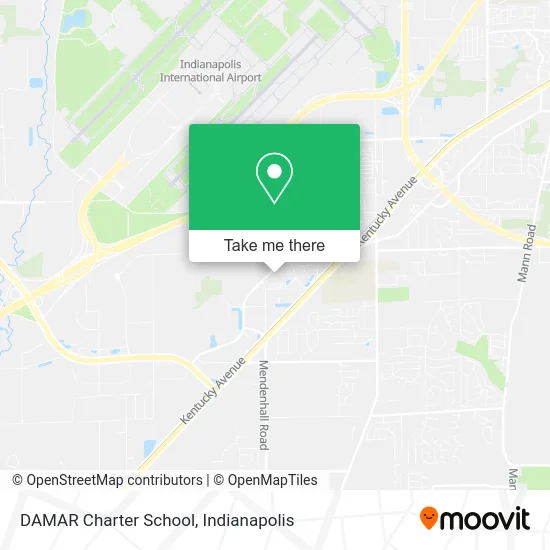
See DAMAR Charter School, Indianapolis City (Balance), on the map
Public Transit to DAMAR Charter School in Indianapolis City (Balance)
Wondering how to get to DAMAR Charter School in Indianapolis City (Balance)? Moovit helps you find the best way to get to DAMAR Charter School with step-by-step directions from the nearest public transit station.
Moovit provides free maps and live directions to help you navigate through your city. View schedules, routes, timetables, and find out how long does it take to get to DAMAR Charter School in real time.
Looking for the nearest stop or station to DAMAR Charter School? Check out this list of stops closest to your destination: Gatwick Dr & Decatur Blvd.
Bus: 24.
Want to see if there’s another route that gets you there at an earlier time? Moovit helps you find alternative routes or times. Get directions from and directions to DAMAR Charter School easily from the Moovit App or Website.
We make riding to DAMAR Charter School easy, which is why over 1.5 million users, including users in Indianapolis City (Balance), trust Moovit as the best app for public transit. You don’t need to download an individual bus app or train app, Moovit is your all-in-one transit app that helps you find the best bus time or train time available.
For information on prices of bus, costs and ride fares to DAMAR Charter School, please check the Moovit app.
Use the app to navigate to popular places including to the airport, hospital, stadium, grocery store, mall, coffee shop, school, college, and university.
Location: Indianapolis City (Balance), Indianapolis
- Whitesell Corporation,
- Holladay Properties Services Midwest,
- Hydro-Gear,
- Master Cash & Carry,
- Law Enforcement Training Institute,
- TLC Express,
- Challenger Learning Center,
- Toa USA,
- Hoosier Lottery Distribution Center,
- St Vincent Hosp & Health Care Center,
- Indiana State Police Commercial Vehicle Enforcement,
- USPS INDIANAPOLIS P&DC,
- Bluegrass Equipment and Small Engine Service,
- Performance Stoneworks,
- FedEx Freight - IND,
- Valley Mills, Indiana,
- Triton Water Solutions,
- 4444 Decatur Blvd,
- Department of Motor Vehicles,
- SMC Urgent Care
Places Near DAMAR Charter School (Indianapolis City (Balance))
- I-465 / I-65 Interchange, Indianapolis City (Balance),
- Eskenazi Hospital, Indianapolis City (Balance),
- Methodist Hospital of Indianapolis, Indianapolis City (Balance),
- 119 W 19th St Parking, Indianapolis City (Balance),
- I U Health Methodist Hospital, Indianapolis City (Balance),
- Lilly Corporate Center (Eli Lilly & Co), Indianapolis City (Balance),
- Indiana, Indianapolis City (Balance),
- Plainfield, IN, Plainfield,
- Lucas Oil Stadium, Indianapolis City (Balance),
- Indianapolis Airport Zone 2, Indianapolis City (Balance),
- THE BALT, Indianapolis City (Balance),
- St. Vincent entrance #1, Indianapolis City (Balance),
- Cotter's Massage Parlor With Happy Endings, Indianapolis City (Balance),
- Indianapolis Motor Speedway, Speedway,
- Indiana Convention Center, Indianapolis City (Balance),
- Gainbridge Fieldhouse, Indianapolis City (Balance),
- Train Ride At Castleton Mall, Indianapolis City (Balance),
- Jersey Barn, Indianapolis City (Balance),
- St. Vincent Hospital - Indianapolis, Indianapolis City (Balance),
- Castleton Square Mall, Indianapolis
How to get to popular places in Indianapolis with public transit
Get around Indianapolis City (Balance) by public transit!
Traveling around Indianapolis City (Balance) has never been so easy. See step by step directions as you travel to any attraction, street or major public transit station. View bus and train schedules, arrival times, service alerts and detailed routes on a map, so you know exactly how to get to anywhere in Indianapolis City (Balance).
When traveling to any destination around Indianapolis City (Balance) use Moovit's Live Directions with Get Off Notifications to know exactly where and how far to walk, how long to wait for your line, and how many stops are left. Moovit will alert you when it's time to get off — no need to constantly re-check whether yours is the next stop.
Wondering how to use public transit in Indianapolis City (Balance) or how to pay for public transit in Indianapolis City (Balance)? Moovit public transit app can help you navigate your way with public transit easily, and at minimum cost. It includes public transit fees, ticket prices, and costs. Looking for a map of Indianapolis City (Balance) public transit lines? Moovit public transit app shows all public transit maps in Indianapolis City (Balance) with all bus routes and stops on an interactive map.
Indianapolis has 1 transit type(s), including: bus, operated by several transit agencies, including IndyGo, FlixBus-us and Greyhound-us