Directions to DHL Express ServicePoint (San Andrés Cholula) with public transportation
The following transit lines have routes that pass near DHL Express ServicePoint
 Bus: RUTA 33, RUTA 4, RUTA 67, RUTA AZTECA A, RUTA AZTECA B.
How to get to DHL Express ServicePoint by bus?
Click on the bus route to see step by step directions with maps, line arrival times and updated time schedules.
From chachapa, Puebla
56 minFrom Colegio La Salle, Puebla
51 minFrom Fraccionamiento Puerta de Hierro, San Pedro Cholula
40 minFrom Juzgado Municipal de lo Civil y lo Penal San Andrés Cholula, Santa Isabel Cholula
56 minFrom Gonzalo Bautista, Puebla
30 minFrom Gran Bodega Balcones del Sur, Ocoyucan
45 minFrom Tianguis San Martin Texmelucan, Ocoyucan
48 minFrom Villa Lazaro Cardenas (La Uno), puebla, San Pedro Cholula
44 minFrom Universidad De Las Américas - Puebla, San Jerónimo Tecuanipan
45 minFrom Santo Tomas Chautla, Puebla
63 min
Bus stops near DHL Express ServicePoint in San Andrés Cholula
Bus lines to DHL Express ServicePoint in San Andrés Cholula
- TLAXCALANCINGO - CENTRO (8 PONIENTE), Tlaxcalcingo - Centro,VIEW
- RUTA 2A, Ramal 1, Col. 90 Encinos - San Miguel Las Pajaritas,VIEW
- RUTA 38, Ramal 1 San José Los Cerritos - Santa Bárbara (Ida),VIEW
- RUTA 38A, Ramal 1 San Sebastián Aparicio - Centro (Ida),VIEW
- RUTA 54A, Ramal 1, La Vista - Centro,VIEW
- RUTA 58, Ramal 2, La Resurrección - Centro (Regreso),VIEW
- RUTA AZTECA A, Ramal 2 Unidad San Ángel - La Noria,VIEW
- RUTA AZTECA B, Ramal 1, Lomas Flor Del Bosque - Villa De Los Ángeles (Regreso),VIEW
- RUTA AZTECA C, Ramal 1, San Esteban - Villa De Los Ángeles,VIEW
- RUTA LA JOSEFINA, Ramal 1 Lím. Est. Pue - Tlax - San Pablo De Los Frailes (Ida),VIEW
- RUTA 1, Ramal Infonavit Amalucan - Barrio De Santiago,VIEW
- RUTA 35, Ramal 1, Heroes Del 5 De Mayo- Lomas Del Cristo,VIEW
- RUTA 37, Ramal 2, Pedregal - Barrio De Santiago,VIEW
- RUTA 44, Ramal 2, Las Cuartillas - La Joya (Ida),VIEW
- RUTA 52, Ramal 1, Bosques De San Sebastián - Las Cuartillas,VIEW
- RUTA 68B, Ramal 1, San Miguel Xonacatepec - San Pablo De Los Frailes,VIEW
- RUTA JAGUARES, Ramal 1, Galaxia La Calera - Las Cuartillas,VIEW
- RUTA 19, Ramal 2, 10 De Mayo - Centro,VIEW
- RUTA 23A, Ramal 1, El Encinar - San Miguelito,VIEW
- RUTA 68C, Ramal 1, Colonia Del Valle - Barrio De San Miguelito,VIEW
What are the closest stations to DHL Express ServicePoint?
The closest stations to DHL Express ServicePoint are:
- Avenida 8 Oriente, 77 is 221 meters away, 4 min walk.
- Calle 10 Oriente 17 is 325 meters away, 5 min walk.
- Avenida 10 Poniente 102 is 423 meters away, 6 min walk.
- Calle 4 Norte, 809 is 489 meters away, 7 min walk.
- Calle 5 Norte, 340 is 497 meters away, 7 min walk.
- Calle 2 Norte, 1327 is 542 meters away, 8 min walk.
- Avenida 12 Oriente, 409 is 619 meters away, 9 min walk.
Which bus lines stop near DHL Express ServicePoint?
These bus lines stop near DHL Express ServicePoint: RUTA 33, RUTA 4, RUTA 67, RUTA AZTECA A, RUTA AZTECA B, RUTA CONMEMORATIVO 76, TLAXCALANCINGO - CENTRO (8 PONIENTE).
What’s the nearest bus station to DHL Express ServicePoint in San Andrés Cholula?
The nearest bus station to DHL Express ServicePoint in San Andrés Cholula is Avenida 8 Oriente, 77. It’s a 4 min walk away.
What time is the first bus to DHL Express ServicePoint in San Andrés Cholula?
The RUTA 38A is the first bus that goes to DHL Express ServicePoint in San Andrés Cholula. It stops nearby at 5:00 AM.
What time is the last bus to DHL Express ServicePoint in San Andrés Cholula?
The RUTA AZTECA C is the last bus that goes to DHL Express ServicePoint in San Andrés Cholula. It stops nearby at 12:00 AM.
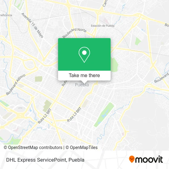
See DHL Express ServicePoint, San Andrés Cholula, on the map
Public Transit to DHL Express ServicePoint in San Andrés Cholula
Wondering how to get to DHL Express ServicePoint in San Andrés Cholula? Moovit helps you find the best way to get to DHL Express ServicePoint with step-by-step directions from the nearest public transit station.
Moovit provides free maps and live directions to help you navigate through your city. View schedules, routes, timetables, and find out how long does it take to get to DHL Express ServicePoint in real time.
Looking for the nearest stop or station to DHL Express ServicePoint? Check out this list of stops closest to your destination: Avenida 8 Oriente; Calle 10 Oriente 17; Avenida 10 Poniente 102; Calle 4 Norte; Calle 5 Norte; Calle 2 Norte; Avenida 12 Oriente.
Bus: RUTA 33, RUTA 4, RUTA 67, RUTA AZTECA A, RUTA AZTECA B, RUTA CONMEMORATIVO 76, TLAXCALANCINGO - CENTRO (8 PONIENTE), RUTA 2A, RUTA 38, RUTA 38A, RUTA 54A, RUTA 58, RUTA AZTECA C, RUTA LA JOSEFINA, RUTA 1, RUTA JAGUARES, RUTA 19, RUTA 23A, RUTA 68C, CHACHAPA - CENTRO.
Want to see if there’s another route that gets you there at an earlier time? Moovit helps you find alternative routes or times. Get directions from and directions to DHL Express ServicePoint easily from the Moovit App or Website.
We make riding to DHL Express ServicePoint easy, which is why over 1.5 million users, including users in San Andrés Cholula, trust Moovit as the best app for public transit. You don’t need to download an individual bus app or train app, Moovit is your all-in-one transit app that helps you find the best bus time or train time available.
For information on prices of bus, costs and ride fares to DHL Express ServicePoint, please check the Moovit app.
Use the app to navigate to popular places including to the airport, hospital, stadium, grocery store, mall, coffee shop, school, college, and university.
DHL Express ServicePoint Address: 4 Oriente 15 B Centro street in San Andrés Cholula
- Catedral,
- Calle 2 Norte 403-14,
- Miniso,
- La Plaza,
- Color Process Laboratorio Fotográfico,
- Saborcito Corazón Restaurante Fonda Mexicana,
- Dulceria La Gran Fama,
- Palacio Municipal,
- Restaurante Casa de los Muñecos Centro,
- Museo De La Revolución Mexicana, Casa De Los Hermanos Serdán,
- Las Momias,
- Capilla del Rosario Octava Maravilla del Mundo,
- Calle 5 de Mayo,
- Plaza Puebla,
- Casa de los Muñecos,
- Avenida 2 Sur Esquina Av Juan de Palafox y Mendoza 203,
- Artemex Papel Picado,
- San Pedro Museo de Arte,
- Momias de la Victoria,
- Deportes Nuñez
Places Near DHL Express ServicePoint (San Andrés Cholula)
- Galerías Serdán, San Pedro Cholula,
- SAT, San Andrés Cholula,
- Hospital Traumatología y Ortopedia de Puebla, San Pedro Cholula,
- Centro Integral de Servicios CIS, San Andrés Cholula,
- Tres Cruces, Puebla,
- Parque Puebla, Puebla,
- Complejo Cultural Universitario, Ocoyucan,
- Centro de Desarrollo Comunitario Tres Cruces, Puebla,
- 25 Zona Militar, Puebla,
- Ciudad Universitaria, Puebla,
- Zona de los Fuertes, Puebla,
- Centro Comercial Angelópolis, San Andrés Cholula,
- Estadio Cuauhtémoc, Puebla,
- Hospital Imss La Margarita, Puebla,
- Plaza Las Animas, Puebla,
- Parque Ecologico, Pue., San Andrés Cholula,
- Secretaria de Finanzas, Puebla,
- Plaza Dorada Centro Comercial, Puebla,
- Hospital General Regional 36 IMSS San Alejandro, San Andrés Cholula,
- Ciudad Judicial del Estado de Puebla, San Andrés Cholula
How to get to popular places in Puebla with public transit
Get around San Andrés Cholula by public transit!
Traveling around San Andrés Cholula has never been so easy. See step by step directions as you travel to any attraction, street or major public transit station. View bus and train schedules, arrival times, service alerts and detailed routes on a map, so you know exactly how to get to anywhere in San Andrés Cholula.
When traveling to any destination around San Andrés Cholula use Moovit's Live Directions with Get Off Notifications to know exactly where and how far to walk, how long to wait for your line, and how many stops are left. Moovit will alert you when it's time to get off — no need to constantly re-check whether yours is the next stop.
Wondering how to use public transit in San Andrés Cholula or how to pay for public transit in San Andrés Cholula? Moovit public transit app can help you navigate your way with public transit easily, and at minimum cost. It includes public transit fees, ticket prices, and costs. Looking for a map of San Andrés Cholula public transit lines? Moovit public transit app shows all public transit maps in San Andrés Cholula with all bus routes and stops on an interactive map.
Puebla has 1 transit type(s), including: bus, operated by several transit agencies, including RUTA, RUTA Alimentadoras, Rutas Convencionales and Líneas temporales