Directions to DHL Express Service Point Springfield Gardens (Queens) with public transportation
The following transit lines have routes that pass near DHL Express Service Point Springfield Gardens
 Bus: Q111, Q6.
- Train: FAR ROCKAWAY BRANCH, LONG BEACH BRANCH, BABYLON BRANCH.
How to get to DHL Express Service Point Springfield Gardens by bus?
Click on the bus route to see step by step directions with maps, line arrival times and updated time schedules.
From 163-03 Horace Harding Expressway, Queens
63 minFrom Fresh Meadows, Queens
77 minFrom Forest Park, Queens
94 minFrom St. John's University, Queens
68 minFrom Resorts World Casino, Rockaway, NY, Queens
48 minFrom Queens College, Queens
73 minFrom Fresh Meadows, Queens
75 minFrom Howard Beach, Queens
89 minFrom LIRR - Jamaica Station, Queens
44 minFrom DMV Jamaica Office, Queens
53 min
How to get to DHL Express Service Point Springfield Gardens by train?
Click on the train route to see step by step directions with maps, line arrival times and updated time schedules.
Train stations near DHL Express Service Point Springfield Gardens in Queens
Bus stops near DHL Express Service Point Springfield Gardens in Queens
Bus lines to DHL Express Service Point Springfield Gardens in Queens
What are the closest stations to DHL Express Service Point Springfield Gardens?
The closest stations to DHL Express Service Point Springfield Gardens are:
- Rosedale is 885 yards away, 11 min walk.
- Eastern Rd/Building 250 is 1251 yards away, 15 min walk.
- 147 Av /Springfield Ln is 1912 yards away, 23 min walk.
- Laurelton is 2586 yards away, 31 min walk.
Which bus lines stop near DHL Express Service Point Springfield Gardens?
These bus lines stop near DHL Express Service Point Springfield Gardens: Q111, Q6.
Which train line stops near DHL Express Service Point Springfield Gardens?
FAR ROCKAWAY BRANCH (Far Rockaway)
What’s the nearest train station to DHL Express Service Point Springfield Gardens in Queens?
The nearest train station to DHL Express Service Point Springfield Gardens in Queens is Rosedale. It’s a 11 min walk away.
What’s the nearest bus station to DHL Express Service Point Springfield Gardens in Queens?
The nearest bus station to DHL Express Service Point Springfield Gardens in Queens is Eastern Rd/Building 250. It’s a 15 min walk away.
What time is the first train to DHL Express Service Point Springfield Gardens in Queens?
The FAR ROCKAWAY BRANCH is the first train that goes to DHL Express Service Point Springfield Gardens in Queens. It stops nearby at 3:25 AM.
What time is the last train to DHL Express Service Point Springfield Gardens in Queens?
The FAR ROCKAWAY BRANCH is the last train that goes to DHL Express Service Point Springfield Gardens in Queens. It stops nearby at 2:55 AM.
What time is the first bus to DHL Express Service Point Springfield Gardens in Queens?
The Q6 is the first bus that goes to DHL Express Service Point Springfield Gardens in Queens. It stops nearby at 3:14 AM.
What time is the last bus to DHL Express Service Point Springfield Gardens in Queens?
The Q6 is the last bus that goes to DHL Express Service Point Springfield Gardens in Queens. It stops nearby at 3:15 AM.
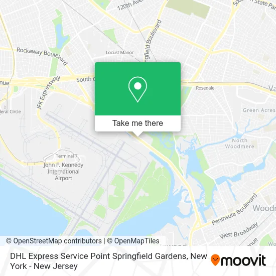
See DHL Express Service Point Springfield Gardens, Queens, on the map
Public Transit to DHL Express Service Point Springfield Gardens in Queens
Wondering how to get to DHL Express Service Point Springfield Gardens in Queens? Moovit helps you find the best way to get to DHL Express Service Point Springfield Gardens with step-by-step directions from the nearest public transit station.
Moovit provides free maps and live directions to help you navigate through your city. View schedules, routes, timetables, and find out how long does it take to get to DHL Express Service Point Springfield Gardens in real time.
Looking for the nearest stop or station to DHL Express Service Point Springfield Gardens? Check out this list of stops closest to your destination: Rosedale; Eastern Rd/Building 250; 147 Av /Springfield Ln; Laurelton.
Bus: Q111, Q6.Train: FAR ROCKAWAY BRANCH, LONG BEACH BRANCH, BABYLON BRANCH.
Want to see if there’s another route that gets you there at an earlier time? Moovit helps you find alternative routes or times. Get directions from and directions to DHL Express Service Point Springfield Gardens easily from the Moovit App or Website.
We make riding to DHL Express Service Point Springfield Gardens easy, which is why over 1.5 million users, including users in Queens, trust Moovit as the best app for public transit. You don’t need to download an individual bus app or train app, Moovit is your all-in-one transit app that helps you find the best bus time or train time available.
For information on prices of bus, subway and train, costs and ride fares to DHL Express Service Point Springfield Gardens, please check the Moovit app.
Use the app to navigate to popular places including to the airport, hospital, stadium, grocery store, mall, coffee shop, school, college, and university.
DHL Express Service Point Springfield Gardens Address: 230-19 Rockaway Blvd street in Queens
- Kintetsu World Express Usa,
- 225,
- 190,
- Forward Air, Inc.,
- Jeff Hunt Traditional Shotokan Karate Inc.,
- Tsa Local Headquarters - JFK,
- The Rock - TSA Headquarters,
- Usda,
- JFK Cargo-Amb Logistics Center,
- Forward Air Inc,
- Rosedale Soccer Field,
- The Pelham Market,
- Glass Christmas Ornaments,
- Public School 181,
- Pow-Tv.Net,
- Ups Supply Chain Solutions,
- P.S. 181q Brookfield,
- The Ups Store,
- Idlewild Cricket Ground,
- Swat International Usa
Places Near DHL Express Service Point Springfield Gardens (Queens)
- Hudson Yards, Manhattan,
- 1 Police Plaza, Manhattan,
- qqqq, Manhattan,
- Bellevue Hospital, Manhattan,
- Pier 83, Manhattan,
- Wall Street, Manhattan,
- Chinatown, Manhattan,
- 3 Stone St, Manhattan,
- 911 Memorial, Manhattan,
- Times Square, Manhattan,
- 66 John Street, Manhattan,
- Rockefeller Center, Manhattan,
- San Gennaro Feast, Manhattan,
- 111 Centre New York City Supreme Court, Manhattan,
- 26 Federal Plaza, Manhattan,
- Queens Center Mall, Queens,
- SoHo, Manhattan,
- Mountainside Hospital, Glen Ridge,
- 376 Hudson Street, Manhattan,
- Katz's Deli, Manhattan
How to get to popular places in New York - New Jersey with public transit
Get around Queens by public transit!
Traveling around Queens has never been so easy. See step by step directions as you travel to any attraction, street or major public transit station. View bus and train schedules, arrival times, service alerts and detailed routes on a map, so you know exactly how to get to anywhere in Queens.
When traveling to any destination around Queens use Moovit's Live Directions with Get Off Notifications to know exactly where and how far to walk, how long to wait for your line, and how many stops are left. Moovit will alert you when it's time to get off — no need to constantly re-check whether yours is the next stop.
Wondering how to use public transit in Queens or how to pay for public transit in Queens? Moovit public transit app can help you navigate your way with public transit easily, and at minimum cost. It includes public transit fees, ticket prices, and costs. Looking for a map of Queens public transit lines? Moovit public transit app shows all public transit maps in Queens with all Bus, Train, Subway, Light Rail, Ferry and Cable Car routes and stops on an interactive map.
New York - New Jersey has 6 transit type(s), including: Bus, Train, Subway, Light Rail, Ferry and Cable Car, operated by several transit agencies, including MTA Subway, Metro-North Railroad, LIRR, PATH, MTA New York City Transit - Express routes, MTA Bus, NJ Transit, NYC Ferry, NICE bus, Bee-Line Bus, NJ Transit Rail, Norwalk Transit District, Hartford Line, River Valley Transit and HART