How to get to DMS Express by bus?
Click on the bus route to see step by step directions with maps, line arrival times and updated time schedules.
From Alamo Rent A Car, Miami
69 minFrom SW 8th St & 122 Ave, Kendale Lakes-Tamiami
88 minFrom MDT Metrorail - Hialeah Station, Hialeah
93 minFrom Lejeune And Calle Ocho, Miami
67 minFrom 37th Ave & West Flagler St, Miami
69 minFrom Flagler, Miami
66 minFrom Barbara Goleman Senior High School's, Hialeah
86 minFrom Consulado General de Honduras en Miami, Miami
68 minFrom Palmetto General Hospital, Hialeah
66 minFrom Ponce De Leon Boulevard & Southwest 37th Avenue, Miami
60 min
How to get to DMS Express by train?
Click on the train route to see step by step directions with maps, line arrival times and updated time schedules.
Train station near DMS Express in North Westside
- Okeechobee, 6 min walk,VIEW
Bus stops near DMS Express in North Westside
Bus lines to DMS Express in North Westside
What are the closest stations to DMS Express?
The closest stations to DMS Express are:
- Okeechobee is 448 yards away, 6 min walk.
- Nw 84 Av & Nw 64 St is 524 yards away, 7 min walk.
- Nw 74 St & Nw 82 Pl is 1282 yards away, 16 min walk.
Which bus lines stop near DMS Express?
These bus lines stop near DMS Express: 36, 73, 87.
Which train line stops near DMS Express?
GREEN (Dadeland South Stat.rail Northbound→Palmetto Station Rail Northbound)
What’s the nearest train station to DMS Express in North Westside?
The nearest train station to DMS Express in North Westside is Okeechobee. It’s a 6 min walk away.
What’s the nearest bus station to DMS Express in North Westside?
The nearest bus station to DMS Express in North Westside is Nw 84 Av & Nw 64 St. It’s a 7 min walk away.
What time is the first train to DMS Express in North Westside?
The GREEN is the first train that goes to DMS Express in North Westside. It stops nearby at 5:00 AM.
What time is the last train to DMS Express in North Westside?
The GREEN is the last train that goes to DMS Express in North Westside. It stops nearby at 1:01 AM.
What time is the first bus to DMS Express in North Westside?
The 87 is the first bus that goes to DMS Express in North Westside. It stops nearby at 5:09 AM.
What time is the last bus to DMS Express in North Westside?
The 87 is the last bus that goes to DMS Express in North Westside. It stops nearby at 11:15 PM.
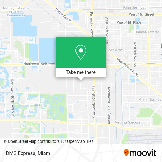
See DMS Express, North Westside, on the map
Public Transit to DMS Express in North Westside
Wondering how to get to DMS Express in North Westside? Moovit helps you find the best way to get to DMS Express with step-by-step directions from the nearest public transit station.
Moovit provides free maps and live directions to help you navigate through your city. View schedules, routes, timetables, and find out how long does it take to get to DMS Express in real time.
Looking for the nearest stop or station to DMS Express? Check out this list of stops closest to your destination: Okeechobee; Nw 84 Av & Nw 64 St; Nw 74 St & Nw 82 Pl.
Bus: 36, 73, 87, DLOOP2, DLOOP3.Train: GREEN.
Want to see if there’s another route that gets you there at an earlier time? Moovit helps you find alternative routes or times. Get directions from and directions to DMS Express easily from the Moovit App or Website.
We make riding to DMS Express easy, which is why over 1.5 million users, including users in North Westside, trust Moovit as the best app for public transit. You don’t need to download an individual bus app or train app, Moovit is your all-in-one transit app that helps you find the best bus time or train time available.
For information on prices of bus and train, costs and ride fares to DMS Express, please check the Moovit app.
Use the app to navigate to popular places including to the airport, hospital, stadium, grocery store, mall, coffee shop, school, college, and university.
DMS Express Address: 6423 NW 82nd Ave street in North Westside
- Gio Express,
- Ebay Store,
- Mosaic Cargo,
- Megala Blinds & Shades,
- Air & Heat Doctors,
- Techno Cabinets 305,
- TL of Florida,
- Ship Cargo,
- VIP Auto Rental Luxury & Economic Vehicles,
- Has Aviation,
- Allure Hospitality Suppliers Inc.,
- Viewlight LLC,
- FSV Construction,
- Auto Services International,
- JJ Travel Multiservices,
- Locksmith In Miami-Dade LTD,
- smart Trading International,
- Repo Depot South,
- Colonial Windows,
- Hair Pieces Toupee
Places Near DMS Express (North Westside)
- Hard Rock Stadium, Miami Gardens,
- Aventura Mall, Miami,
- Little Havana, Miami,
- Miami Freedom Park, Miami,
- Miami-Dade County Courthouse, Miami,
- Aventura Mall, Miami Beach,
- Sawgrass mall ( FL ), Miami Beach,
- Marlins Park, Miami,
- Port of Miami Cruise Terminal, Miami,
- Wynwood, Miami,
- Zoo Miami, Miami,
- Miami Design District, Miami,
- Dolphin Mall Bus, Miami,
- Keiser University Flagship Campus, West Palm Beach,
- Brickell City Centre, Miami,
- Richard E. Gerstein Justice Building, Miami,
- Miami VA Hospital, Miami,
- Bayside Marketplace, Miami,
- Dolphin Mall, Miami,
- Sawgrass Mall, Miami
How to get to popular places in Miami with public transit
Get around North Westside by public transit!
Traveling around North Westside has never been so easy. See step by step directions as you travel to any attraction, street or major public transit station. View bus and train schedules, arrival times, service alerts and detailed routes on a map, so you know exactly how to get to anywhere in North Westside.
When traveling to any destination around North Westside use Moovit's Live Directions with Get Off Notifications to know exactly where and how far to walk, how long to wait for your line, and how many stops are left. Moovit will alert you when it's time to get off — no need to constantly re-check whether yours is the next stop.
Wondering how to use public transit in North Westside or how to pay for public transit in North Westside? Moovit public transit app can help you navigate your way with public transit easily, and at minimum cost. It includes public transit fees, ticket prices, and costs. Looking for a map of North Westside public transit lines? Moovit public transit app shows all public transit maps in North Westside with all Bus, Train, Light Rail and Ferry routes and stops on an interactive map.
Miami has 4 transit type(s), including: Bus, Train, Light Rail and Ferry, operated by several transit agencies, including Broward County Transit, Miami-Dade Transit, Metrorail, Palm Tran, Tri-Rail, Brightline, MARTY, City of Homestead Trolley, Key West Transit, Treasure Coast Connector, GoLine IRT, Amtrak, Greyhound-us, FlixBus-us and Aventura Express Shuttle Bus