How to get to DMV Elite Clean by bus?
Click on the bus route to see step by step directions with maps, line arrival times and updated time schedules.
From PG Mall, Prince George's County
76 minFrom Pasquerilla Healthcare Center, Georgetown University, Washington
56 minFrom Arlington Central Library, Arlington County
72 minFrom Embassy Suites by Hilton Washington DC Georgetown, Washington
35 minFrom Basilica of the National Shrine, Washington
52 minFrom Wilson Blvd, Arlington County
73 minFrom 1919 Connecticut Ave NW, Washington
45 minFrom National Guard Bureau, Arlington County
86 minFrom Wegmans, Washington
70 minFrom Alfred Street Baptist Church, Alexandria
59 min
How to get to DMV Elite Clean by train?
Click on the train route to see step by step directions with maps, line arrival times and updated time schedules.
How to get to DMV Elite Clean by metro?
Click on the metro route to see step by step directions with maps, line arrival times and updated time schedules.
From PG Mall, Prince George's County
45 minFrom Arlington Central Library, Arlington County
41 minFrom Embassy Suites by Hilton Washington DC Georgetown, Washington
35 minFrom Basilica of the National Shrine, Washington
39 minFrom Wilson Blvd, Arlington County
38 minFrom 1919 Connecticut Ave NW, Washington
37 minFrom Wegmans, Washington
51 minFrom Alfred Street Baptist Church, Alexandria
58 min
Bus stops near DMV Elite Clean in Washington
Metro stations near DMV Elite Clean in Washington
Bus lines to DMV Elite Clean in Washington
What are the closest stations to DMV Elite Clean?
The closest stations to DMV Elite Clean are:
- Pennsylvania Av Se+11 St SE is 236 yards away, 4 min walk.
- K St Se+Potomac Av SE is 325 yards away, 5 min walk.
- 8 St Se+G St SE is 442 yards away, 6 min walk.
- Pennsylvania Av Se+Potomac Av SE is 507 yards away, 7 min walk.
- Potomac Av Se+14 St SE is 535 yards away, 7 min walk.
- Eastern Market is 647 yards away, 8 min walk.
- Navy Yard Metro Station is 1293 yards away, 16 min walk.
Which bus lines stop near DMV Elite Clean?
These bus lines stop near DMV Elite Clean: 612-WAR, C41, C51, C53, C55, D10.
Which train line stops near DMV Elite Clean?
NORTHEAST REGIONAL (Boston)
Which metro lines stop near DMV Elite Clean?
These metro lines stop near DMV Elite Clean: BLUE, ORANGE, SILVER.
What’s the nearest metro station to DMV Elite Clean in Washington?
The nearest metro station to DMV Elite Clean in Washington is Eastern Market. It’s a 8 min walk away.
What’s the nearest bus station to DMV Elite Clean in Washington?
The nearest bus station to DMV Elite Clean in Washington is Pennsylvania Av Se+11 St SE. It’s a 4 min walk away.
What time is the first metro to DMV Elite Clean in Washington?
The BLUE is the first metro that goes to DMV Elite Clean in Washington. It stops nearby at 5:08 AM.
What time is the last metro to DMV Elite Clean in Washington?
The ORANGE is the last metro that goes to DMV Elite Clean in Washington. It stops nearby at 12:22 AM.
What time is the first bus to DMV Elite Clean in Washington?
The C53 is the first bus that goes to DMV Elite Clean in Washington. It stops nearby at 3:00 AM.
What time is the last bus to DMV Elite Clean in Washington?
The C53 is the last bus that goes to DMV Elite Clean in Washington. It stops nearby at 3:20 AM.
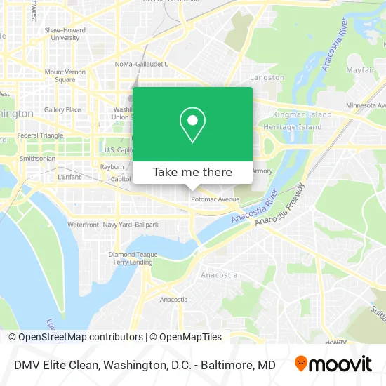
See DMV Elite Clean, Washington, on the map
Public Transit to DMV Elite Clean in Washington
Wondering how to get to DMV Elite Clean in Washington? Moovit helps you find the best way to get to DMV Elite Clean with step-by-step directions from the nearest public transit station.
Moovit provides free maps and live directions to help you navigate through your city. View schedules, routes, timetables, and find out how long does it take to get to DMV Elite Clean in real time.
Looking for the nearest stop or station to DMV Elite Clean? Check out this list of stops closest to your destination: Pennsylvania Av Se+11 St SE; K St Se+Potomac Av SE; 8 St Se+G St SE; Pennsylvania Av Se+Potomac Av SE; Potomac Av Se+14 St SE; Eastern Market; Navy Yard Metro Station.
Bus: 612-WAR, C41, C51, C53, C55, D10, D1X.Train: NORTHEAST REGIONAL.Metro: BLUE, ORANGE, SILVER, GREEN.
Want to see if there’s another route that gets you there at an earlier time? Moovit helps you find alternative routes or times. Get directions from and directions to DMV Elite Clean easily from the Moovit App or Website.
We make riding to DMV Elite Clean easy, which is why over 1.5 million users, including users in Washington, trust Moovit as the best app for public transit. You don’t need to download an individual bus app or train app, Moovit is your all-in-one transit app that helps you find the best bus time or train time available.
For information on prices of bus, metro and train, costs and ride fares to DMV Elite Clean, please check the Moovit app.
Use the app to navigate to popular places including to the airport, hospital, stadium, grocery store, mall, coffee shop, school, college, and university.
DMV Elite Clean Address: G St SE Washington, DC 20003 street in Washington
- Chavez Schools (Cesar Chavez Public Charter Schools),
- Tyler Elementary School,
- Salvation Army,
- Potomac Garden Apartments (Potomac Gardens),
- Frager's Ace Hardwarefrager's Ace Hardware,
- Potomac Gardens,
- Will of God,
- Kipling House,
- Watkins Elementary School,
- Duo Nomad,
- Watkins,
- Harbin Lawrence Attorney,
- Hill Center,
- Little Pearl,
- Jeni's Splendid Ice Creams,
- Calloway & Associates,
- PNC Bank,
- Ginza Karaoke BBQ Lounge,
- Robert F. Kennedy Department of Justice Building,
- Friendship Public Charter School (Friendship Primary Charter School Chamberlain Elementary Campus)
Places Near DMV Elite Clean (Washington)
- Warner Theatre, Washington,
- Camden Yards, Baltimore,
- Capital One Arena, Washington,
- M&T Bank Stadium, Baltimore,
- PG Mall, Prince George's County,
- Pennsylvania Ave NW (3rd st and pennsylvania), Washington,
- Museum Of The Bible, Washington,
- The Anthem, Washington,
- Marriott Marquis Washington, DC, Washington,
- Georgetown, Washington,
- Washington National Cathedral, Washington,
- National Zoo, Washington,
- National Museum of African American History and Culture, Washington,
- Washington DC VA Medical Center, Washington,
- Amazon Hq2, Arlington County,
- Rock Creek Tennis Center, Washington,
- Westfield Montgomery Mall, Montgomery County,
- Sibley Memorial Hospital, Washington,
- National Mall, Washington,
- Basilica of the National Shrine, Washington
How to get to popular places in Washington, D.C. - Baltimore, MD with public transit
Get around Washington by public transit!
Traveling around Washington has never been so easy. See step by step directions as you travel to any attraction, street or major public transit station. View bus and train schedules, arrival times, service alerts and detailed routes on a map, so you know exactly how to get to anywhere in Washington.
When traveling to any destination around Washington use Moovit's Live Directions with Get Off Notifications to know exactly where and how far to walk, how long to wait for your line, and how many stops are left. Moovit will alert you when it's time to get off — no need to constantly re-check whether yours is the next stop.
Wondering how to use public transit in Washington or how to pay for public transit in Washington? Moovit public transit app can help you navigate your way with public transit easily, and at minimum cost. It includes public transit fees, ticket prices, and costs. Looking for a map of Washington public transit lines? Moovit public transit app shows all public transit maps in Washington with all Bus, Train, Metro, Light Rail and Ferry routes and stops on an interactive map.
Washington, D.C. - Baltimore, MD has 5 transit type(s), including: Bus, Train, Metro, Light Rail and Ferry, operated by several transit agencies, including WMATA, Montgomery County Ride On, Fairfax Connector, TheBus, PRTC, DASH - Alexandria, Arlington Transit (ART), RTA of Central Maryland, MDOT MTA, MDOT MTA Light RailLink, MDOT MTA Commuter Bus, MDOT MTA Local Bus, FXBGO!, Virginia Railway Express (VRE) and MARC