How to get to DOUDOU by bus?
Click on the bus route to see step by step directions with maps, line arrival times and updated time schedules.
From Zhongnanhai, Yuelu District
44 minFrom Pozi Street/Banxiang Street Intersection, Yuelu District
27 minFrom Guapiao Mountain, Yuelu District
52 minFrom Sany Avenue 485, Kaifu District
29 minFrom Guansha Ridge Street Public Service Station, Yuelu District
39 minFrom Yue Fang iDmall, Tianxin District
29 minFrom Taiping Street, Yuelu District
27 minFrom Yuelu Academy, Yuelu District
42 minFrom Central South University South Campus - Fourth Teaching Building, Yuelu District
45 minFrom Changsha Mingde Middle School Branch, Yuhua District
43 min
How to get to DOUDOU by metro?
Click on the metro route to see step by step directions with maps, line arrival times and updated time schedules.
From Zhongnanhai, Yuelu District
52 minFrom Pozi Street/Banxiang Street Intersection, Yuelu District
27 minFrom Sany Avenue 485, Kaifu District
39 minFrom Guansha Ridge Street Public Service Station, Yuelu District
65 minFrom Yue Fang iDmall, Tianxin District
28 minFrom Taiping Street, Yuelu District
25 minFrom Yuelu Academy, Yuelu District
48 minFrom Central South University South Campus - Fourth Teaching Building, Yuelu District
53 minFrom Changsha Mingde Middle School Branch, Yuhua District
42 min
Bus stops near DOUDOU in Furong District
Metro stations near DOUDOU in Furong District
Bus lines to DOUDOU in Furong District
- Route 66, Changsha South Railway,VIEW
- Route 122, South Suburb Park,VIEW
- Route 802, Steel Market,VIEW
- Route 810, Route 810 Terminal,VIEW
- Route 915, Sea World,VIEW
- Temporary Route 131, West Fuyuan Road Bridge,VIEW
- Route 130, Labor Square,VIEW
- Route 208, Changsha South Railway,VIEW
- Route 707, Huaxia,VIEW
- Route 143 Inner Loop, Guitang River,VIEW
- Route 143 Outer Ring, Guitang River,VIEW
- Route 405, East Hehua Road,VIEW
- Route 19, Qifeng Road,VIEW
- Route 147, Sifangping,VIEW
- Route 204, Lens Technology,VIEW
- Route 705, Martyrs Park East Gate,VIEW
What are the closest stations to DOUDOU?
The closest stations to DOUDOU are:
- Wanjiali Plaza is 199 meters away, 4 min walk.
- Hehua Road South is 224 meters away, 5 min walk.
- Mawangdui Intersection is 417 meters away, 7 min walk.
- Hehua Intersection is 689 meters away, 10 min walk.
- Furong District Government is 1620 meters away, 21 min walk.
Which bus lines stop near DOUDOU?
These bus lines stop near DOUDOU: Route 405, Route 66, Route 810, Route 915.
Which metro lines stop near DOUDOU?
These metro lines stop near DOUDOU: Line 2, Line 5.
What’s the nearest metro station to DOUDOU in Furong District?
The nearest metro station to DOUDOU in Furong District is Furong District Government. It’s a 21 min walk away.
What’s the nearest bus station to DOUDOU in Furong District?
The nearest bus station to DOUDOU in Furong District is Wanjiali Plaza. It’s a 4 min walk away.
What time is the first metro to DOUDOU in Furong District?
The Line 2 is the first metro that goes to DOUDOU in Furong District. It stops nearby at 6:30 AM.
What time is the last metro to DOUDOU in Furong District?
The Line 2 is the last metro that goes to DOUDOU in Furong District. It stops nearby at 11:35 PM.
What time is the first bus to DOUDOU in Furong District?
The Route 130 is the first bus that goes to DOUDOU in Furong District. It stops nearby at 5:56 AM.
What time is the last bus to DOUDOU in Furong District?
The Route 143 Outer Ring is the last bus that goes to DOUDOU in Furong District. It stops nearby at 10:59 PM.
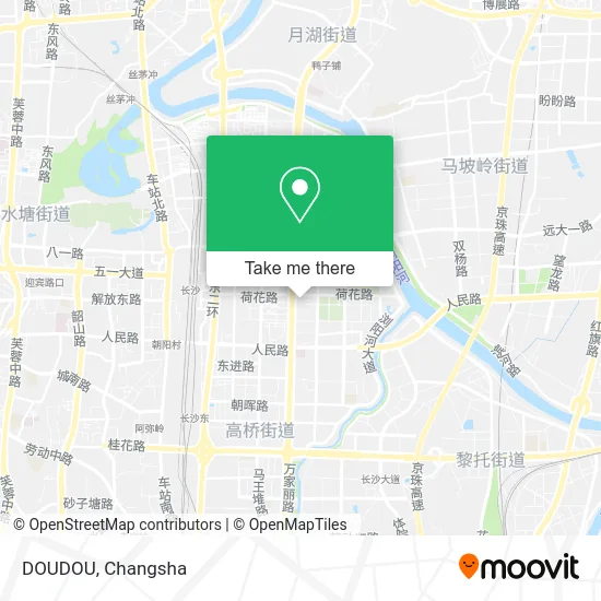
See DOUDOU, Furong District, on the map
Public Transit to DOUDOU in Furong District
Wondering how to get to DOUDOU in Furong District? Moovit helps you find the best way to get to DOUDOU with step-by-step directions from the nearest public transit station.
Moovit provides free maps and live directions to help you navigate through your city. View schedules, routes, timetables, and find out how long does it take to get to DOUDOU in real time.
Looking for the nearest stop or station to DOUDOU? Check out this list of stops closest to your destination: Wanjiali Plaza; Hehua Road South; Mawangdui Intersection; Hehua Intersection; Furong District Government.
Bus: Route 405, Route 66, Route 810, Route 915, Route 66, Route 122, Route 802, Route 810, Route 915, Temporary Route 131, Route 130, Route 208, Route 707, Route 143 Inner Loop, Route 143 Outer Ring, Route 405.Metro: Line 2, Line 5, Line 5, Line 2.
Want to see if there’s another route that gets you there at an earlier time? Moovit helps you find alternative routes or times. Get directions from and directions to DOUDOU easily from the Moovit App or Website.
We make riding to DOUDOU easy, which is why over 1.5 million users, including users in Furong District, trust Moovit as the best app for public transit. You don’t need to download an individual bus app or train app, Moovit is your all-in-one transit app that helps you find the best bus time or train time available.
For information on prices of bus and metro, costs and ride fares to DOUDOU, please check the Moovit app.
Use the app to navigate to popular places including to the airport, hospital, stadium, grocery store, mall, coffee shop, school, college, and university.
DOUDOU Address: 长沙市芙蓉区万家丽中路99号万家丽国际购物广场B1 street in Furong District
- Seven Wave Hui (Wanjiali Branch),
- Niu 99 (Wanjiali Plaza Branch),
- YOU XIZI,
- Wen and Friend Old Changsha Big Sausage (Wanjiali Store),
- Kela Ocean (Wanjiali Plaza Store),
- Yingshu (Wanjiali Plaza Store),
- Miniso (Wanjiali Middle Road Branch),
- XIYUGONGCHA (Wanjiali International Shopping Plaza Store),
- Amazon Seafood Barbecue Buffet (Wanjiali International Shopping Plaza Branch),
- Xiaoli Wardrobe (Wanjiali Plaza Branch),
- Crystal Love (Wanjiali International Shopping Plaza Store),
- Suiyi International Design Center,
- Cha Yan Yue Se (Wanjiali Plaza Branch),
- Xiangchuan Skewers (Wanjiali Plaza Branch),
- SUPERSTAR FIGHT CLUB (Wanjiali Plaza Branch),
- Grand Prix,
- N Boundary,
- ME Mirror (Wanjiali Store),
- One Meter One Line (Wanjiali International Plaza Branch),
- Ant Star Factory (Wanjiali International Shopping Mall)
Places Near DOUDOU (Furong District)
- Changsha Bank ATM (Sifang Branch), Kaifu District,
- Desiqin City Square, Yuhua District,
- Zhongnan University Xiangya Hospital, Kaifu District,
- Changsha Yangming Mountain Funeral Home, Yuhua District,
- Xingsha Police Station Songya Community Police Room, Changsha County,
- National University of Defense Technology (North Gate), Kaifu District,
- Changsha Bank (Sifang Branch), Kaifu District,
- Wanjiali International Mall, Furong District,
- Yuelu Mountain Juzizhou Tourist Area, Yuelu District,
- First Affiliated Hospital of Hunan University of Traditional Chinese Medicine - Outpatient Department, Yuhua District,
- Du Fu River Pavilion, Tianxin District,
- Hunan Provincial Maternal and Child Health Hospital - Outpatient Department, Kaifu District,
- Hunan Provincial Museum - Multipurpose Hall, Kaifu District,
- Changsha South Station, Yuhua District,
- Hunan Province Tumor Hospital, Yuelu District,
- Hunan University of Traditional Chinese Medicine First Affiliated Hospital, Yuhua District,
- Central South University Xiangya Second Hospital, Furong District,
- First Club, Kaifu District,
- Changsha South Station Square, Yuelu District,
- Apple Authorized Dealer (Sam Changsha Store), Yuhua District
How to get to popular places in Changsha with public transit
Get around Furong District by public transit!
Traveling around Furong District has never been so easy. See step by step directions as you travel to any attraction, street or major public transit station. View bus and train schedules, arrival times, service alerts and detailed routes on a map, so you know exactly how to get to anywhere in Furong District.
When traveling to any destination around Furong District use Moovit's Live Directions with Get Off Notifications to know exactly where and how far to walk, how long to wait for your line, and how many stops are left. Moovit will alert you when it's time to get off — no need to constantly re-check whether yours is the next stop.
Wondering how to use public transit in Furong District or how to pay for public transit in Furong District? Moovit public transit app can help you navigate your way with public transit easily, and at minimum cost. It includes public transit fees, ticket prices, and costs. Looking for a map of Furong District public transit lines? Moovit public transit app shows all public transit maps in Furong District with all Bus and Metro routes and stops on an interactive map.
Changsha has 2 transit type(s), including: Bus and Metro, operated by several transit agencies, including Changsha Metro and Changsha Bus Group