How to get to DVG Interactive by bus?
Click on the bus route to see step by step directions with maps, line arrival times and updated time schedules.
From Brooklyn Museum, Manhattan
40 minFrom Central Park, Manhattan
39 minFrom Hospital for Special Surgery, Manhattan
57 minFrom Memorial Sloan Kettering Memorial Hospital, Manhattan
53 minFrom Astoria, Queens
95 minFrom Lyric Theatre, Manhattan
30 minFrom 31st St (astoria blvd & 31st street), Queens
96 minFrom Walmart Supercenter, Bayonne
62 minFrom Bayonne, NJ, Bayonne
45 min
How to get to DVG Interactive by train?
Click on the train route to see step by step directions with maps, line arrival times and updated time schedules.
How to get to DVG Interactive by subway?
Click on the subway route to see step by step directions with maps, line arrival times and updated time schedules.
From Brooklyn Museum, Manhattan
36 minFrom Central Park, Manhattan
36 minFrom Hospital for Special Surgery, Manhattan
37 minFrom Memorial Sloan Kettering Memorial Hospital, Manhattan
35 minFrom Astoria, Queens
37 minFrom Lyric Theatre, Manhattan
19 minFrom 31st St (astoria blvd & 31st street), Queens
38 min
Bus stops near DVG Interactive in Manhattan
Subway stations near DVG Interactive in Manhattan
Bus lines to DVG Interactive in Manhattan
- X27, Bay Ridge Shore Rd Via Broadway,VIEW
- X28, Coney Island Sea Gate Via Broadway,VIEW
- SIM32, Downtown Worth St Via Church St,VIEW
- M55, South Ferry,VIEW
- SIM1, Soho Houston St Via Church St,VIEW
- SIM1C, Eltngvlle Trans Ctr Via Hylan Via Rich,VIEW
- SIM3C, Pt Rchmnd Via Narrows Rd N Via Watchogue,VIEW
- SIM4, Downtown Worth St Via Church St,VIEW
- SIM4C, Huguenot Via Richmond Av Via Arthur Kill,VIEW
- M103, City Hall Via Lex Av,VIEW
- SIM15, Downtown Loop Via Church St Via Water St,VIEW
- QM65, Laurelton,VIEW
- SUBURBAN TRANSIT, New York,VIEW
- BXM18, Riverdale 263 St Via Madison Av Via H. Hudson Pky,VIEW
- SIM2, Downtown Worth St Via Church St,VIEW
- SIM33C, Midtown Via Church Via Madison Av,VIEW
- SIM34, Soho Houston St Via Church St,VIEW
- QM7, Fresh Meadows - Downtown Express,VIEW
- QM8, Glen Oaks - Downtown Express,VIEW
- QM11, Forest Hills - Downtown Express,VIEW
What are the closest stations to DVG Interactive?
The closest stations to DVG Interactive are:
- Broadway/Barclay St is 131 yards away, 2 min walk.
- Fulton St is 173 yards away, 3 min walk.
- Park Row/Beekman St is 175 yards away, 3 min walk.
- World Trade Center is 200 yards away, 3 min walk.
- Broadway Between Fulton & Dey St is 248 yards away, 4 min walk.
- Church St/Vesey St is 271 yards away, 4 min walk.
- Church St/Fulton St is 283 yards away, 4 min walk.
- City Hall is 309 yards away, 4 min walk.
- Broadway @ Vessey St. is 369 yards away, 5 min walk.
Which bus lines stop near DVG Interactive?
These bus lines stop near DVG Interactive: 120, BXM18, QM11, X27.
Which train lines stop near DVG Interactive?
These train lines stop near DVG Interactive: GRE, RED.
Which subway lines stop near DVG Interactive?
These subway lines stop near DVG Interactive: 2, 3, 4, 5, C, R.
What’s the nearest subway station to DVG Interactive in Manhattan?
The nearest subway stations to DVG Interactive in Manhattan are Fulton St and World Trade Center. The closest one is a 3 min walk away.
What’s the nearest bus station to DVG Interactive in Manhattan?
The nearest bus station to DVG Interactive in Manhattan is Broadway/Barclay St. It’s a 2 min walk away.
What time is the first subway to DVG Interactive in Manhattan?
The J is the first subway that goes to DVG Interactive in Manhattan. It stops nearby at 3:00 AM.
What time is the last subway to DVG Interactive in Manhattan?
The 2 is the last subway that goes to DVG Interactive in Manhattan. It stops nearby at 4:11 AM.
What time is the first bus to DVG Interactive in Manhattan?
The M103 is the first bus that goes to DVG Interactive in Manhattan. It stops nearby at 3:35 AM.
What time is the last bus to DVG Interactive in Manhattan?
The M103 is the last bus that goes to DVG Interactive in Manhattan. It stops nearby at 3:35 AM.
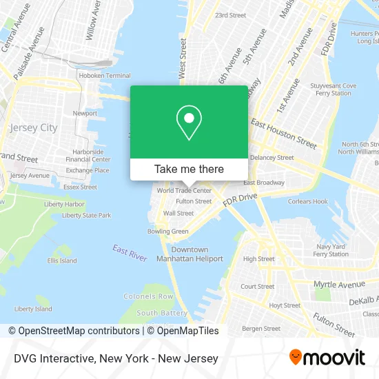
See DVG Interactive, Manhattan, on the map
Public Transit to DVG Interactive in Manhattan
Wondering how to get to DVG Interactive in Manhattan? Moovit helps you find the best way to get to DVG Interactive with step-by-step directions from the nearest public transit station.
Moovit provides free maps and live directions to help you navigate through your city. View schedules, routes, timetables, and find out how long does it take to get to DVG Interactive in real time.
Looking for the nearest stop or station to DVG Interactive? Check out this list of stops closest to your destination: Broadway/Barclay St; Fulton St; Park Row/Beekman St; World Trade Center; Broadway Between Fulton & Dey St; Church St/Vesey St; Church St/Fulton St; City Hall; Broadway @ Vessey St..
Bus: 120, BXM18, QM11, X27, X28, SIM32, M55.Train: GRE, RED.Subway: 2, 3, 4, 5, C, R, A, J, Z, E, N, Q, W.
Want to see if there’s another route that gets you there at an earlier time? Moovit helps you find alternative routes or times. Get directions from and directions to DVG Interactive easily from the Moovit App or Website.
We make riding to DVG Interactive easy, which is why over 1.5 million users, including users in Manhattan, trust Moovit as the best app for public transit. You don’t need to download an individual bus app or train app, Moovit is your all-in-one transit app that helps you find the best bus time or train time available.
For information on prices of subway, bus, train and light rail, costs and ride fares to DVG Interactive, please check the Moovit app.
Use the app to navigate to popular places including to the airport, hospital, stadium, grocery store, mall, coffee shop, school, college, and university.
DVG Interactive Address: 222 Broadway street in Manhattan
- Ares Legal,
- Barclay's Bank (BARCLAYS USA),
- Wework 222 Broadway,
- House Of Balance,
- Crypto Sensei Xrp,
- Viosk,
- Chase (Chase Bank),
- Bookkeeping Chef - Nyc Bookkeeping Firm,
- Smsglobal,
- Review Hq Inc.,
- Jafton | Mobile App Development New York,
- Social2b,
- 222 Broadway LLC,
- St. Paul's Chapel Ground Zero,
- Technosip,
- Chase Home Lending,
- Ivory Worldwide,
- Wallaroo Labs,
- Fulton St corner Canyon of Heroes,
- Trinity Church
Places Near DVG Interactive (Manhattan)
- Queens Center Mall, Queens,
- Hudson Yards, Manhattan,
- Times Square, Manhattan,
- 26 Federal Plaza, Manhattan,
- 376 Hudson Street, Manhattan,
- Chinatown, Manhattan,
- Rockefeller Center, Manhattan,
- San Gennaro Feast, Manhattan,
- Bellevue Hospital, Manhattan,
- Wall Street, Manhattan,
- Katz's Deli, Manhattan,
- 3 Stone St, Manhattan,
- SoHo, Manhattan,
- 1 Police Plaza, Manhattan,
- Pier 83, Manhattan,
- qqqq, Manhattan,
- 111 Centre New York City Supreme Court, Manhattan,
- 911 Memorial, Manhattan,
- Mountainside Hospital, Glen Ridge,
- 66 John Street, Manhattan
How to get to popular places in New York - New Jersey with public transit
Get around Manhattan by public transit!
Traveling around Manhattan has never been so easy. See step by step directions as you travel to any attraction, street or major public transit station. View bus and train schedules, arrival times, service alerts and detailed routes on a map, so you know exactly how to get to anywhere in Manhattan.
When traveling to any destination around Manhattan use Moovit's Live Directions with Get Off Notifications to know exactly where and how far to walk, how long to wait for your line, and how many stops are left. Moovit will alert you when it's time to get off — no need to constantly re-check whether yours is the next stop.
Wondering how to use public transit in Manhattan or how to pay for public transit in Manhattan? Moovit public transit app can help you navigate your way with public transit easily, and at minimum cost. It includes public transit fees, ticket prices, and costs. Looking for a map of Manhattan public transit lines? Moovit public transit app shows all public transit maps in Manhattan with all Bus, Train, Subway, Light Rail, Ferry and Cable Car routes and stops on an interactive map.
New York - New Jersey has 6 transit type(s), including: Bus, Train, Subway, Light Rail, Ferry and Cable Car, operated by several transit agencies, including MTA Subway, Metro-North Railroad, LIRR, PATH, MTA New York City Transit - Express routes, MTA Bus, NJ Transit, NYC Ferry, NICE bus, Bee-Line Bus, NJ Transit Rail, Norwalk Transit District, Hartford Line, River Valley Transit and HART